Wild Weekend Weather
Here is a closer look at the issues facing Alabama this weekend…
SEVERE STORMS POSSIBLE OVER NORTHWEST ALABAMA TONIGHT: Temperatures today will warm into the low 70s with a strong south wind, setting the stage for the potential for strong to severe storms over parts of the state late tonight/early tomorrow…
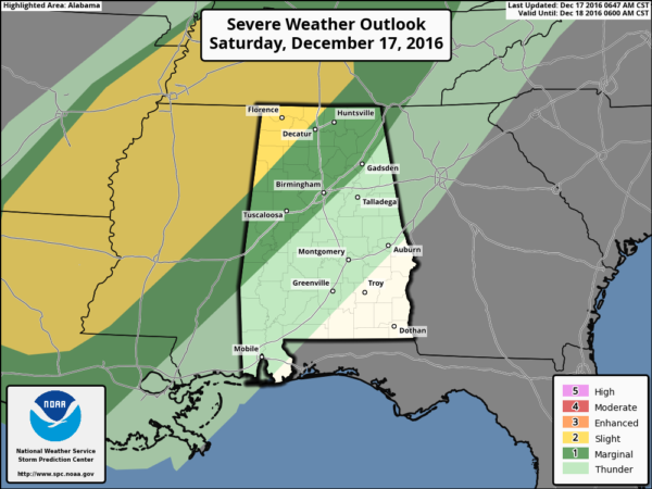
PLACEMENT: As you can see from the SPC outlook, the standard “slight risk” of severe weather has been defined for the northwest corner of Alabama, and this is where the primary threat will be. This includes Muscle Shoals, Moulton, Russellville, Hamilton, Winfield, and Vernon. A “marginal risk” includes Birmingham and Tuscaloosa… no severe weather is expected over East Alabama.
TIMING: It now looks like the main threat for severe storms across Northwest Alabama will come from about 12:00 midnight through 4:00 a.m.
THREATS: The main issue will be strong straight line winds, although a few isolated tornadoes could form within the line of storms in this “low CAPE, high shear” environment. It is unlikely that discrete storms form ahead of the line, and generally any tornadoes that form in this linear setup are smaller and don’t last long. But still, you have to be vigilant and pay close attention to warnings if they are needed. When it comes to thunderstorms, “expected the unexpected”…
On the positive side, rain amounts of 1-2 inches are likely… which is badly needed here.
SUNDAY TEMPERATURE CRASH: At 6:00 CT Sunday, an Arctic front should be close to a line from Anniston to Alabaster to Thomasville…
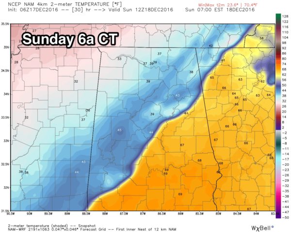
North Alabama will hold in the 30s all day, and south of the front, some will wake up with temperatures in the mid to upper 60s, but they fall quickly through the 50s and 40s, and into the 30s. It will be a very cold December day.
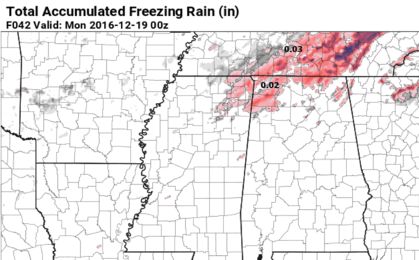
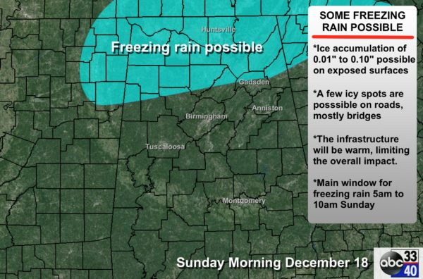
WINTRY MIX? As the Arctic air settles southward, there is a chance that freezing rain and some sleet could develop on the back side of the precipitation mass over North Alabama Sunday morning…
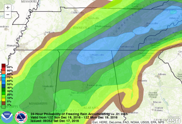
With temperatures today rising into the low 70s, this means the infrastructure will be warm, limiting the overall impact, but a few icy spots are possible on bridges over the northern third of Alabama tomorrow morning.
Sometimes computer models don’t handle incoming Arctic air like this very well; all of Minnesota will be in the -20F to -30F range early tomorrow morning; this is a brutally cold airmass up in the source region. For now this doesn’t look like an especially high impact event for Alabama, but keep an eye on forecast developments over the next 24 hours if you plan on driving tomorrow morning across North Alabama.
A snow flake or two is also possible as the precipitation ends and the cold air gets deeper.
We will have frequent updates on the blog… watch for the new posts over the weekend.
Category: Alabama's Weather
About the Author (Author Profile)
James Spann is one of the most recognized and trusted television meteorologists in the industry. He holds the AMS CCM designation and television seals from the AMS and NWA. He is a past winner of the Broadcast Meteorologist of the Year from both professional organizations.Subscribe
If you enjoyed this article, subscribe to receive more just like it.


