SPC Upgrades Day 1 Outlook For Parts Of North/Central Alabama
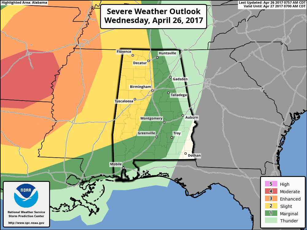
Much of the western half of North/Central Alabama has been upgraded to a slight risk for severe storms for the late night hours tonight until AM Thursday morning, with the marginal risk expanding well to the east out to Gadsden, Auburn, and Troy.
SETUP
We will have a QLCS (Quasi-Linear Convective System) moving through North/Central Alabama during the late night and into the early morning hours on Thursday that will be bringing us a risk of strong to severe storms. Latest model guidance is showing that we’ll have most-unstable CAPE values of 1000-2000 J/kg to advect into the area just ahead of the QLCS. Conditions will be favorable for the QLCS to possibly transition into a broken line of bowing segments and supercells, due to the winds becoming more westerly at 18,000 ft and the trough axis flattening out. Shear values of 50-65 kts will allow the storms to lean enough to not choke out the updrafts and allow the cells to last a while. Storm Relative Helicity values of 300 m2/s2 shows the potential for rotating updrafts.
THREATS
The main threats will be from damaging thunderstorm winds and hail. Right now, the tornado threat is low, but if the instability becomes more surface-based, there is the possibility of a few large supercells to form, and a strong tornado cannot be ruled out if that happens.
TIMING
The storms will begin to enter the state right around midnight tonight and will transverse across the state during the morning hours on Thursday. The main window for severe storms will be from midnight-3AM for the western locations (Tuscaloosa, Decatur, Muscle Shoals), 2AM-6AM for the central locations (including Birmingham & Huntsville), and 5AM-9AM for the eastern locations (Gadsden, Anniston, Montgomery, Troy).
This is an evolving threat for severe storms for the overnight hours tonight into Thursday morning. Go ahead and have your place of safety and emergency supplies ready to go just in case you are placed in a warning later tonight. Have your smartphones charged and check the batteries in your NOAA Weather Radio. Stay weather aware this evening, and keep checking back with the Alabama Wx Weather Blog for updates.
Category: ALL POSTS
About the Author (Author Profile)
Scott Martin is an operational meteorologist, professional graphic artist, musician, husband, and father. Not only is Scott a member of the National Weather Association, but he is also the Central Alabama Chapter of the NWA president. Scott is also the co-founder of Racecast Weather, which provides forecasts for many racing series across the USA. He also supplies forecasts for the BassMaster Elite Series events including the BassMaster Classic.Subscribe
If you enjoyed this article, subscribe to receive more just like it.


