

A Midday Look At Our Weather, And The Week Ahead
CURRENTLY ACROSS CENTRAL ALABAMA
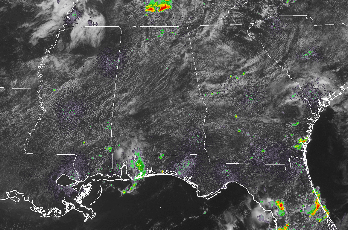
We have mostly clear skies across Central Alabama at the midday hour, and the radar across the area is dry at this point. Temperatures are currently in the mid to upper 80s for most in the area, with the warm spot of Montgomery already touching 90 degrees at the noon hour.
A THREAT OF STRONG TO SEVERE STORMS AND FLOODING TODAY
With a moist and unstable airmass that will move over Central Alabama this afternoon will bring showers and thunderstorms to the area. With precipitable water values near 2 inches, we’ll have a threat of flash flooding, especially with the already saturated soil from late week with Cindy, and since Thursday with the storm activity. Surface CAPE values will be in the 2500-3500 J/kg range this afternoon and early evening, which means storms could have strong updrafts and become strong quickly. We also have Downdraft CAPE values near 1000 J/kg, meaning we’ll have a good possibility of strong storms producing strong to severe downburst winds.
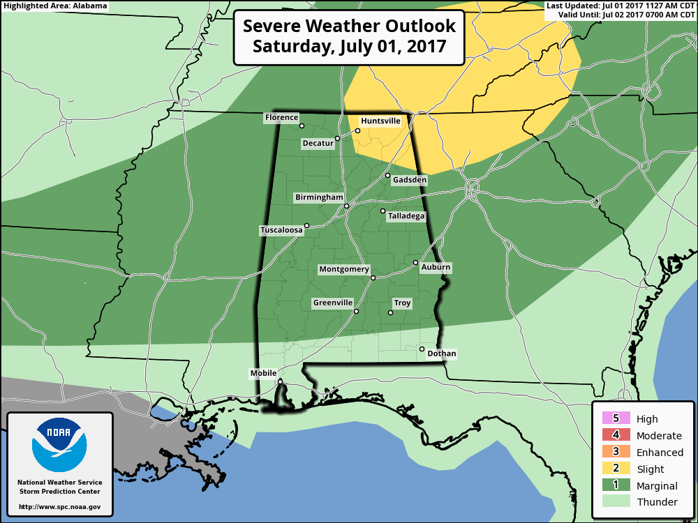
SPC has all of Central Alabama in a Marginal Risk for severe storms throughout the remainder of the day and into the early morning hours on Sunday. They have removed the Slight Risk from nearly all of the area, and keep it limited to the extreme northeast corner of the state. The main risk will be from damaging wind gusts that could reach up to 60 MPH. Torrential rainfall can be expected under some of these storms, and a Flash Flood Watch has been issued for the northeast and north-central parts of Central Alabama.
Skies will become partly cloudy as convection will start to take place, and scattered showers and thunderstorms will start to form around the mid-afternoon hours. Afternoon highs will be in the upper 80s to the lower 90s across Central Alabama. Shower and storm activity will continue into the evening hours before moving south out of the area and mostly dissipating by midnight. Overnight lows will be in the lower to mid 70s.
WEATHER FOR SUNDAY THROUGHOUT INDEPENDENCE DAY
It will be a typical weather pattern for Central Alabama for the summertime… We’ll have a northwest flow aloft setting up over the area, which will drive thunderstorm complexes that develop over the plains and the midwest towards the state, enhancing our risks for showers and storms. We can expect a mix of sun and clouds, with the daily risk of scattered showers and storms. Highs will be in the upper 80s tot he lower 90s throughout Central Alabama.
FOR THE REMAINDER OF THE WEEK
Same story for Wednesday through Friday in Central Alabama… We’ll have hot and muggy conditions with a daily risk for scattered showers and thunderstorms. We’ll also have to keep an eye to our northwest to see if any MCS activity develops and makes a move to the southeast. This is the season for those to happen. Afternoon highs will be in the upper 80s to the lower 90s, with lows in the lower to mid 70s.
HEADING TO THE BEACH
For a detailed look at the weather from Fort Morgan over to Panama City Beach, click here to see the AlabamaWx Beach Forecast Center page. The Beach Forecast is partially underwritten by the support of Brett/Robinson Vacation Rentals in Gulf Shores and Orange Beach. Click here to see Brett/Robinson’s “Own Your Summer” specials now!
A LOOK AT THE TROPICS
All remains quiet across the Atlantic basin, and tropical storm formation is not expected through the next five days.
TODAY IN WEATHER HISTORY
July 1, 1989 – Showers and thunderstorms associated with the low pressure system which was once Tropical Storm Allison continued to drench parts of Mississippi, Louisiana and eastern Texas. Late night thunderstorms produced 12.58 inches of rain at Biloxi, MS, in six hours, and 10.73 inches at Gulfport MS. Flooding in Mississippi over the first six days of the month caused 55 million dollars damage.
WEATHERBRAINS
Don’t forget you can listen to our weekly 90 minute netcast anytime on the web, or on iTunes. This is the show all about weather featuring many familiar voices, including our meteorologists here at ABC 33/40. you can watch it live here on Monday nights at 8:30PM CDT.
Category: Alabama's Weather, ALL POSTS
About the Author (Author Profile)
Scott Martin is an operational meteorologist, professional graphic artist, musician, husband, and father. Not only is Scott a member of the National Weather Association, but he is also the Central Alabama Chapter of the NWA president. Scott is also the co-founder of Racecast Weather, which provides forecasts for many racing series across the USA. He also supplies forecasts for the BassMaster Elite Series events including the BassMaster Classic.Subscribe
If you enjoyed this article, subscribe to receive more just like it.


