Hot, Humid Today; Strong Storms Late This Week
HOT, MUGGY SUMMER WEATHER: The upper ridge will strengthen across Alabama today, meaning highs up in the low to mid 90s with just a few widely scattered showers and thunderstorms this afternoon and early tonight. Pretty much the same story tomorrow; the high will be in the 92-95 degree range with a few pop up storms by afternoon, but there is a chance organized storms could reach far North Alabama late in the day and tomorrow night ahead of a surface front. SPC has the northern third of Alabama in a “marginal risk” of severe storms for this potential.
FRIDAY: SPC has much of North Alabama in the standard “slight risk” of severe storms, with a “marginal risk” down into the southern counties of the state thanks to the front to the north pushing southward. Anytime you have a good surface boundary around here in late July storms associated with it can certainly pack a punch.
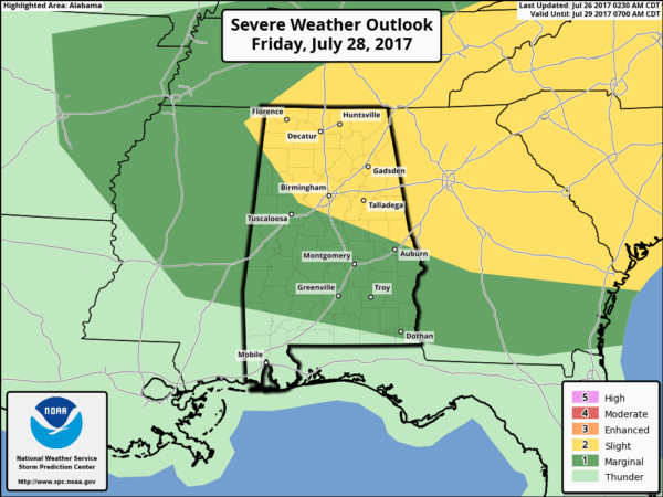
The main risk with the heavier storms Friday afternoon and Friday night will come from wet microbursts, or localized areas of damaging straight line winds than can knock down trees and power lines. The high Friday will be close to 90 degrees for most spots.
THE ALABAMA WEEKEND: The main chance of showers and storms Saturday will be along and south of I-20 as the front continues to move slowly southward. It won’t rain all day, but just be ready for a passing shower or storm a time or two. And, storms Saturday afternoon could be pretty strong, especially over the southern half of the state. Saturday’s high will be in the 80s.
On Sunday, a rather refreshing airmass will drop down into the state featuring dry, continental air. This will mean a cooler morning and lower humidity values during the day. Some of the cooler pockets across North Alabama could reach the upper 50s early Sunday morning. The sky will be mostly sunny with a high in the upper 80s.
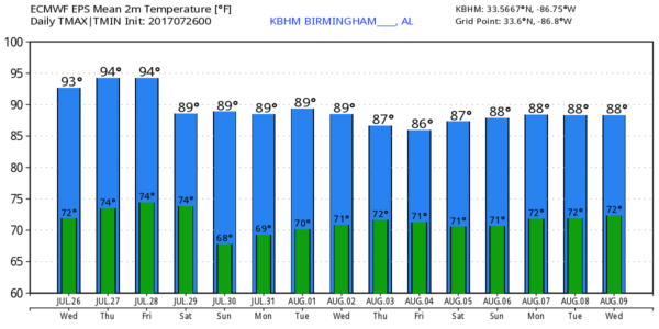
NEXT WEEK: Rather dry air for mid-summer will continue to cover the state Monday, but moisture levels creep up again Tuesday with some risk of widely scattered storms. Then, rather typical weather is the story for the latter half of the week with “scattered, mostly afternoon and evening showers and storms”. Temperatures next week should be a bit below average, with highs in the 87-90 degree range most days. See the Weather Xtreme video for maps, graphics, and more details.
TROPICS: A wave in the far eastern Atlantic could show slow organization over the next five days, but development will be pretty limited due to dry air. The rest of the Atlantic basin is quiet.
BEACH FORECAST: Click here to see the AlabamaWx Beach Forecast Center page. The Beach Forecast is partially underwritten by the support of Brett/Robinson Vacation Rentals in Gulf Shores and Orange Beach. Click here to see Brett/Robinson’s Own Your Summer specials now!
WEATHER BRAINS: Don’t forget you can listen to our weekly 90 minute netcast anytime on the web, or on iTunes. This is the show all about weather featuring many familiar voices, including our meteorologists here at ABC 33/40.
CONNECT: You can find me on all of the major social networks…
Facebook
Twitter
Google Plus
Instagram
Pinterest
Snapchat: spannwx
Look for the next Weather Xtrme video here by 4:00 this afternoon… enjoy the day!
Category: Alabama's Weather, ALL POSTS, Weather Xtreme Videos
About the Author (Author Profile)
James Spann is one of the most recognized and trusted television meteorologists in the industry. He holds the AMS CCM designation and television seals from the AMS and NWA. He is a past winner of the Broadcast Meteorologist of the Year from both professional organizations.Subscribe
If you enjoyed this article, subscribe to receive more just like it.


