Today’s Forecast Is A Question Mark
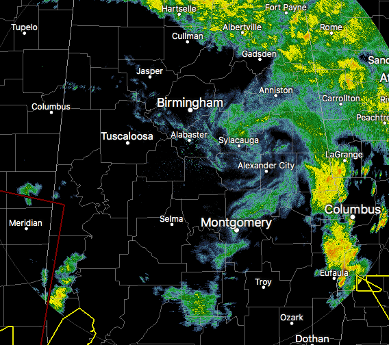
An interesting look at the latest radar image of Alabama. We were expecting a lot more rain on radar at this point, but drier air has really moved in across much of the area. The mass of rain that was affecting the southern half of Central Alabama has pretty much diminished and has left a question mark reflection in its wake.
We are still expecting more tropical showers and storms to move in later this afternoon, but I believe the coverage will be far less than what the models are showing, especially the HRRR.
We still have a threat for a few tornadoes mainly over the western parts of Central Alabama throughout the afternoon and early evening hours, but that threat will diminish as we lose the daytime heating. Stay informed on the latest in weather with the AlabamaWx Weather Blog.
Category: Alabama's Weather, ALL POSTS
About the Author (Author Profile)
Scott Martin is an operational meteorologist, professional graphic artist, musician, husband, and father. Not only is Scott a member of the National Weather Association, but he is also the Central Alabama Chapter of the NWA president. Scott is also the co-founder of Racecast Weather, which provides forecasts for many racing series across the USA. He also supplies forecasts for the BassMaster Elite Series events including the BassMaster Classic.Subscribe
If you enjoyed this article, subscribe to receive more just like it.


