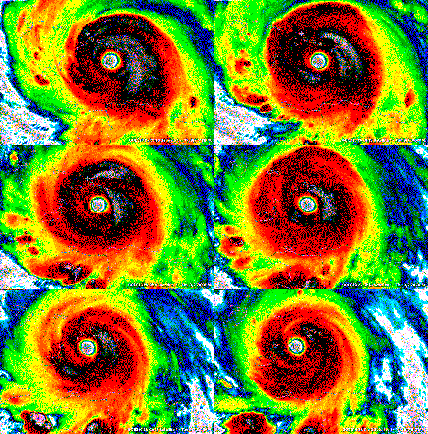
9:30 p.m. Thoughts on Hurricane Irma
Hurricane Irma is bearing down on the Turks and Caicos Islands tonight. The eyewall is passing over the Caicos and Grand Turk right now.
A few signs indicate that the storm is a little less organized and slightly weaker tonight, but you can’t tell it by the central pressure (921 millibars) or the flight level winds. The strongest flight level winds found by the Air Force Reserve Hurricane Hunter WC-130 Aircraft were 168 knots. If you discount that by 10% for altitude to 151 knots. Multiply that by 1.15 to get the reading in mph, and you still have 174 mph.
Cloud tops around the center have warmed a bit tonight, but outflow still looks good. Fluctuations in intensity have been expected due to eyewall replacement cycles and that appears to have been occurring tonight.
The crew reported an elliptical eye on the center penetration, which often indicates that concentric eyewalls are forming. This means that an eyewall replacement cycle may be beginning. The inner eye will disintegrate as an outer eyewall forms and becomes dominant. As this larger eyewall forms, the hurricane can lose 20-25 mph of intensity. Don’t be surprised if you hear that happen tonight. And don’t be fooled that Irma is less dangerous.
The hurricane is still over very warm water, with sea surface temperatures running over 30C (86F). Tha’s very warm.
There is some slightly drier air ahead of Irma that could put a bit of a damper on intensification early tomorrow, but there is much more moist air closer to Florida. In fact, strong storms formed tonight over Southwest Flordia from Tapa to Fort Myers to Key West in that moist air on the front edge of the trough that wants to turn Irma to the northeast.
Many of the reliable computer models indicate that the hurricane could intensify rapidly at some point, especially tomorrow night and early Saturday. The storm will be moving over higher oceanic heat content water as it approaches the Great Bahama Bank and the Florida Straits. Some of our most notorious hurricanes, including the Labor Day Hurricane of 1935 (strongest ever at landfall in the U.S.) have grown into monsters in this area. Wind shear may increase slightly over the next 12 hours but will relax again by Friday as the hurricane makes its final approach to South Florida.
Even if Irma drops back to a category four storm over the next several hours, there is a very high chance it will regain category five status tomorrow night and Saturday, which is very concerning given its expected landfall late Saturday night and early Sunday morning.
Irma is now a huge storm, way larger than Hurricane Andrew, which made landfall south of Miami as a Category Five Monster. As our friend John Morales said this evening on NBC-6 in Miami, don’t tell me you went through Andrew unless you were south of Kendall Avenue. Andrew was a very small and violent hurricane. Irma will be much larger, with wider effects and much higher storm surge.
One of the largest evacuations in Florida history is underway. Traffic is bumper to bumper and slow tonight from south of Ocala all the way to north of Valdosta. Traffic is stop and go northbound out of Savannah on I-95.
The new run of the GFS will be coming in shortly, and I will have a sneak peek at it before 10:30 p.m.


