Latest GFS Model Run For Irma, Parts Of Alabama To Get Some Rain & Wind
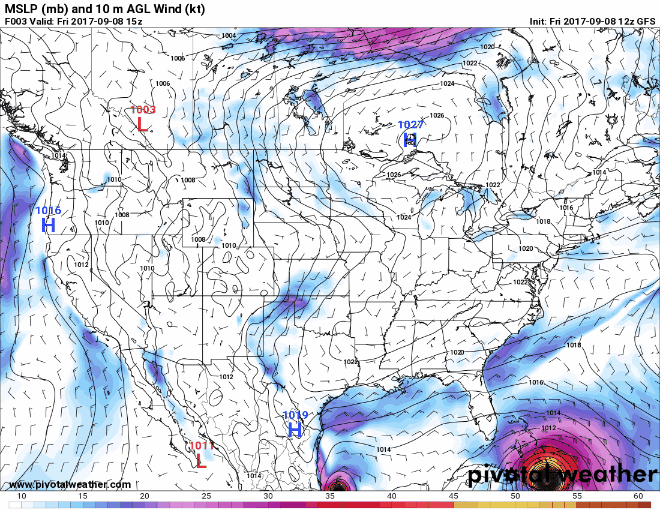
The latest run of the GFS is mostly out and this run is in pretty close agreement to the forecast track from the National Hurricane Center and to the earlier European model run. According to this run, Hurricane Irma should start rapid intensification within the next 24 hours and could climb back into category 5 strength before landfall.
Expected point of landfall in the latest GFS run will occur on early Sunday morning before dawn (2:00AM-5:00AM EDT) as a category 5, with winds up to 157 knots, or up to 180 MPH. Barometric pressure is expected to be around 898mb when crossing the Keys and making landfall in the Everglades. If this holds true, Irma will have the 2nd lowest pressure at landfall, just behind the 1935 Labor Day Hurricane at 892mb.
On this model track, the southeastern parts of Central Alabama could start seeing the tropical showers and some winds from Irma by early Monday afternoon, with the activity moving northwesterly during the remainder of the day and into the day on Tuesday. Rain can be expected to last into Tuesday evening, and becoming more scattered in nature from Wednesday through Friday. Winds could be as high as 20-30 MPH sustained for a while during that time frame on Monday to Tuesday, with gusts up to 40 MPH possible.
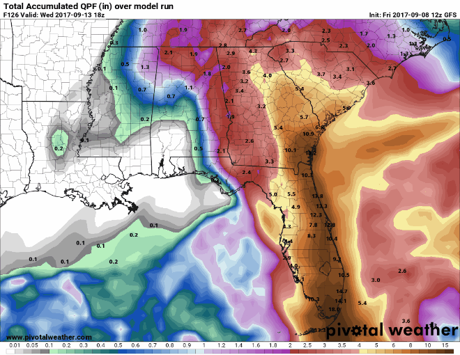
Rainfall amounts could reach up to 1-3 inches, with the heavier amounts closer to the AL/GA state line.
Category: Alabama's Weather, ALL POSTS
About the Author (Author Profile)
Scott Martin is an operational meteorologist, professional graphic artist, musician, husband, and father. Not only is Scott a member of the National Weather Association, but he is also the Central Alabama Chapter of the NWA president. Scott is also the co-founder of Racecast Weather, which provides forecasts for many racing series across the USA. He also supplies forecasts for the BassMaster Elite Series events including the BassMaster Classic.Subscribe
If you enjoyed this article, subscribe to receive more just like it.


