Quick Notes on Irma Just Before 2 p.m.
The center of Hurricane Irma is 140 miles southeast of Key West at 1:30 p.m. The hurricane is moving west at 9 mph. It is over the Cuban Keys on the north coast of Cuba at this time.
Convection continues to increase around the center of the storm despite the fact that part of the core is over Cuba. The eye is becoming more distinct on visible satellite imagery as more of the center is over water. I think the hurricane does have the chance to strengthen rapidly in the 18 hours before landfall in the keys and further before it gets to Southwest Florida.
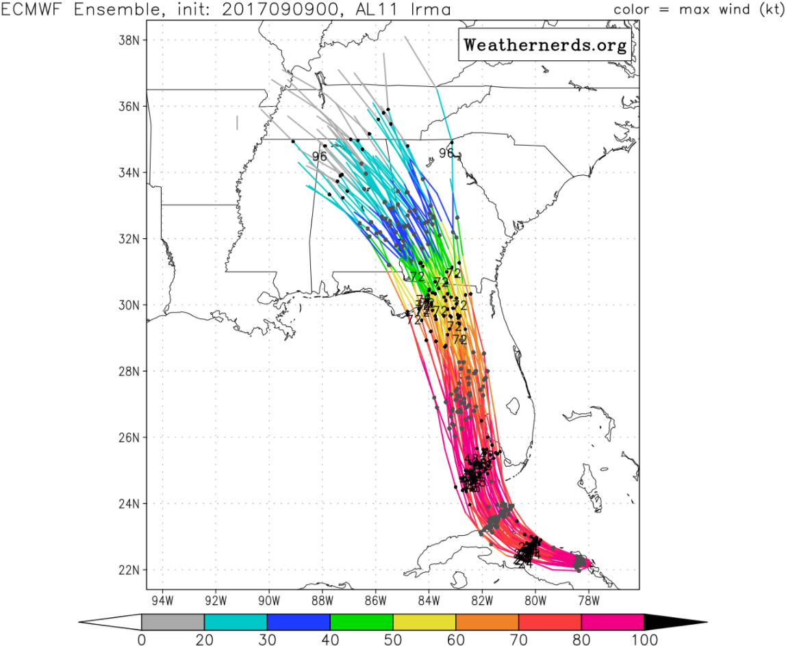
The 12z European is in. It predicts a track right along the West Coast of Florida with a landfall between Fort Myers and Tampa. It’s ensemble members are tightly clustered, but some of them are a little further west than the official track.
All the models are fixated on a landfall in the lower keys, generally from Marathon west to Key West.
The NOAA Plane just about to the center. It is inbound in the northeastern quadrant of the storm and hasn’t found any extreme winds so far.
But I think we will see an intensifying hurricane during this recon mission into the plane. We should have a center fix shortly.
Good agreement among the models’ ensembled members. Here is the European:
Here is the GFS:
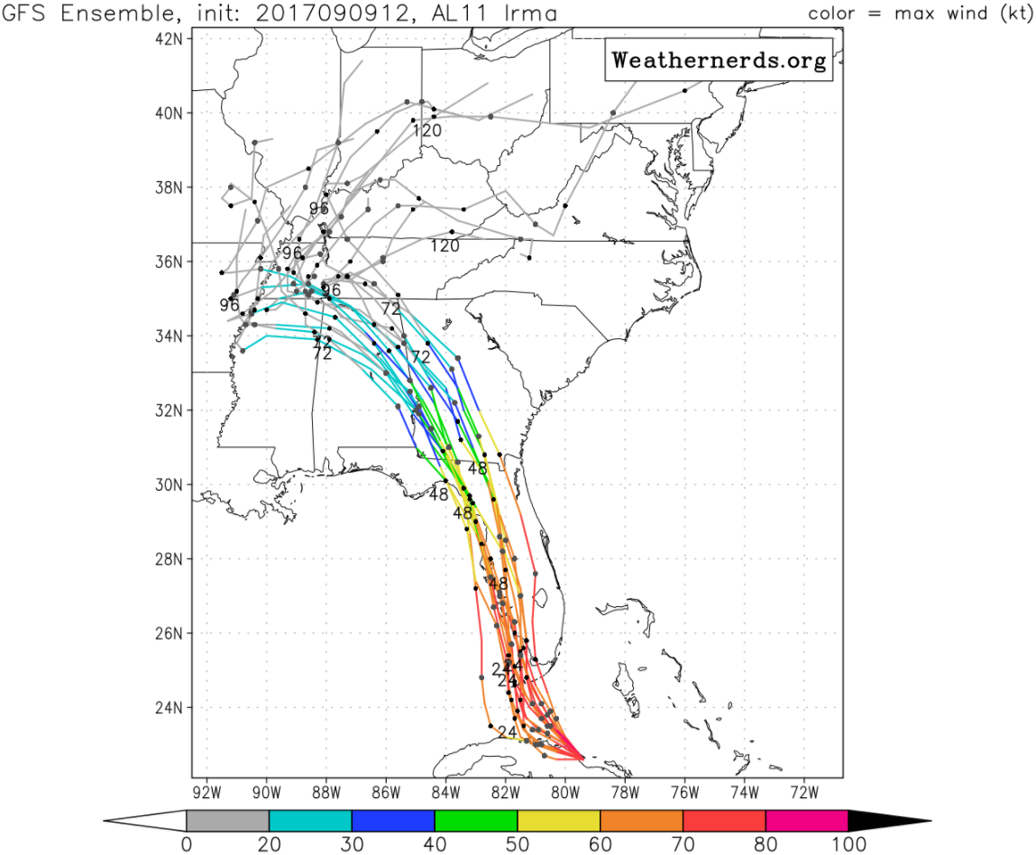
The European is a little west of the GFS and close to the official track. Both end up in Alabama for the most part. Alabama will experience a little wind and a little rain.
About the Author (Author Profile)
Bill Murray is the President of The Weather Factory. He is the site's official weather historian and a weekend forecaster. He also anchors the site's severe weather coverage. Bill Murray is the proud holder of National Weather Association Digital Seal #0001 @wxhistorianSubscribe
If you enjoyed this article, subscribe to receive more just like it.


