Updated Severe Weather Outlook For Today
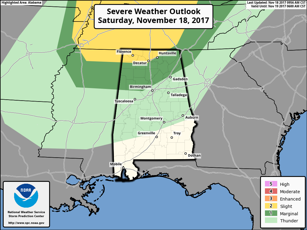
The Storm Prediction Center has updated their Day 1 Severe Outlook for today, and the Marginal Risk for severe storms has been extended a little farther south that now includes the extreme northern parts of Tuscaloosa and Jefferson counties. The SPC has also upgraded the extreme northern parts of the state to a Slight Risk, including the cities of Tuscumbia, Florence, Decatur, Madison, Huntsville and Hazel Green.
For the Slight Risk area, thunderstorms will be capable of producing severe wind gusts, hail up to severe criteria, or a brief tornado mainly throughout the afternoon hours today.
Much of the main forcing with today’s system will be mainly north of the state, but there will be enough in the northern part that a couple of severe storms are possible. Steep lapse rates will allow for some hail that could reach up to 1-inch in diameter, especially during the earlier parts of the afternoon. There will be some instability along and just ahead of the front that will allow for some thunderstorm development, more to the north. Helicity values will be high enough to support rotating updrafts, but with limited buoyancy, the risk for a tornado will remain rather low.
For the rest of Central Alabama that is not in a risk zone, we can expect a few showers to form out ahead of the front, but these will generally be light in nature and should not contain any thunder. By the time the cold front reaches the area, conditions will be more unfavorable for severe storms, even though a few stronger storms still remain possible.
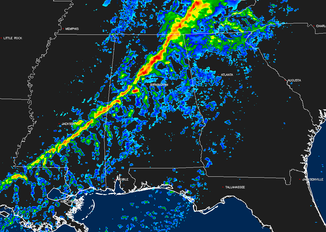
NAM-3k Simulated Radar valid at 8PM tonight.
Showers should start developing and moving into the northwestern parts of the state during the late morning to the early afternoon hours and progress eastward through the afternoon and evening hours. The main band of showers along with the cold front should enter the northwestern parts of the state by 3-5PM, and into the Birmingham Metropolitan Area by 6-8PM, and out of the area by 11PM-1AM. There may be a few lingering showers just behind the front, but those will clear out shortly after the passage of the front.
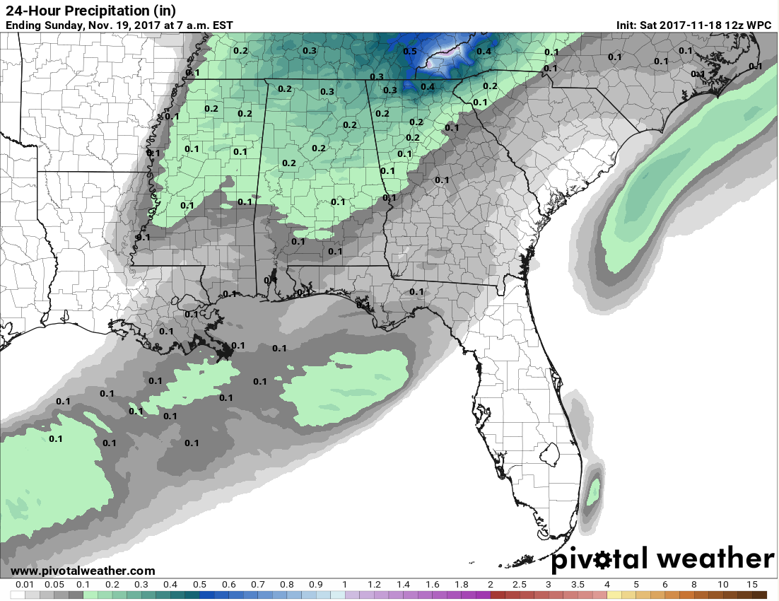
Rainfall amounts will be low throughout today’s event with the limited moisture and the quick movement of the front. Most everyone will see totals of 1/4-inch or less, with lighter amounts in the southern parts of the state.
Good news is that the organized showers and storms will occur well after the Alabama and Auburn football games are over, but a small shower will be possible during the second half in Tuscaloosa.
Category: Alabama's Weather, ALL POSTS
About the Author (Author Profile)
Scott Martin is an operational meteorologist, professional graphic artist, musician, husband, and father. Not only is Scott a member of the National Weather Association, but he is also the Central Alabama Chapter of the NWA president. Scott is also the co-founder of Racecast Weather, which provides forecasts for many racing series across the USA. He also supplies forecasts for the BassMaster Elite Series events including the BassMaster Classic.Subscribe
If you enjoyed this article, subscribe to receive more just like it.


