Wind Advisory Issued For Parts of Central Alabama Until 3:00 AM Sunday
The National Weather Service in Birmingham has issued a Wind Advisory, which is in effect until 3:00 AM CST Sunday for these counties in Central Alabama…
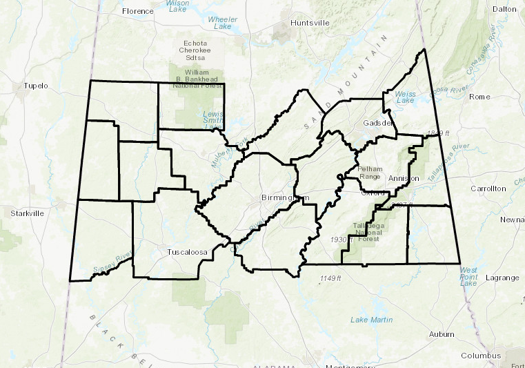
Marion, Lamar, Fayette, Winston, Walker, Blount, Etowah, Calhoun, Cherokee, Cleburne, Pickens, Tuscaloosa, Jefferson, Shelby, St. Clair, Talladega, Clay, and Randolph.
A cold front will move into Central Alabama this evening. There will be gusty south and southwest winds ahead of the front and gusty northwest winds behind the front.
* TIMING…through 3 am, but gusts should begin diminishing west to east after 10 pm
* WINDS…sustained winds around 15 mph and wind gust to 35 mph possible
* IMPACTS…a few tree limbs may be broken off and non-secured outdoor items may be knocked over. Driving will also be hazardous for high profile vehicles, especially driving in a an east or west direction.
A Wind Advisory means that wind gusts of 35 mph are expected. Winds this strong can make driving difficult…especially for
high profile vehicles. Use extra caution.
Category: Alabama's Weather, ALL POSTS
About the Author (Author Profile)
Scott Martin is an operational meteorologist, professional graphic artist, musician, husband, and father. Not only is Scott a member of the National Weather Association, but he is also the Central Alabama Chapter of the NWA president. Scott is also the co-founder of Racecast Weather, which provides forecasts for many racing series across the USA. He also supplies forecasts for the BassMaster Elite Series events including the BassMaster Classic.Subscribe
If you enjoyed this article, subscribe to receive more just like it.


