Line of Showers Moving into The Birmingham Metropolitan Area at Midday
RADAR CHECK AT 11:30 AM
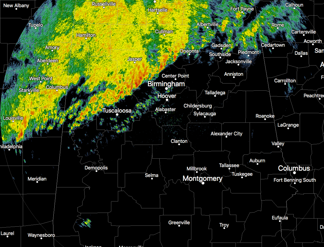
A line of showers with a few heavy downpours on the leading edge have now entered well into the central parts of Central Alabama at this point, stretching from Oneonta to Mount Olive to Northport. The good news is that there were no lightning strikes at this point, and none of these were strong or severe. The line is slowly progressing to the southeast and will be entering into the Tuscaloosa and Birmingham metropolitan areas.
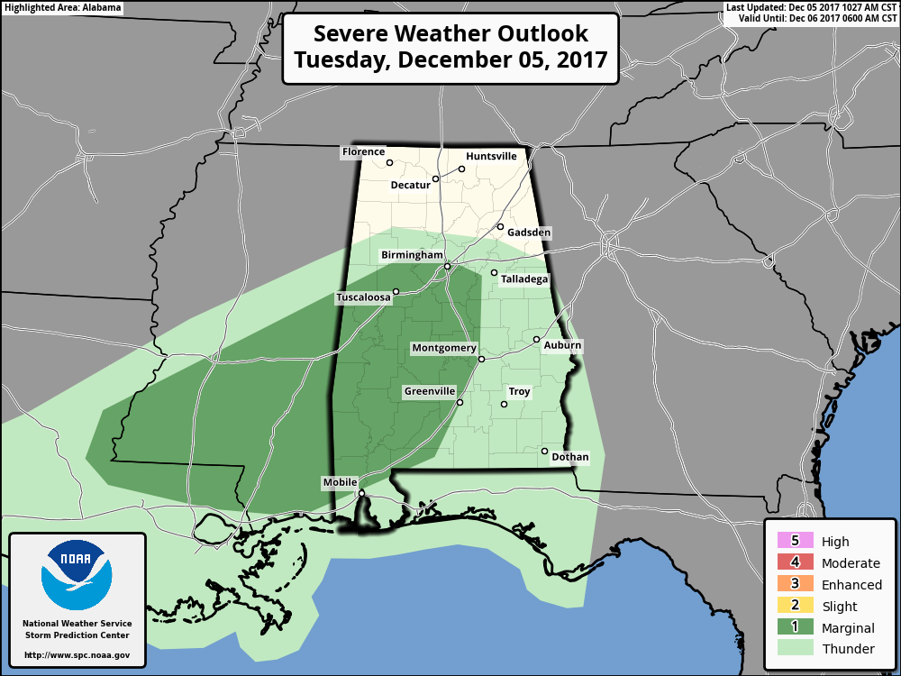
The Storm Prediction Center still has all of the southwestern parts in a Marginal Risk for severe storms throughout the rest of the afternoon hours. The main risks will be from gusty winds that could reach up to severe criteria, but an isolated tornado or two cannot be ruled out. At this point, conditions do not look favorable for that to happen. If a few breaks in the clouds occur and allows for a little more convection, a strong or severe storm could form.
WEATHER FOR THE REMAINDER OF THE DAY
Rain and the possibility of a few embedded thunderstorms will be likely throughout Central Alabama for the remainder of the afternoon and early evening hours. Rainfall could be heavy at times, especially on the front of the line, but flood issues are not expected today. The cold front is lagging just behind the line of showers and temperatures will really start to drop after it passes your location. Highs will be topping out soon in the 60s in the north with 70s in the south, but those temperatures will quickly drop into the 40s and 50s for the northern half of the area by mid-evening.
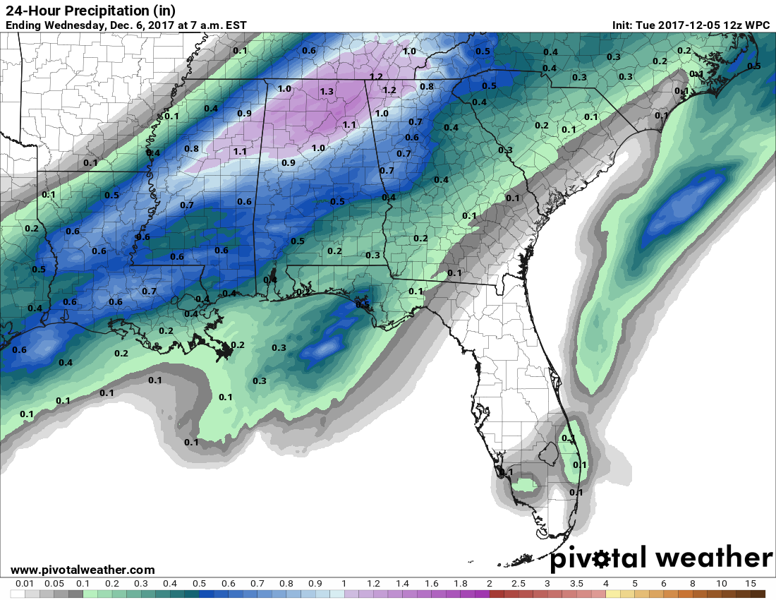
Rainfall totals throughout the remainder of today should end up being around the 1/2-inch to 1-inch mark for most of the area, with slightly higher totals in the extreme northern parts of the area. Most of the rain activity associated with the front should be out of the Birmingham area by 7:00 PM, but a few lingering light showers or sprinkles are possible through the late night and predawn hours on Wednesday. Lows will drop down into the mid-30s to the mid-40s.
MUCH COOLER AND STILL A LITTLE RAINY ON TOMORROW
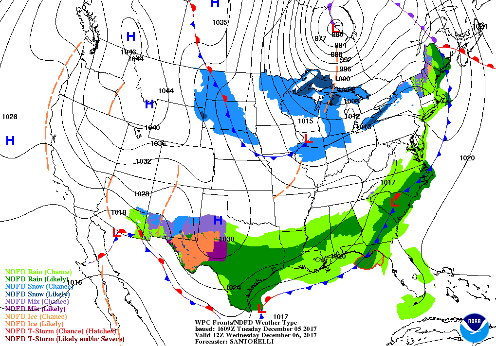
Skies will continue to be gray throughout the day on Wednesday, and rain will be likely for much of the area, especially for the area along and south of I-20. Highs will only top out in the mid-40s to near 50 degrees throughout the area. Shower activity will start to slowly diminish from north to south throughout the evening and into the overnight hours. Some showers will be lingering in the southeastern corner of the area before dawn, while the rest of the area will have cloudy skies. Lows will be in the 30s.
THE BEACH FORECAST
Be sure to keep up to date with the detailed forecasts from Fort Morgan over to Panama City Beach with the AlabamaWx Weather Blog. Click here to see the AlabamaWx Beach Forecast Center page. The Beach Forecast is partially underwritten by the support of Brett/Robinson Vacation Rentals in Gulf Shores and Orange Beach. Click here to see Brett/Robinson’s Off-Season Deals now!
ON THIS DAY IN WEATHER HISTORY
1953 – A killer tornado hit Vicksburg, MS, killing 38 persons, injuring 270 others, and causing 25 million dollars damage, the most damage since the forty-seven days of continuous shelling the town received in the Civil War.
WEATHERBRAINS
Check out the show at www.WeatherBrains.com. You can also subscribe via iTunes. You can watch the show live at live.bigbrainsmedia.com. You will be able to see the show on the James Spann 24×7 weather channel on cable or directly over the air on the dot 2 feed.
Category: Alabama's Weather, ALL POSTS
About the Author (Author Profile)
Scott Martin is an operational meteorologist, professional graphic artist, musician, husband, and father. Not only is Scott a member of the National Weather Association, but he is also the Central Alabama Chapter of the NWA president. Scott is also the co-founder of Racecast Weather, which provides forecasts for many racing series across the USA. He also supplies forecasts for the BassMaster Elite Series events including the BassMaster Classic.Subscribe
If you enjoyed this article, subscribe to receive more just like it.


