A Quick Update On Our Weather Situation At 11:45 AM
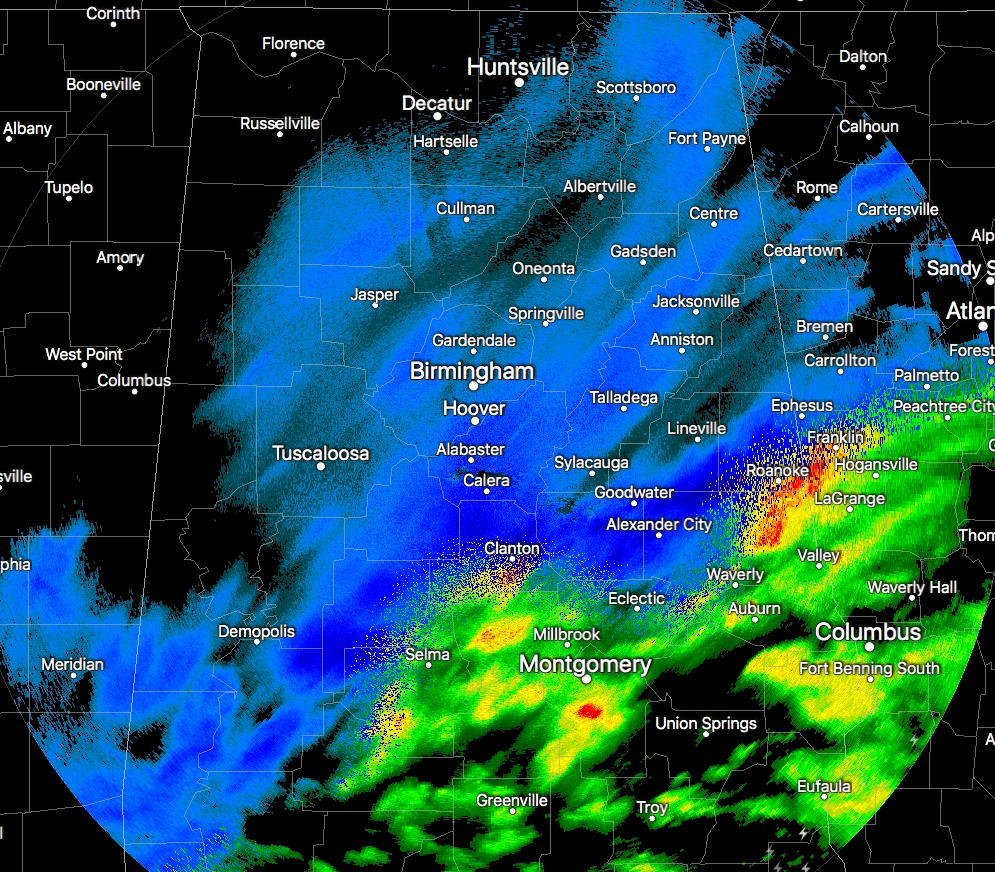
RADAR CHECK AT 11:30 AM
Snow is starting to taper off in the western parts of the state, but there is still a good snowband producing moderate to heavy snow showers from Uniontown to Jemison over to Alexander City and Wedowee. The band will continue to move to the east and should be out of the Birmingham metropolitan are within the next hour. Much, if not all, of the snowfall should come to an end for the areas west of and including Tuscaloosa to Birmingham by the 1:00-2:00 PM timeframe. Snow will persist for a several more hours after that for east and southeastern parts of the area, with some snow showers lasting into the overnight hours tonight and into the pre-dawn hours on Saturday.
WATCHES AND ADVISORIES
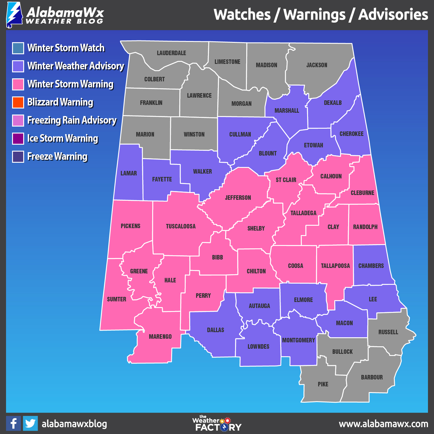
The Winter Storm Warning continues in effect for Bibb, Calhoun, Chilton, Clay, Cleburne, Coosa, Greene, Hale, Jefferson, Marengo, Perry, Randolph, Shelby, St. Clair, Sumter, Talladega, Tallapoosa, and Tuscaloosa counties until 12:00 AM Saturday.
A Winter Weather Advisory continues in effect for Autauga, Blount, Chambers, Cherokee, Dallas, Elmore, Etowah, Fayette, Lamar, Pickens, and Walker counties until 12:00 AM Saturday.
Another Winter Weather Advisory continues in effect for Marshall, De Kalb and Cullman counties until 3:00 PM Friday.
The National Weather Service is advising people to get where they need to be for the evening before we lose the daylight. With the snow cover out there already, the temperatures are ranging from just below freezing to just above freezing. Much of the snow and moisture of the surfaces will not evaporate before nightfall and icing will become an issue. More roadways may become impassible and/or closed throughout the evening.
Here are a few of the snow totals from around Central Alabama as of 11:00 AM…
6.0 inches – Montevallo
6.0 inches – Crestwood Area of Birmingham
5.5 inches – Trussville
5.0 inches – Moody
5.0 inches – Eastaboga
5.0 inches – Weaver (Calhoun)
5.0 inches – Thorsby (Chilton)
5.0 inches – near Mars Hill (Cleburne)
5.0 inches – Oak Mountain State Park
4.8 inches – Centre (Cherokee)
4.8 inches – Maylene (Shelby)
4.5 inches – Blue Mountain (Calhoun)
4.5 inches – Pleasant Grove (Jefferson)
4.5 inches – Greystone (Shelby)
4.5 inches – Wilsonville (Shelby)
4.5 inches – Centreville (Bibb)
4.5 inches – Marion (Perry)
4.3 inches – Choccolocco (Calhoun)
4.3 inches – Irondale (Jefferson)
4.3 inches – Leeds (Jefferson)
4.0 inches – Childersburg (Talladega)
4.0 inches – Homewood (Jefferson)
4.0 inches – Helena (Shelby)
4.0 inches – Riverchase (Shelby)
4.0 inches – McCalla (Jefferson)
4.0 inches – Mountain Brook
Category: Alabama's Weather, ALL POSTS
About the Author (Author Profile)
Scott Martin is an operational meteorologist, professional graphic artist, musician, husband, and father. Not only is Scott a member of the National Weather Association, but he is also the Central Alabama Chapter of the NWA president. Scott is also the co-founder of Racecast Weather, which provides forecasts for many racing series across the USA. He also supplies forecasts for the BassMaster Elite Series events including the BassMaster Classic.Subscribe
If you enjoyed this article, subscribe to receive more just like it.


