Stronger Storms Affecting Jackson, Marshall, & Dekalb Counties
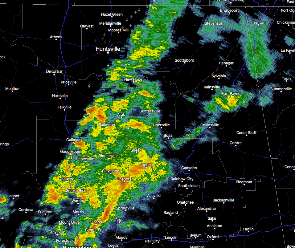
At 914 AM CST, Doppler radar was tracking a cluster of showers and thunderstorms producing strong gusty winds from near New Market to Douglas. Movement was northeast at around 30 mph. Wind gusts up to 50 mph will be possible just ahead of and within these showers and storms.
Locations impacted include…
Albertville, Scottsboro, Fort Payne, Boaz, Guntersville, Rainsville, Bridgeport, Henagar, Stevenson and Collinsville.
Strong gusty winds will be capable of snapping tree limbs and knocking down small shallow rooted trees along with other small unsecured items. Seek safe shelter until this line of storms has passed.
Category: Alabama's Weather, ALL POSTS
About the Author (Author Profile)
Scott Martin is an operational meteorologist, professional graphic artist, musician, husband, and father. Not only is Scott a member of the National Weather Association, but he is also the Central Alabama Chapter of the NWA president. Scott is also the co-founder of Racecast Weather, which provides forecasts for many racing series across the USA. He also supplies forecasts for the BassMaster Elite Series events including the BassMaster Classic.Subscribe
If you enjoyed this article, subscribe to receive more just like it.


