

Winter Weather Advisory Expanded to Include Jefferson, Shelby, Walker
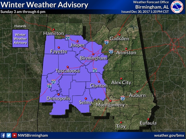
The NWS in Birmingham has expanded the Winter Weather Advisory to include more of Central Alabama, including Jefferson, Shelby and Walker Counties including Birmingham, Jasper, Hoover, Columbiana, Pelham and Alabaster.
Other counties included in the Advisory include: Autauga, Bibb, Chilton, Dallas, Fayette, Greene, Hale, Lamar, Marengo, Perry, Pickens, Sumter and Tuscaloosa.
The GFS and European models have consistently shunted the precipitation to the south of the Birmingham Metro on Sunday morning. The NAM continues to be an outlier, showing more impact further north, so we have to consider it as well, just in case.
I will have a complete look at the latest model data, but wanted to give you the heads up that the advisory had been posted and travel could be impacted in the Birmingham Metro area on Sunday morning as well.
IMPACT
A brief period of light freezing rain and sleet could cause slipped conditions on sidewalks, roads and bridges. Accumulations are expected to be light, less than 0.10 inches, so power should not be affected.
WHEN
Beginning between 6-9 a.m. and continuing through mid-afternoon as it pushes southeastward. The precipitation should end in the Tuscaloosa/Birmingham area by noon and in Shelby County by 3 p.m.
Category: Alabama's Weather, ALL POSTS
About the Author (Author Profile)
Bill Murray is the President of The Weather Factory. He is the site's official weather historian and a weekend forecaster. He also anchors the site's severe weather coverage. Bill Murray is the proud holder of National Weather Association Digital Seal #0001 @wxhistorianSubscribe
If you enjoyed this article, subscribe to receive more just like it.


