

A Look at the Latest Data for Tonight, Early Monday
An approaching upper-level disturbance and weak surface low will trigger precipitation across Alabama and western Georgia tonight and Monday morning, which could affect your late night and early morning travel over Northeast and East Alabama and western Georgia. This is, of course, a concern for any football fans traveling to the National Championship game in Atlanta.
Why does it always seem that when Alabama or Auburn is in the National Championship game that there is a threat to travel? But I digress.
High clouds are moving across much of Alabama at this hour, with thicker clouds marching eastward across Mississippi. They will be with us starting later today.

GOES-16 Visible imagery of clouds across Southeast at 10:48 am CST
Temperatures right now are in the middle and upper 30s to near 40F across Central Alabama, heading for highs in the middle to upper 40s to near 50F in places like Tuscaloosa and Demopolis. By 2 a.m. tonight, readings will fall back to around 40F at Tuscaloosa, to 36-38F around Birmingham to 33-35F from Cullman to Gadsden to Anniston to Alex City. From Jackson, DeKalb, and Cherokee Counties down through Calhoun, Cleburne, Clay and Randolph counties over to near Atlanta, temperatures will be falling into the upper 20s. This will allow for a window of light freezing rain as the precipitation starts between midnight and 7 a.m.
This could produce a light glaze of ice on bridges and exposed objects. Precipitation amounts are expected to be light during the period of freezing surface temperatures, so accumulation on trees and power lines should not be a threat to electric transmission.
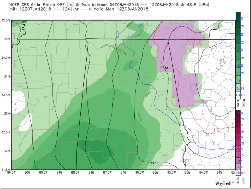
Here is the GFS at 6 am CST Monday showing precipitation type between 3-6 a.m. The pink represents freezing rain over eatern Alabama and western Georgia.
I am concerned for the Atlanta area, looking at the 3 km NAM. It has been consistently later with the precipitation and stronger with the cold air in the Atlanta area. It keeps temperatures in the 32F-34F range throughout the day in Atlanta.
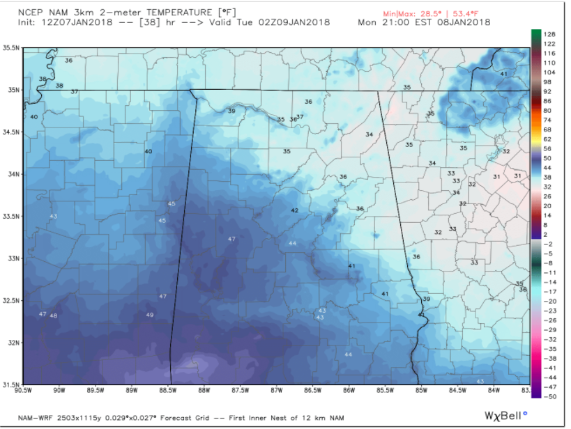
Temperatures at 3 p.m. EST Monday from the 3 km NAM
This would mean that precipitation falling during the late morning and early afternoon could be in the form of freezing rain. We will have to watch for that possibility.
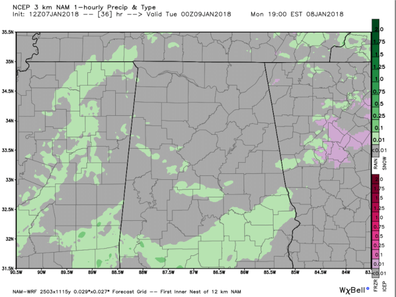
Precipitation type from the 3 km NAM at noon EST Monday.
National Weather Service offices in Huntsville, Birmingham and Atlanta have issued winter weather advisories for the potentially affected areas for after midnight through mid-morning in Alabama and into the afternoon in Georgia.

These advisories could be expanded into the Atlanta area this afternoon. Look at this late message from the NWS Atlanta:
Media and EM partners, Just wanted to give some additional insight on our thought process going into this afternoon’s package. A tough call with this event, especially for the metro areas for a relatively low chance freezing rain event (40%) but very high impact potential given timing at rush hour and the number of potential travelers for the big event Monday evening. For these reasons, we will be looking hard at potentially expanding advisory with afternoon package. The advisory would be for criteria and chances we may not usually issue for but given events of Monday may be the best call. Not a certainty we will be expanding advisory but wanted to give heads up on our though process leading into.
Category: ALL POSTS, Winter Weather
About the Author (Author Profile)
Bill Murray is the President of The Weather Factory. He is the site's official weather historian and a weekend forecaster. He also anchors the site's severe weather coverage. Bill Murray is the proud holder of National Weather Association Digital Seal #0001 @wxhistorianSubscribe
If you enjoyed this article, subscribe to receive more just like it.


