Nice And Warm At Midday; Big Cool Down Occurs Tomorrow
HOW’S THE WEATHER OUTSIDE AT 11:25 AM
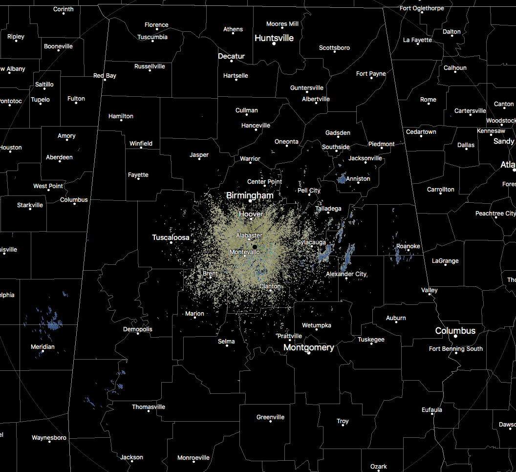
We have a mix of sun and clouds out there across Central Alabama as we start to make our way to the midday hour on your Thursday. The good news is that temperatures are quite mild at this point, and nearly everyone is dry. We are picking up a few returns on radar over in the eastern parts of the area, but much of what is showing is not reaching the ground. There are a few sprinkles to very light showers falling over southwestern St. Clair County, and down into portions of Clay, Randolph, Tallapoosa, and Chambers counties. Temperatures are ranging from the lower 60s in the north to the lower 70s in the south… definitely not a day that you would expect for the winter months in Alabama.
WEATHER FOR THE REST OF YOUR THURSDAY
We’ll continue to have more clouds than sun throughout the remainder of the afternoon and into the early evening hours, and there is a small risk for a few isolated showers for much of the area, with scattered to numerous showers expected for the latter part of the afternoon in the western locations. Afternoon highs will make it into the mid-60s to the lower 70s throughout the area and could be a degree or two warmer if any sunshine breaks through for a little while.
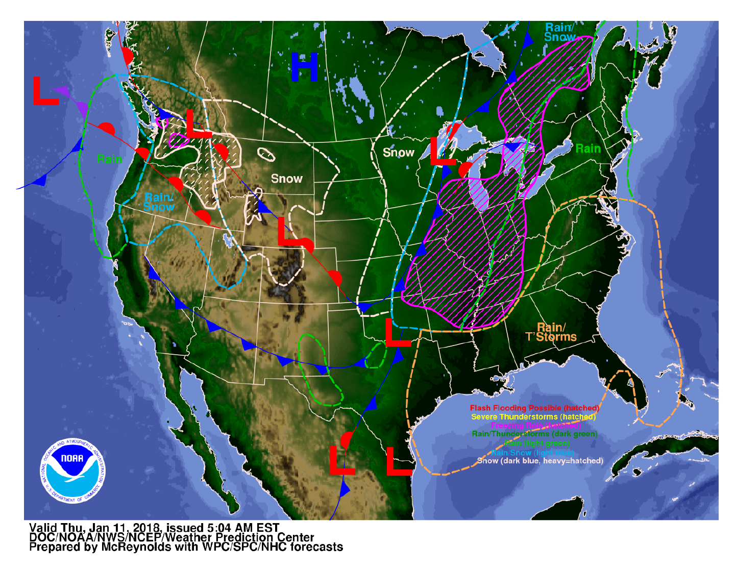
For the late night and the overnight hours, the cold front will move into the western portions of the state after midnight, bringing with it a line of showers and maybe a few thunderstorms. The front will slowly move eastward and should make it to the I-65 corridor by daybreak. No severe weather is expected, and temperatures will range from the lower 40s in the extreme northwestern locations to the lower 60s in the extreme southeastern parts of Central Alabama.
RAIN ENDS AND TURNING MUCH COLDER ON FRIDAY
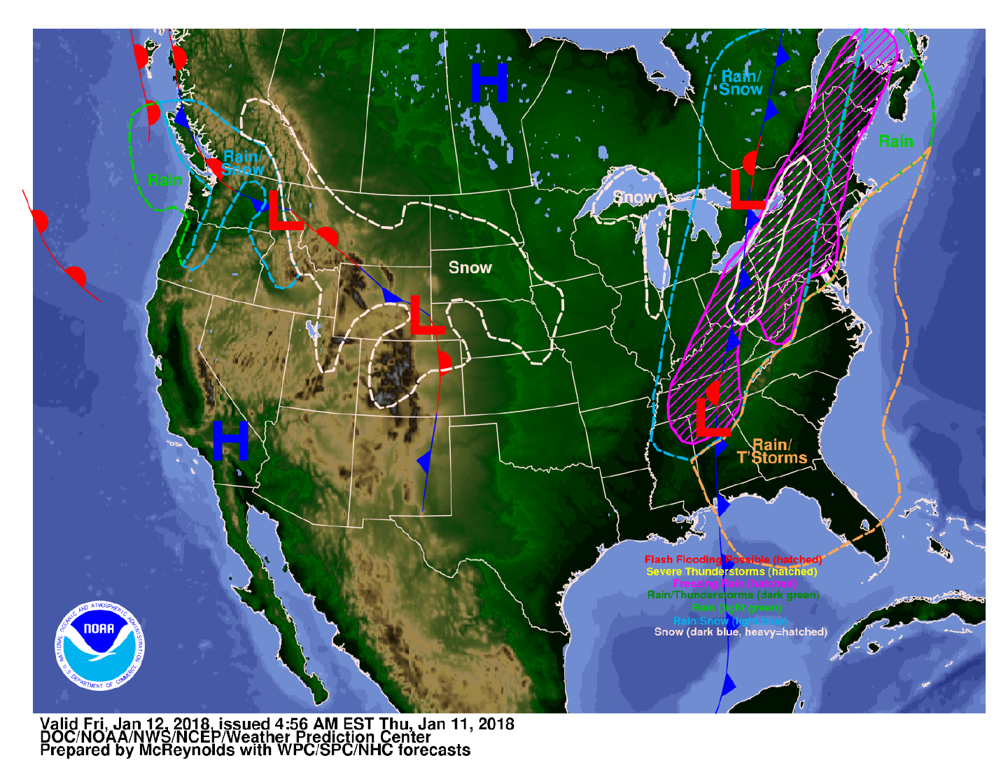
Showers and a few thunderstorms will continue to move through Central Alabama during the morning hours, but I believe that most of the main activity will be out of the state shortly after the start of the noon hour. Models have been trending drier on the backside of the front, keeping any significant moisture out of the area, even though a few flurries or small sleet pellets are possible north of the I-20 corridor during the afternoon and evening hours. No travel issues expected for Central Alabama, but do expect temperatures to fall throughout the day. At noon, we’ll be in the lower 30s in the northwest to near 60 degrees in the southeast. By 6:00 PM, those temperatures will have dropped into the upper 20s to the mid-40s, and will bottom out in the lower 20s to near 30 degrees.
WINTER WEATHER ADVISORY ISSUED FOR EXTREME NORTH ALABAMA
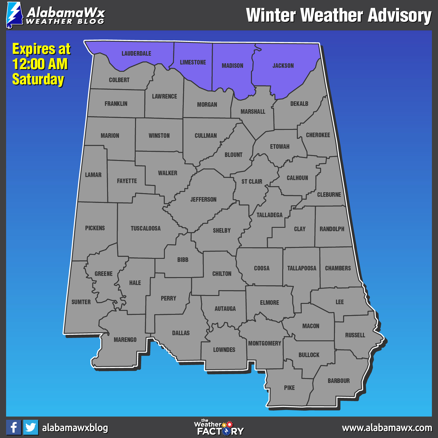
At this point, the only locations that could potentially have any accumulations from snowfall or sleet and freezing rain will be the counties located on the Tennessee state line. Therefore, NWS Huntsville has issued a Winter Weather Advisory from 8:00 AM Friday morning to 12:00 AM Saturday for Lauderdale, Limestone, Madison, and Jackson counties. A changeover from rain to a wintry mix will occur from west to east during the morning and into the afternoon hours, then end as light snow during the evening and into the late night hours. Accumulations of up to 1/10th of an inch of ice and snow and/or sleet accumulations up to 1/2 inch are possible throughout the day. Difficult travel conditions may occur, especially on elevated surfaces and lesser traveled roads.
ON THIS DAY IN WEATHER HISTORY
2008 – Iraqis in Baghdad woke up to the novelty of falling snowflakes as the city experienced its first snowfall in about 100 years.
THE BEACH FORECAST
Click here to see the AlabamaWx Beach Forecast Center page. The Beach Forecast is partially underwritten by the support of Brett/Robinson Vacation Rentals in Gulf Shores and Orange Beach. Click here to see Brett/Robinson’s Off-Season Deals now!
WEATHERBRAINS
Check out the show at www.WeatherBrains.com. You can also subscribe on iTunes. You can watch the show live at live.bigbrainsmedia.com. You will be able to see the show on the James Spann 24×7 weather channel on cable or directly over the air on the dot 2 feed.
E-FORECAST
Get the AlabamaWx Weather Blog’s Seven-Day Forecast delivered directly to your inbox by email twice daily. It is the most detailed weather forecast available in Central Alabama. Subscribe here… It’s free!
ADVERTISE WITH US
Don’t miss out! We can customize a creative, flexible and affordable package that will suit your organization’s needs. Contact Bill Murray at (205) 687-0782.
Category: Alabama's Weather, ALL POSTS
About the Author (Author Profile)
Scott Martin is an operational meteorologist, professional graphic artist, musician, husband, and father. Not only is Scott a member of the National Weather Association, but he is also the Central Alabama Chapter of the NWA president. Scott is also the co-founder of Racecast Weather, which provides forecasts for many racing series across the USA. He also supplies forecasts for the BassMaster Elite Series events including the BassMaster Classic.Subscribe
If you enjoyed this article, subscribe to receive more just like it.


