A Brief Check On Our Weather At 12:50 PM… Snowband Entering Jefferson County
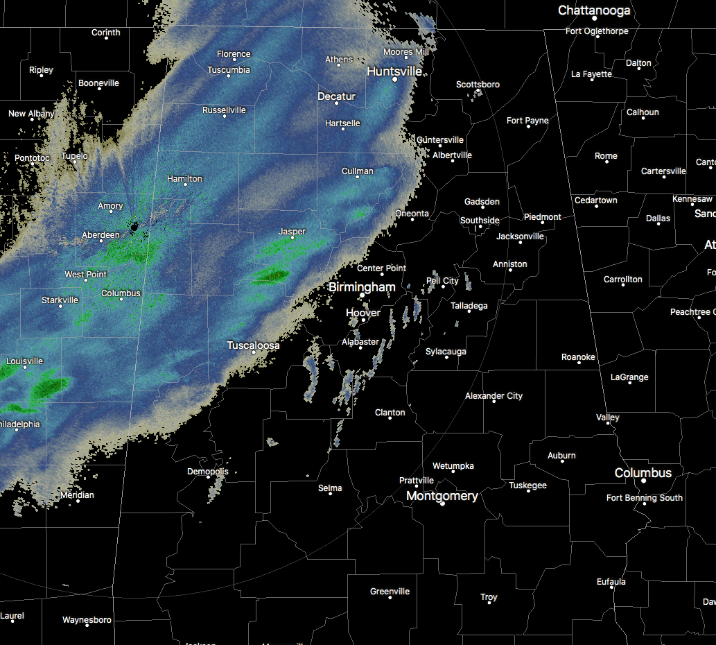
Radar check at 12:30 PM is showing the front edge of the main snow band now moving into the western portions of Blount and Jefferson counties and stretching back into Tuscaloosa County approaching the city of Tuscaloosa. That front edge continues back into Greene and Sumter counties. If the Blount and Jefferson counties part of that sentence sounds like a repeat… well it is. There was a leading edge of precipitation that extended out a few miles farther, but that part of the band dissipated nearly an hour ago.
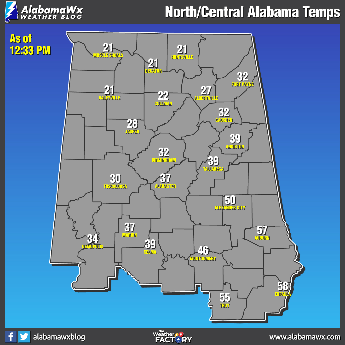
If your location is north of the I-59 and I-20/59 corridors, then your temperatures are below freezing, ranging from the lower 20s in the north to the freezing point at Birmingham and Gadsden. South of that, temperatures are in the mid-30s to the upper 50s… that’s right… the upper 50s. Auburn, Troy, Eufaula, and other locations in the southeastern parts of Central Alabama received a good bit of sunshine before the precipitation moves in later today. With that being the case, there is the possibility that rain will start off the event in that section of the area and eventually transition to freezing rain to sleet to snow. The rest of the North and Central Alabama area will have mainly snow when it starts in your location if it hasn’t reached there yet.
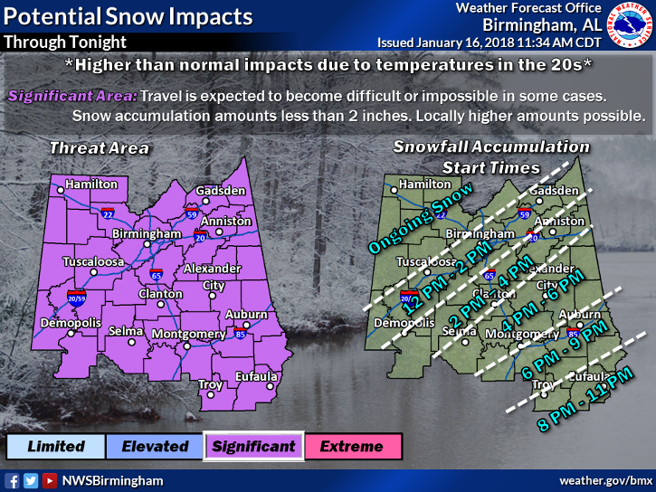
In the northwestern parts of the state, multiple accidents have been reported and multiple roadways deemed impassable. If you don’t have to be on the roadways, just stay put. If travel is not affected in your area at this point, be sure you are at the place where you plan to be before the snow starts in your location. Roadways will quickly become slick and then impassible soon after.
I know that this has been repeated several times already, but this is very important. Along with the snow threat comes a major cooldown throughout the area for the rest of the day. A Wind Chill Advisory has been issued for all of North and Central Alabama, along with a Hard Freeze Warning for all of Central Alabama, both until 9:00 AM Wednesday. Low temperatures are expected to bottom out in the 5 to 15-degree range from the Tennessee state line down to Troy and Eufaula. Combine those temperatures with winds out of the north up to 15 MPH, wind chills will be in the -5 to 5-degree range. Frostbite and hypothermia can occur very quickly if precautions are not taken. Make sure you wear a hat and gloves.
Please remember the 4-Ps… People, Pets, Plants, and Pipes. The cold air that will be in place can cause damage to plants and property, so be sure you take the proper steps to protect those. Be sure to check on the elderly and make sure they have proper and safe ways of staying warm. Bring those pets indoors as this cold will be harmful or even deadly.
Keep checking back with us on the blog throughout the day for the latest updates, and follow us on Twitter and Facebook (@AlabamaWxBlog).
Category: Alabama's Weather, ALL POSTS
About the Author (Author Profile)
Scott Martin is an operational meteorologist, professional graphic artist, musician, husband, and father. Not only is Scott a member of the National Weather Association, but he is also the Central Alabama Chapter of the NWA president. Scott is also the co-founder of Racecast Weather, which provides forecasts for many racing series across the USA. He also supplies forecasts for the BassMaster Elite Series events including the BassMaster Classic.Subscribe
If you enjoyed this article, subscribe to receive more just like it.


