A Brief Check On Central Alabama’s Weather Situation Just After 1:00 PM
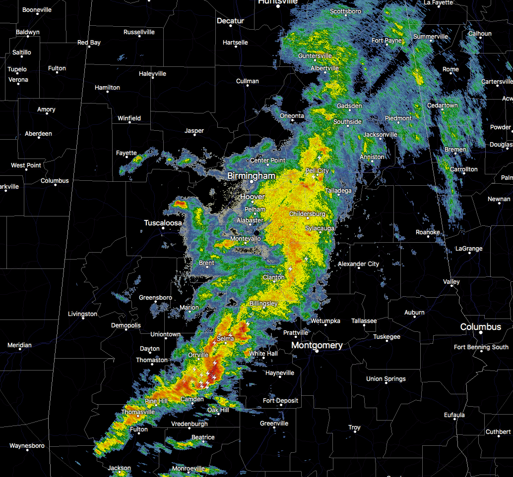
RADAR CHECK AT 1:10 PM
The line of showers and thunderstorms has now made it across a good portion of the state at this time, and has actually shown signs of weakening a little on the northern parts.
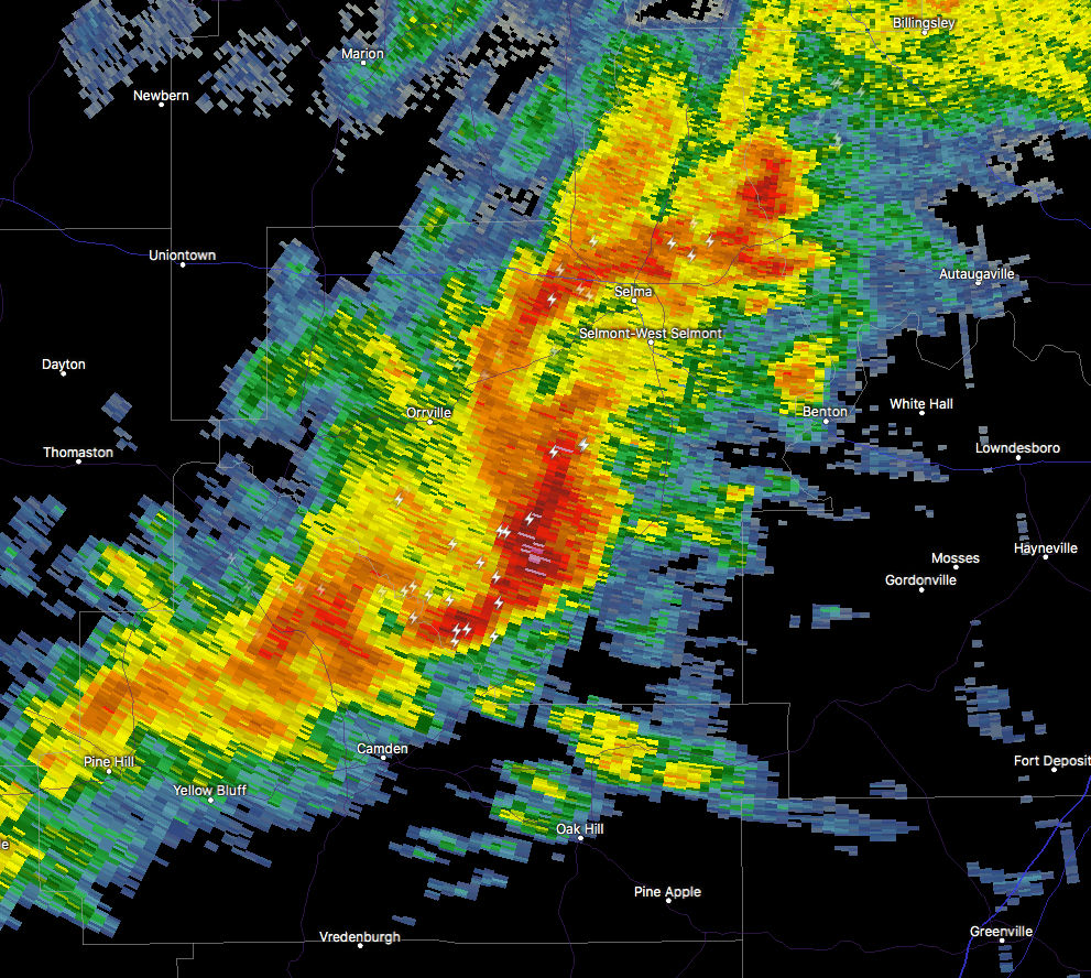
One cell that we need to keep our eyes on is down in Dallas and Wilcox counties that is showing a sudden burst of heavy rain and frequent cloud-to-ground lightning. NWS Birmingham has just issued a Significant Weather Advisory for Southern Autauga, Western Lowndes, and Southeastern Dallas counties until 2:15 PM.
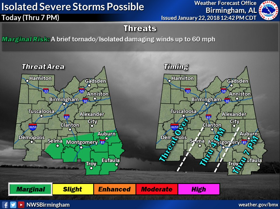
The Marginal Risk for severe storms has been reduced and confined to the southern and southeastern parts of Central Alabama through the rest of the day (mainly along and south of a line from Selma to Eclectic to Valley).
For locations north of the threat area, it will mainly be a good rain event with a few embedded thunderstorms. Some of the embedded cells could have brief gusts of wind but will be well less of severe criteria.
I still believe the timing is on-track for the remainder of the state today… now until 4:00 PM for the central parts (Selma, Clanton, Birmingham, Gadsden), and 2:00 PM – 6:00 PM for the eastern parts (Montgomery, Troy, Alexander City, Anniston).
Category: Alabama's Weather, ALL POSTS
About the Author (Author Profile)
Scott Martin is an operational meteorologist, professional graphic artist, musician, husband, and father. Not only is Scott a member of the National Weather Association, but he is also the Central Alabama Chapter of the NWA president. Scott is also the co-founder of Racecast Weather, which provides forecasts for many racing series across the USA. He also supplies forecasts for the BassMaster Elite Series events including the BassMaster Classic.Subscribe
If you enjoyed this article, subscribe to receive more just like it.


