Severe Thunderstorm Warning for Southeastern Dallas County Will Expire at 1:45 PM
Severe Weather Statement
National Weather Service Birmingham AL
135 PM CST MON JAN 22 2018
ALC047-221945-
/O.EXP.KBMX.SV.W.0001.000000T0000Z-180122T1945Z/
Dallas AL-
135 PM CST MON JAN 22 2018
…THE SEVERE THUNDERSTORM WARNING FOR SOUTHEASTERN DALLAS COUNTY
WILL EXPIRE AT 145 PM CST…
The storm which prompted the warning has weakened below severe
limits, and no longer poses an immediate threat to life or property.
Therefore the warning will be allowed to expire.

Severe Weather Statement
National Weather Service Birmingham AL
127 PM CST MON JAN 22 2018
ALC047-221945-
/O.CON.KBMX.SV.W.0001.000000T0000Z-180122T1945Z/
Dallas AL-
127 PM CST MON JAN 22 2018
…A SEVERE THUNDERSTORM WARNING REMAINS IN EFFECT UNTIL 145 PM CST
FOR SOUTHEASTERN DALLAS COUNTY…
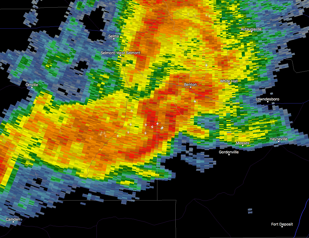
At 127 PM CST, a severe thunderstorm was located near Belknap, or 12
miles south of Selmont-West Selmont, moving east at 40 mph.
HAZARD…60 mph wind gusts and quarter size hail.
SOURCE…Radar indicated.
IMPACT…Hail damage to vehicles is expected. Expect wind damage to
roofs, siding, and trees.
Locations impacted include…
Dallas Lake and Belknap.
PRECAUTIONARY/PREPAREDNESS ACTIONS…
For your protection move to an interior room on the lowest floor of a
building.
BULLETIN – IMMEDIATE BROADCAST REQUESTED
Severe Thunderstorm Warning
National Weather Service Birmingham AL
112 PM CST MON JAN 22 2018
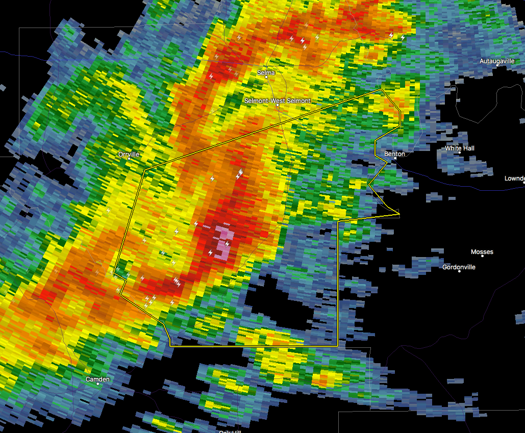
The National Weather Service in Birmingham has issued a
* Severe Thunderstorm Warning for…
Southeastern Dallas County in south central Alabama…
* Until 145 PM CST
* At 112 PM CST, a severe thunderstorm was located near Dallas Lake,
or 14 miles southwest of Selmont-West Selmont, moving east at 35
mph.
HAZARD…60 mph wind gusts and quarter size hail.
SOURCE…Radar indicated.
IMPACT…Hail damage to vehicles is expected. Expect wind damage
to roofs, siding, and trees.
* Locations impacted include…
Dallas Lake, Old Cahaba Park, Belknap, Dannelly Reservoir, Tyler,
Tilden, Whites Bluff, Carlowville, Minter and Craig Field Aiport.
PRECAUTIONARY/PREPAREDNESS ACTIONS…
For your protection move to an interior room on the lowest floor of a
building.
Category: Archived Warnings
About the Author (Author Profile)
Scott Martin is an operational meteorologist, professional graphic artist, musician, husband, and father. Not only is Scott a member of the National Weather Association, but he is also the Central Alabama Chapter of the NWA president. Scott is also the co-founder of Racecast Weather, which provides forecasts for many racing series across the USA. He also supplies forecasts for the BassMaster Elite Series events including the BassMaster Classic.Subscribe
If you enjoyed this article, subscribe to receive more just like it.


