Strong Storms Approaching Jackson County
Special Weather Statement
National Weather Service Huntsville AL
156 AM CST SUN FEB 25 2018
ALZ009-TNZ097-250830-
Jackson AL-Franklin TN-
156 AM CST SUN FEB 25 2018
…SIGNIFICANT WEATHER ADVISORY FOR FRANKLIN COUNTY UNTIL 230 AM
CST…
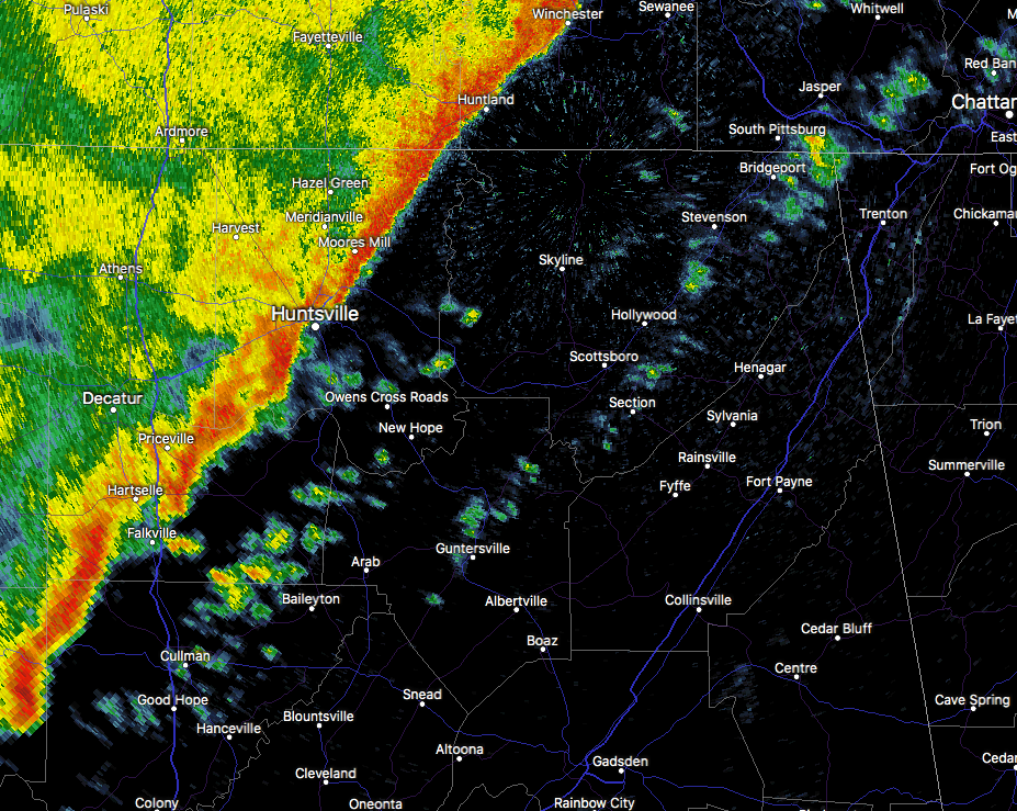
At 156 AM CST, Doppler radar was tracking strong thunderstorms along
a line extending from 8 miles north of Sewanee to near Huntland.
Movement was east at 35 mph.
Wind gusts up to 50 mph and heavy rainfall will be possible with
these storms.
Locations impacted include…
Winchester, South Pittsburg, Decherd, Estill Springs, Cowan,
Monteagle, Huntland, Sewanee, Tims Ford Lake and Anderson.
PRECAUTIONARY/PREPAREDNESS ACTIONS…
Strong gusty winds will be capable of knocking down small tree limbs
along with other small unsecured items. Seek safe shelter until this
line of storms has passed.
Category: Archived Warnings
About the Author (Author Profile)
Scott Martin is an operational meteorologist, professional graphic artist, musician, husband, and father. Not only is Scott a member of the National Weather Association, but he is also the Central Alabama Chapter of the NWA president. Scott is also the co-founder of Racecast Weather, which provides forecasts for many racing series across the USA. He also supplies forecasts for the BassMaster Elite Series events including the BassMaster Classic.Subscribe
If you enjoyed this article, subscribe to receive more just like it.


