Warming Trend Begins Later Today
ANOTHER FREEZE: Here are some temperatures just before daybreak across the great state of Alabama…
Black Creek 22
Fort Payne 25
Pell City 25
Cottondale 25
Gadsden 26
Hueytown 26
Anniston 27
Alexander City 27
Talladega 28
Weaver 28
Thorsby 29
Prattville 29
Haleyville 30
Demopolis 30
Sylacauga 30
Marion 30
Tuscaloosa 31
For most North/Central Alabama communities, this is the third consecutive morning with a freeze. On the positive side, we warm up nicely today with a strong March sun; most places will reach the upper 60s this afternoon. And, tonight, we stay above freezing for a change with lows in the 40s.
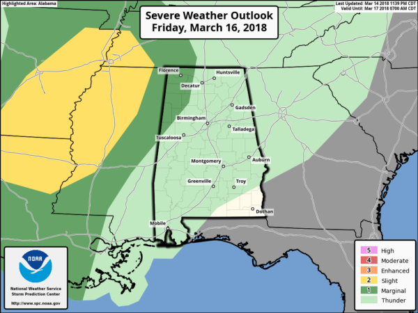
TOMORROW AND THE WEEKEND: Clouds will increase tomorrow, and we will mention the risk of a shower by mid to late afternoon, but most of the day will be dry and mild with a high between 66 and 70 degrees. Showers are more likely tomorrow night as a weakening cold front pushes into the state. Some thunder is possible, but the severe weather threat from this will be mainly west of Alabama. SPC does have a “marginal risk” extending into far Northwest Alabama tomorrow night, but it is a very low end threat.
The front will settle into Central Alabama Saturday morning and stall out; it sure looks most of the day Saturday will be dry with only isolated showers. The sun could break out at times, and temperatures will rise into the upper 70s.
Pretty much the same idea during the daylight hours Sunday; mostly dry with only a small risk of a shower. With a mix of sun and clouds, the afternoon high will be well up in the 70s again.
SUNDAY NIGHT AND MONDAY: Sunday night rain and storms will move into the state as a new surface low forms to the northwest, and the boundary moves northward as a warm front. Some strong storms are possible Sunday night into Monday, but for now SPC does not have any part of Alabama in a risk area. Their “Day 4” outlook for Sunday and Sunday night has a severe weather risk defined to the west.

Monday will be another warm day with a high in the mid to upper 70s.
REST OF NEXT WEEK: Another upper trough forms over the eastern quarter of the nation, and colder air will be pulled down into the state Tuesday. Tuesday will be mostly cloudy, breezy, and very cool with some risk of scattered light rain for the northern quarter of the state… we won’t get out of the 50s. The rest of the week looks dry, and we will have some risk of another freeze, or at least some frost by Wednesday and Thursday morning. See the Weather Xtreme video for maps, graphics, and more details.

BEACH FORECAST: Click here to see the AlabamaWx Beach Forecast Center page.
WEATHER BRAINS: Don’t forget you can listen to our weekly 90 minute netcast anytime on the web, or on iTunes. This is the show all about weather featuring many familiar voices, including our meteorologists here at ABC 33/40.
CONNECT: You can find me on all of the major social networks…
Facebook
Twitter
Google Plus
Instagram
Pinterest
Snapchat: spannwx
I have stops today at First Baptist Church Columbiana… and Chelsea Park Elementary School… look for the next Weather Xtreme video here by 4:00 this afternoon. Enjoy the day!
Category: Alabama's Weather, ALL POSTS, Weather Xtreme Videos
About the Author (Author Profile)
James Spann is one of the most recognized and trusted television meteorologists in the industry. He holds the AMS CCM designation and television seals from the AMS and NWA. He is a past winner of the Broadcast Meteorologist of the Year from both professional organizations.Subscribe
If you enjoyed this article, subscribe to receive more just like it.


