

Watches & Warnings Issued To The West & Northwest; Strong To Severe Storms Arrive Later Tonight
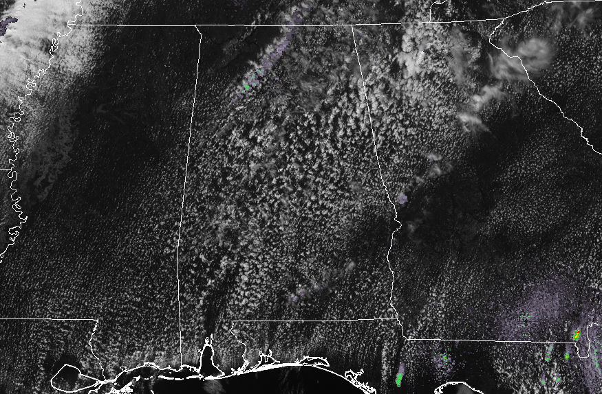
So far across North and Central Alabama, conditions have been decent with a mix of sun and clouds throughout the area, along with nice temperatures and breezy at times. As of 2:00 PM, there are a few returns showing up on radar up in the northern parts of the state, but I highly doubt and raindrops are making it to the surface. The rest of North and Central Alabama is dry. Temperatures are ranging from the mid-70s up on the mountains of northeast Alabama to the lower 80s across the southern parts of Central Alabama. Birmingham was at 81 degrees.
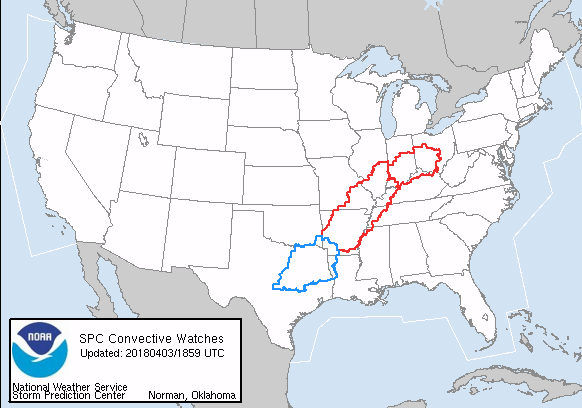
Off to our north and northwest, there are two tornado watches in effect for parts of Ohio, Indiana, Kentucky, Illinois, Missouri, Tennessee, Arkansas, and Mississippi. Southwest of those watches, a severe thunderstorm watch is in effect for parts of Arkansas, Louisiana, and Texas. It is likely that more will be issued as the system continues to move to the east.
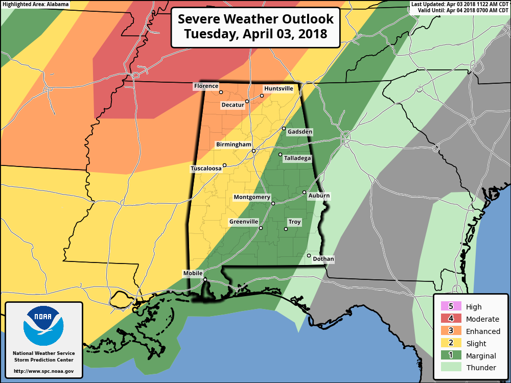
The SPC has an Enhanced Risk of severe storms defined for locations west of a line from Hytop (Jackson Co). to Arley (Winston Co.) to just west of Reform (Pickens Co.). A Slight Risk continues for areas east and southeast of that, stretching to a line from Sand Rock (Cherokee Co.) to Pell City (St. Clair Co.) to Clanton (Chilton Co.) to just east of Selma (Dallas Co.). The rest of Central Alabama east of the slight risk has been defined in a Marginal Risk for severe storms with the exception of the extreme southeastern corner of the area.
We do note that a Moderate Risk of severe storms clips the very northwestern corner of the state, which includes the Waterloo community in Lauderdale County. The threat for damaging winds will be a little higher in the moderate risk zone, while the tornado risk stays the same as the enhanced risk areas.
Timing on impacts from the strong to severe storms for locations west of a line from Gadsden to Birmingham to Demopolis will be from around 8:00 PM to 12:00 AM, and east of that same line from 11:00 PM to 3:00 AM. By the time the line of storms reach the I-85 corridor in the southeastern parts of Central Alabama, the threat of severe weather will have diminished (mainly locations east of a line from Roanoke to Dadeville to Montgomery).
Main threats for tonight will be damaging winds up to 70 MPH, a few tornadoes, and hail up to 1″ in diameter (quarter-size) for locations in the Enhanced Risk locations. Main threats in the Slight Risk locations will be damaging winds up to 60 MPH, a few brief tornadoes, and some hail up to 1″ in diameter. Those threats will continue into the Marginal Risk locations, becoming less likely, but can not be ruled out.
Afternoon highs will top out into the upper 70s to the mid-80s, and skies will be partly to mostly cloudy throughout the remainder of the daylight hours. Clouds will start to build during the early evening and I wouldn’t be surprised if a few scattered showers form and move across before the line enters the state. Much of the rain activity will be out of Central Alabama by noon on Wednesday. Rainfall amounts for tonight’s event should range from 0.50″-1.00″ from the Tennessee state line down to the southern tip of Pike and Barbour counties, so flooding should not be an issue.
We’ll continue to have updates throughout the day on the blog. Be sure to have your safety kits and plans ready to go just in case a warning is issued for your location.
Category: Alabama's Weather, ALL POSTS
About the Author (Author Profile)
Scott Martin is an operational meteorologist, professional graphic artist, musician, husband, and father. Not only is Scott a member of the National Weather Association, but he is also the Central Alabama Chapter of the NWA president. Scott is also the co-founder of Racecast Weather, which provides forecasts for many racing series across the USA. He also supplies forecasts for the BassMaster Elite Series events including the BassMaster Classic.Subscribe
If you enjoyed this article, subscribe to receive more just like it.


