

Shaping up for a Nice Sunday
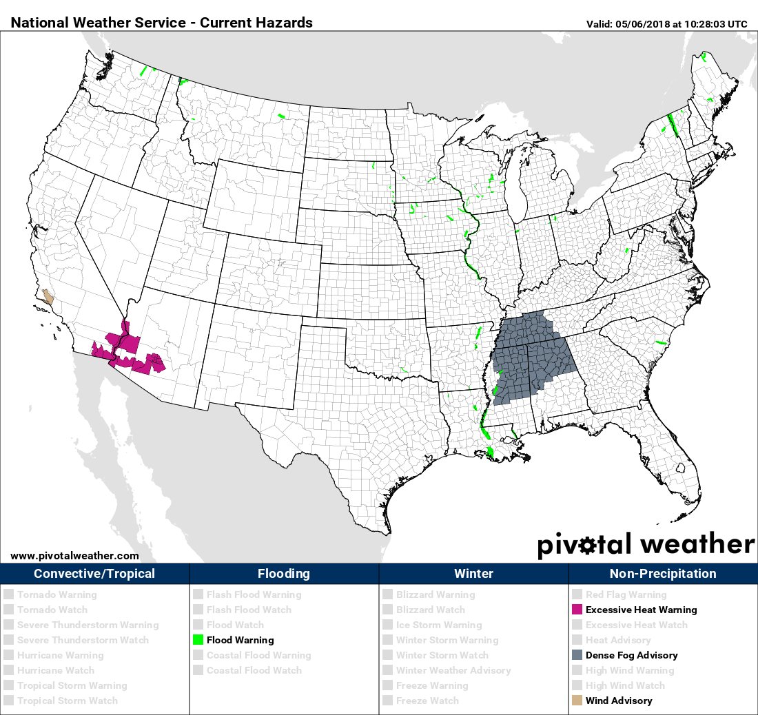
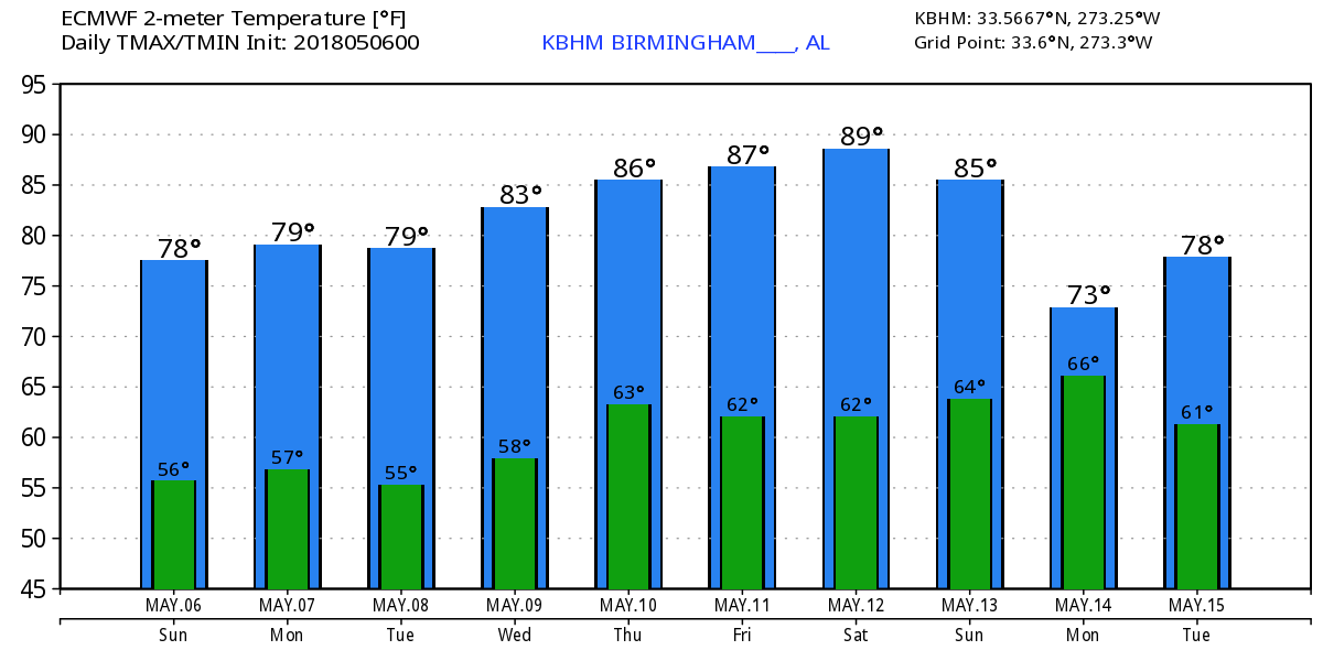
For much of the day yesterday, it looked like the front would never make it as the showers were very slow to move into and across Central Alabama. But by this morning, the front was near the Southeast US Coast stretching southwest into the Gulf. A dense fog advisory covered much of the western half of Tennessee and the northern halves of Alabama and Mississippi. We should see a good deal of sunshine today after the fog burns away with highs around the 80-degree mark in a range from 78 to 82.
The upper trough passing over the area today will stick around the eastern US through Tuesday, but with the trough to our east and the northwesterly flow coming from the Central US, we won’t see much in the way of moisture return. So it looks dry with only the possibility of some passing clouds. Highs should reach the lower 80s.
A relatively strong short wave moves across Minnesota on Wednesday reaching the eastern Great Lakes on Thursday. A surface low below this upper level feature will force a weak cold front into the Tennessee River Valley by Thursday, but the front is expected to become oriented parallel to the upper flow, so it should wash out. Looks like the best shot at an isolated shower or two will be north of Central Alabama.
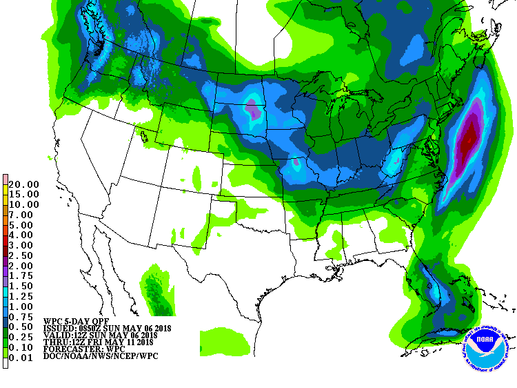
So much of the next week will be dry with little rainfall forecast on our QPF chart. And the risk for severe storms is minimal for the next three days with some potential over the Central Mississippi River Valley on Day 4/Wednesday.
Friday we see the upper flow beginning to morph into an upper ridge for the eastern US as a trough digs into the western US reaching the Texas Panhandle by Saturday. A surface low will form in the vicinity of the Texas/Oklahoma Panhandles on Saturday and move to Northeast Iowa on Sunday. This surface pattern will bring the flow around to the south and increase our moisture levels by Sunday. But for now, it looks like the weekend will start dry with showers possible for Sunday. Highs for the weekend are likely to reach the middle and upper 80s across Central Alabama.
As we verge into voodoo country, the strong upper low is forecast to become negatively tilted along the Mississippi River on Tuesday, so this could set the stage for a fairly significant severe weather event. We’ll surely need to keep an eye on future model runs to see how they handle this feature. Severe weather has been somewhat lacking across the US for 2018 with the absence of any signifiant widespread severe events so far in the year.
If you remember the discussion yesterday, voodoo country was dominated by a very, very strong upper ridge/high. That feature is gone on the latest model run this morning, but there is another fairly strong upper trough forecast to come across the Central US in the May 18-19 time frame. This would spell another potential round for severe storms. But the idea of that huge upper ridge is not completely gone. The GFS showed a big upper ridge beginning to take shape at 372 hours around the 21st of May. So the idea of some heat is still on the table. But it does stand to reason since we are approaching the latter part of May.
Beach Forecast: Click here to see the AlabamaWx Beach Forecast Center page.
WeatherBrains: Don’t forget you can listen to our weekly 90 minute netcast anytime on the web, or on iTunes. This is the show all about weather featuring many familiar voices, including our meteorologists here at ABC 33/40.
I had a great time at Altoona Day yesterday in Etowah County. The clouds held the temperature down and there was a steady light breeze. We also were impacted by an intense and hyperlocal downburst when the Lifesaver helicopter arrived and landed creating havoc for some of the vendors by blowing the roofs off display tents and scattering giveaways!! James Spann is schedule to return with the next Weather Xtreme Video by 7 or so on Monday morning. Have a great day and Godspeed.
-Brian-
.
Category: Alabama's Weather, ALL POSTS, Weather Xtreme Videos
About the Author (Author Profile)
Brian Peters is one of the television meteorologists at ABC3340 in Birmingham and a retired NWS Warning Coordination Meteorologist. He handles the weekend Weather Xtreme Videos and forecast discussion and is the Webmaster for the popular WeatherBrains podcast.Subscribe
If you enjoyed this article, subscribe to receive more just like it.


