Dry Across North/Central Alabama Through Friday
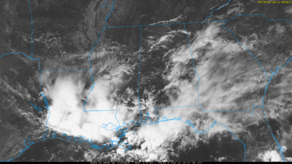
THIS AFTERNOON: We have a very pleasant early June afternoon in progress across the northern half of the state with sunshine through high clouds and temperatures generally below the average high of 86 for June 5. Humidity values remain low as well… the deeper moisture is confined to the southern quarter of the state, where showers and storms have been moving through.
Tonight will be mostly fair; we drop into the 60-65 degree range early tomorrow morning.
TOMORROW THROUGH FRIDAY: The weather stays dry over most of Alabama with sunny days and fair nights. Heat levels will be rising; the high tomorrow will be close to 90, followed by low 90s Thursday and Friday. Any scattered storms will be confined to areas near the Gulf Coast, and even there they will be pretty widely spaced, and there will be a decent amount of sun.
THE ALABAMA WEEKEND: Moisture levels rise, and we will bring back the chance of random, scattered, mostly afternoon and evening showers and thunderstorms Saturday. Otherwise, the day will be partly sunny with a high in the 87-90 degree range. Moisture will be a bit deeper on Sunday, so scattered showers and storms could be a little more numerous. Still, there will be a decent amount of sun, and the high Sunday will be in the upper 80s.
If you like the numbers game, the chance of any one spot getting wet Saturday is around 30 percent, and 40 percent Sunday.
NEXT WEEK: The week looks like it will feature very routine weather for mid-June… a mix of sun and clouds each day with “scattered, mostly afternoon and evening showers and storms”. Highs will be in the upper 80s and low 90s. See the Weather Xtreme video for maps, graphics, and more details.

TROPICS: Tropical storm formation is not expected in the Atlantic basin through the weekend. Over in the eastern Pacific, Showers and thunderstorms associated with an area of low pressure located a few hundred miles south of Manzanillo, Mexico, are becoming better organized. In addition, satellite images indicate that the circulation of the system is now better defined. Continued development of this system is expected, and it will likely become a tropical depression later today or tonight while it moves slowly westward to west-northwestward south of the coast of Mexico.
AIR QUALITY ALERT: There is an “code orange” air quality alert for the Birmingham metro tomorrow (Jefferson and Shelby Counties) due to ground level ozone.
BEACH FORECAST: Click here to see the AlabamaWx Beach Forecast Center page.
WEATHER BRAINS: Don’t forget you can listen to our weekly 90 minute netcast anytime on the web, or on iTunes. This is the show all about weather featuring many familiar voices, including our meteorologists here at ABC 33/40.
CONNECT: You can find me on all of the major social networks…
Facebook
Twitter
Google Plus
Instagram
Pinterest
Snapchat: spannwx
Look for the next Weather Xtreme video here by 7:00 a.m. tomorrow…
Category: Alabama's Weather, ALL POSTS, Weather Xtreme Videos
About the Author (Author Profile)
James Spann is one of the most recognized and trusted television meteorologists in the industry. He holds the AMS CCM designation and television seals from the AMS and NWA. He is a past winner of the Broadcast Meteorologist of the Year from both professional organizations.Subscribe
If you enjoyed this article, subscribe to receive more just like it.


