Showers Remain Numerous for the Weekend
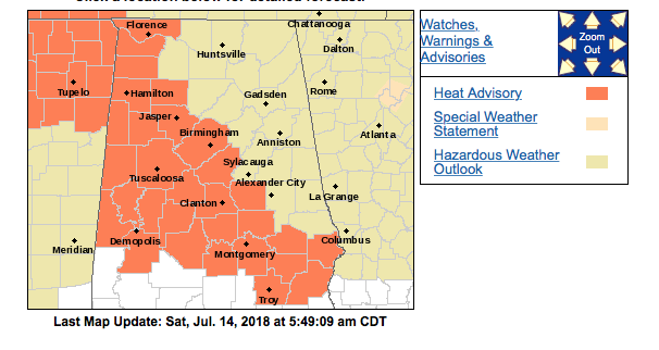
There is not a great deal of change occurring for the weekend across Central Alabama as the weather remains hot and humid. The NWS has posted a heat advisory for a large portion of West Central and Central Alabama for today. Heat index values will push dangerous levels as humidity values remain high with dew points in the lower to middle 70s.
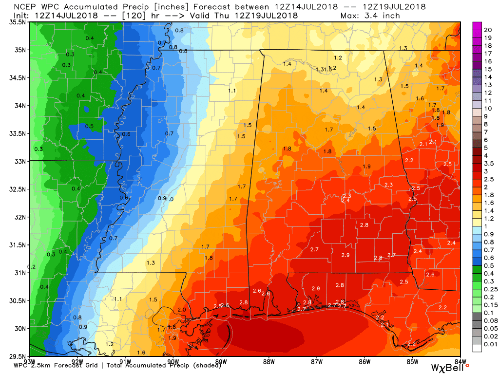
Precipitable water values remain high for the weekend and into the first couple of days of next week. These values at or above 2 inches should favor the potential for numerous thunderstorms, but unfortunately it still means that not everyone one will see rain at their location. Five-day QPF forecasts are for around 2 inches and it’s likely that some spots will see values that high. Isolated flash flooding will be possible since storms will be moving very little resulting in heavy downpours in spots.
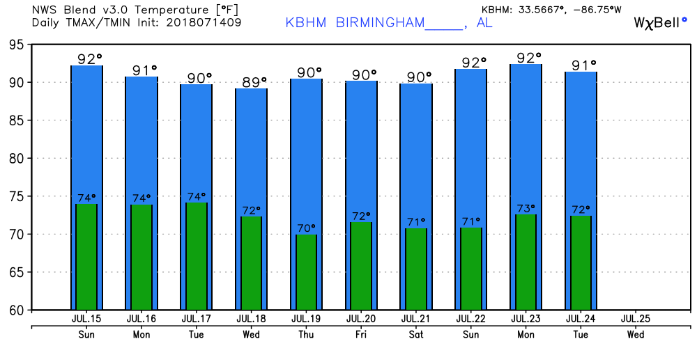
Temperatures for the weekend will continue on the hot side with highs mainly in the lower 90s.
The strong ridge aloft today will wane from Sunday into the middle of the week as it pulls back to the west to become centered in the vicinity of the Four Corners area. This changes the upper flow across the eastern US into a broad trough over the East Coast. With a northwesterly flow aloft over the Southeast US, the northern half of Alabama could see a substantial change to our air mass as precipitable water values drop under that northwesterly flow while the Gulf Coast remains humid. This means that by Wednesday afternoon we could see a big drop in shower potential along with highs slightly cooler with readings in the upper 80s. That should mean we’ll be out of any excessive heat.
The GFS maintains the troughiness along the East Coast for the end of the week and into next weekend with the potential for a cold front to come into the Southeast US by next Friday as a strong trough moves across the Great Lakes region. This could bring back shower chances for the end of the week and next weekend, but the highest precipitable water values are held south of Central Alabama. Highs will continue around the 90-degree mark.
And I like the looks of voodoo country. The GFS inches the upper ridge back toward the Southeast US around the 23rd of July and that’s not good. But after that, from the 24th through the 30th of July, the GFS maintains the upper ridge over the Rockies and a broad trough over the eastern half of the country. This pattern favors warm weather but an absence of extreme heat. This pattern also suggests the potential for weak cold fronts to make it into the region meaning some shower potential and relief from the excessive humidity.
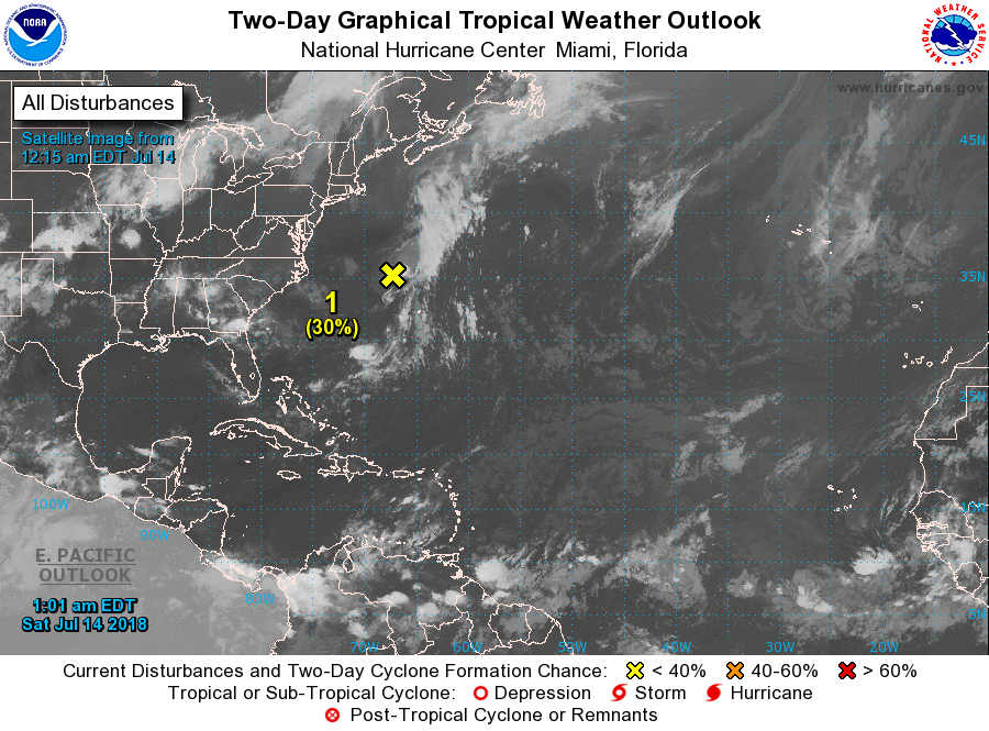
The tropical Atlantic has gone quiet once again with just the ghost of Beryl northwest of Bermuda and forecast to move northeast and gradually degenerate further as it moves over colder water.
Beach Forecast: Click here to see the AlabamaWx Beach Forecast Center page.
WeatherBrains: Don’t forget you can listen to our weekly 90 minute netcast anytime on the web, or on iTunes. This is the show all about weather featuring many familiar voices, including our meteorologists here at ABC 33/40.
Thanks for tuning into the Weather Xtreme Video. I expect to have the next one posted here tomorrow morning by 7 or so. Enjoy the day, but remain weather aware to the dangers of lightning with thunderstorms. The US has recorded 14 lightning deaths so far for 2018, and we don’t need to see that number go any higher. Have a great day and Godspeed.
-Brian-
.
Category: Alabama's Weather, ALL POSTS, Weather Xtreme Videos
About the Author (Author Profile)
Brian Peters is one of the television meteorologists at ABC3340 in Birmingham and a retired NWS Warning Coordination Meteorologist. He handles the weekend Weather Xtreme Videos and forecast discussion and is the Webmaster for the popular WeatherBrains podcast.Subscribe
If you enjoyed this article, subscribe to receive more just like it.


