Non-Typical Severe Weather Threat Today
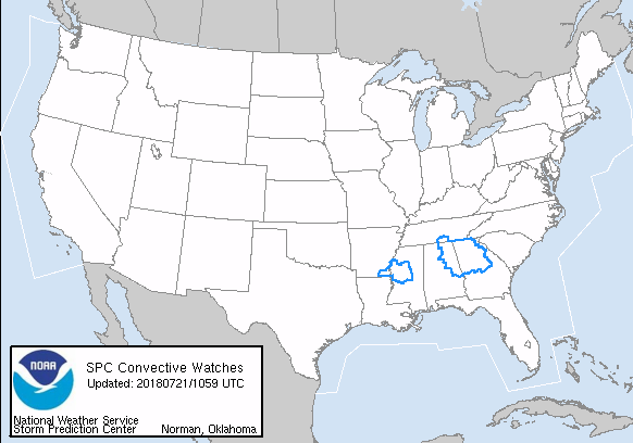
It’s a rather complicated pattern across the Southeast US and one we don’t usually see this time of year. We start with a couple of large areas of thunderstorms on-going this morning, one over North Georgia and one over Central Mississippi. Each of these is covered by a severe thunderstorm watch at this time.
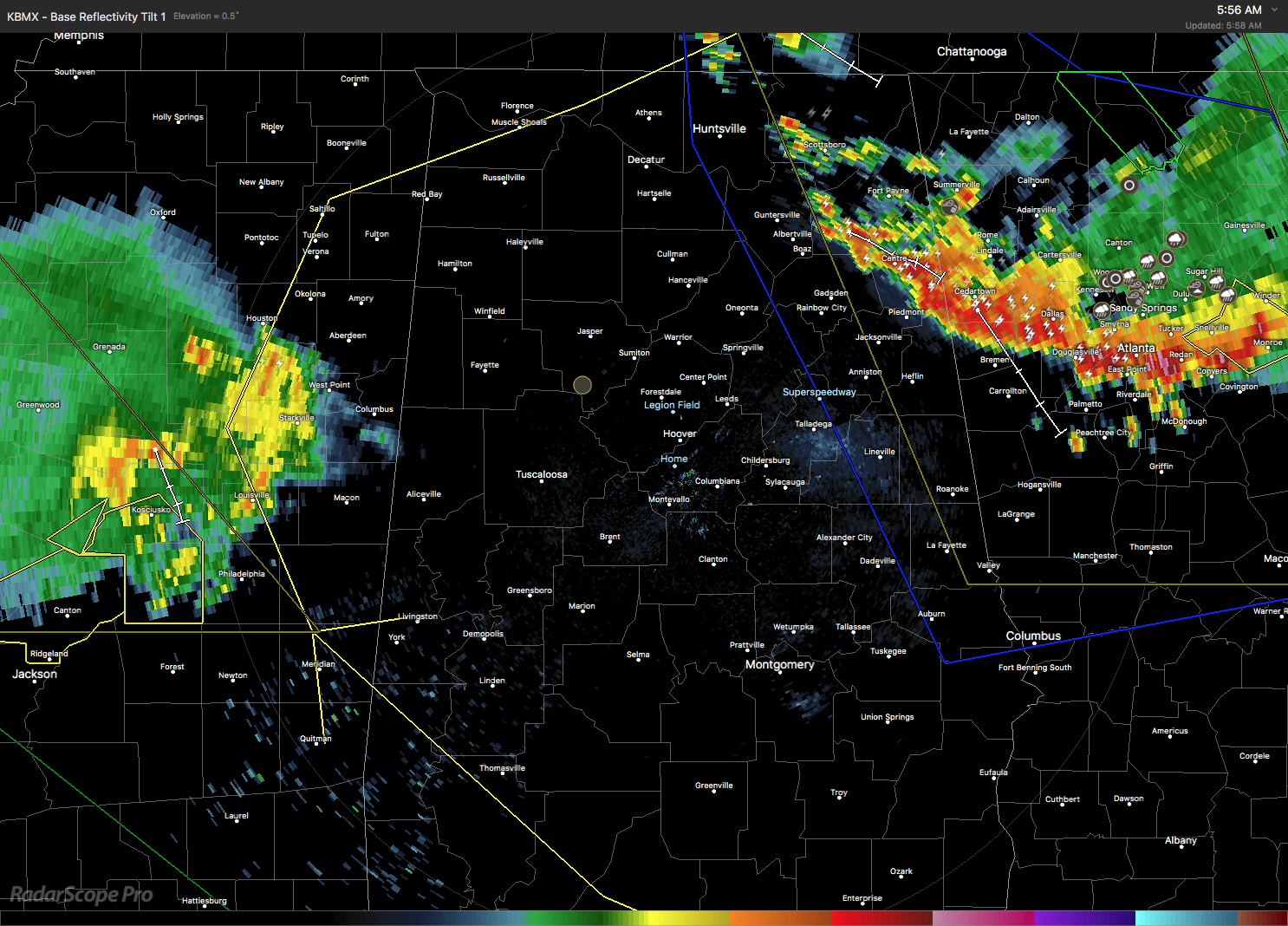
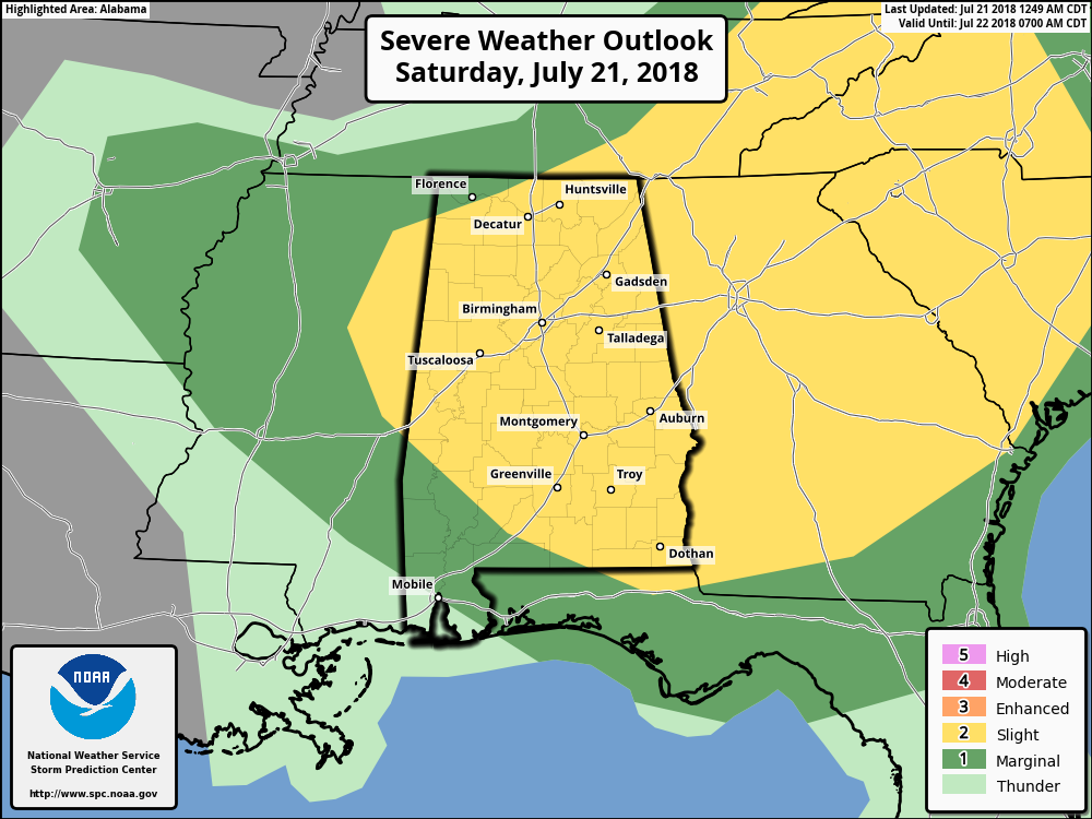
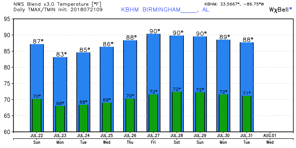
The surface pattern featured an anomalous double low setup with one surface low near Chicago and a second on the Outer Banks of North Carolina. Each had a front trailing back toward the southwest of each low. Aloft was just as unusual for this time of year with a deep trough over the eastern US with a closed upper low over Lake Michigan. CAPE values today will be from 3000 to 4000 j/kg along with significant shear as shown by the Energy Helicity Index with values ranging from 2 to 9 across portions of Alabama, so expect the potential for all modes of severe weather including tornadoes, damaging wind, and large hail. Clouds and the presence of numerous storms should hold the highs today in the upper 80s.
The deep trough over the eastern US will remain with us through Wednesday keeping us somewhat unsettled with a continuation of showers and storms driven primarily by afternoon heating. The good news is that our temperatures should be held down during this period thanks to the upper flow pattern with lows in the upper 60s and the highs in the upper half of the 80s.
For the latter half of the week ahead, we maintain troughing over the eastern US, but that trough is much weaker than we are forecasting to see for the first half of the week. That means that showers and storms will remain daily occurrences as high temperatures once again climb to around 90 degrees.
Looking out into voodoo country, the GFS remains very bullish on the trough maintaining itself over the eastern US. This means no extreme heat. But the upper ridge is forecast to move into the Southeast US near the end of the period around August 5th.
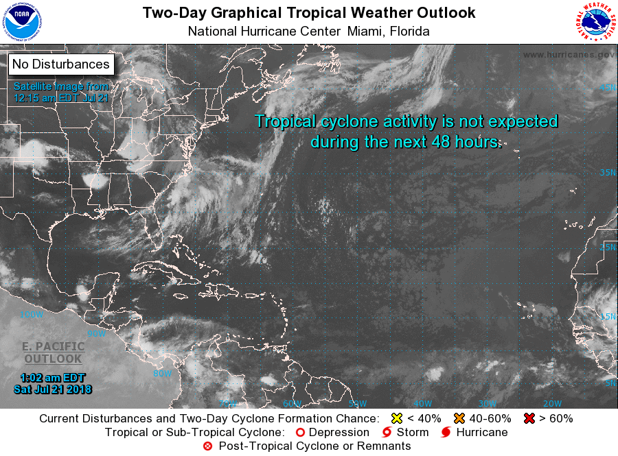
Tropics: All remains quiet across the Atlantic basin and tropical storm formation is not expected through early next week.
Beach Forecast: Click here to see the AlabamaWx Beach Forecast Center page.
WeatherBrains: Don’t forget you can listen to our weekly 90 minute netcast anytime on the web, or on iTunes. This is the show all about weather featuring many familiar voices, including our meteorologists here at ABC 33/40.
Stay weather aware and weather safe today for whatever nature has to throw at us. I anticipate posting the next Weather Xtreme Video here around 7 am or so on Sunday. Godspeed.
-Brian-
Category: Alabama's Weather, ALL POSTS, Weather Xtreme Videos
About the Author (Author Profile)
Brian Peters is one of the television meteorologists at ABC3340 in Birmingham and a retired NWS Warning Coordination Meteorologist. He handles the weekend Weather Xtreme Videos and forecast discussion and is the Webmaster for the popular WeatherBrains podcast.Subscribe
If you enjoyed this article, subscribe to receive more just like it.


