Tropical Storm Micheal Growing Stronger; Headed For The Gulf Coast
Here is a Sunday evening update on Tropical Storm Micheal…
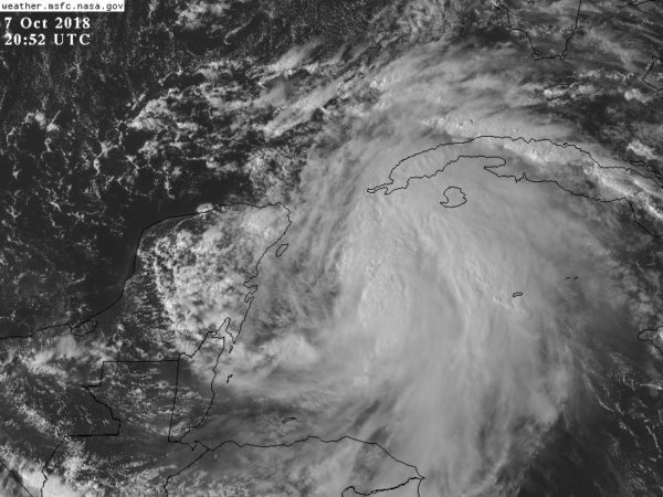
*Data from an Air Force Reserve reconnaissance aircraft indicate that maximum sustained winds have increased to near 50 mph with higher gusts. Additional strengthening is expected during the next few days, and Michael is forecast to become a hurricane tomorrow night or Tuesday. The center of Michael will move
over the Yucatan Channel on Monday, and then across the eastern Gulf of Mexico late Monday through Tuesday night, and approach the Gulf Coast of the Florida Panhandle Wednesday.
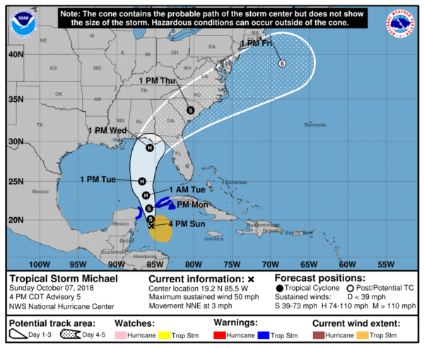
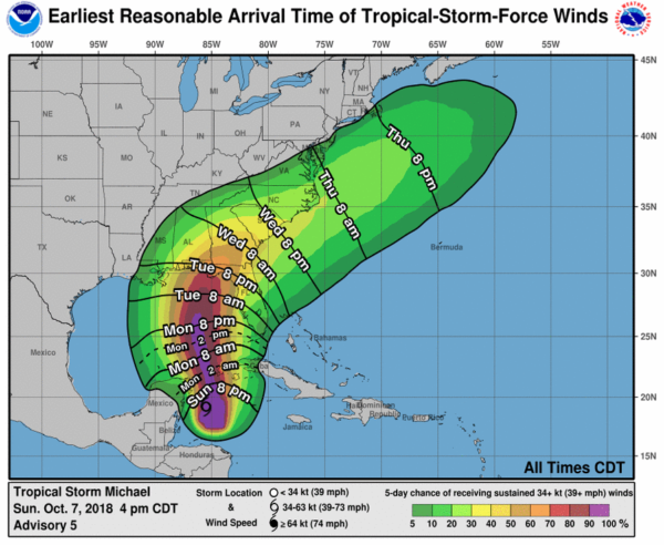
Tropical-storm-force winds extend outward up to 205 miles primarily to the east of the center. The latest minimum central pressure reported by reconnaissance aircraft is 999 mb (29.50 inches).
*We note on this forecast package the NHC track has been shifted eastward primarily in the short term due to the more eastward initial position.
*Michael is forecast to be a hurricane when it reaches the Florida Gulf Coast by mid-week, and the risk of dangerous storm surge, rainfall, and wind impacts continues to increase. In addition, Michael is expected to affect portions of the Florida Gulf Coast that are especially vulnerable to storm surge, regardless of
the storm’s exact track or intensity. Residents in these areas should monitor the progress of this system and follow any advice given by local officials.
*NHC is forecasting Michael to be a category two hurricane at the time of landfall Wednesday afternoon/evening with sustained winds near 100 mph. This can change.
*Dangerous rip currents are likely along the Gulf Coast through the time of landfall; Red Flags are already flying on the Alabama coast this afternoon.
*The most severe storm surge and general impact from Michael will be along and to the right (to the east) of where the system makes landfall. For now it continues to look like the Alabama Gulf Coast will be on the “good” west side of the circulation with an offshore flow. Many are asking about specific locations on the Florida Gulf Coast; remember landfall is still 3 days away, and there can be significant adjustments to the forecast track as the system gets closer. At this moment, it looks like the greatest impact will be from Panama City Beach east to Port Saint Joe and Apalachicola, but this could change.
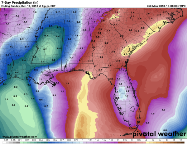
*Concerning inland impact, the heaviest rain in Alabama will come over the southeast corner of the state; places like Dothan, Abbeville, Geneva, and Ozark could see over three inches of rain. Amounts will be much lighter over the rest of the state, as we will be on the drier west side of the system. Most of the rain directly associated with Michael in Alabama will come Wednesday and Wednesday night.
*Michael will not stall like Florence, it will move to the northeast at a good clip over the latter half of the week. Wednesday on the Florida coast will be rough with hurricane conditions, but the weather will be much better on Thursday, and through Friday and the weekend.
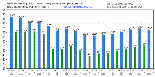
*Michael will help to pull down much cooler air into Alabama Thursday, Friday, and over the weekend with highs in the 70s and lows in the 50s. These four days look very nice with mostly sunny days and fair nights; just a few widely scattered showers are possible Sunday.
Bottom line is that weather for the National Shrimp Festival in Gulf Shores, race weekend in Talladega, and homecoming festivities at the University of Alabama look excellent for now. Again, just some potential for widely scattered showers Sunday.
Keep an eye on the blog for forecast updates…
Category: Alabama's Weather, Tropical
About the Author (Author Profile)
James Spann is one of the most recognized and trusted television meteorologists in the industry. He holds the AMS CCM designation and television seals from the AMS and NWA. He is a past winner of the Broadcast Meteorologist of the Year from both professional organizations.Subscribe
If you enjoyed this article, subscribe to receive more just like it.


