8 a.m. Update: 145 mph Category Four, Pressure 933 Millibars
First visible satellite images of Michael are stunning this morning.
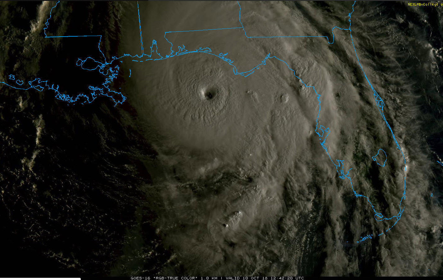
Hurricane Michael Tropical Cyclone Update
NWS National Hurricane Center Miami FL AL142018
800 AM CDT Wed Oct 10 2018
…8 AM CDT POSITION UPDATE…
…WATER LEVELS QUICKLY RISING AND WINDS INCREASING ALONG THE
FLORIDA PANHANDLE AS POTENTIALLY CATASTROPHIC MICHAEL APPROACHES…
A National Ocean Service station at Apalachicola recently reported
a sustained wind of 40 mph (65 km/h) and a wind gust of 53 mph (85
km/h).
SUMMARY OF 800 AM CDT…1300 UTC…INFORMATION
———————————————–
LOCATION…29.1N 86.2W
ABOUT 80 MI…130 KM SSW OF PANAMA CITY FLORIDA
ABOUT 85 MI…135 KM WSW OF APALACHICOLA FLORIDA
MAXIMUM SUSTAINED WINDS…145 MPH…230 KM/H
PRESENT MOVEMENT…N OR 10 DEGREES AT 13 MPH…20 KM/H
MINIMUM CENTRAL PRESSURE…933 MB…27.55 INCHES
$$
Forecaster Brennan
About the Author (Author Profile)
Bill Murray is the President of The Weather Factory. He is the site's official weather historian and a weekend forecaster. He also anchors the site's severe weather coverage. Bill Murray is the proud holder of National Weather Association Digital Seal #0001 @wxhistorianSubscribe
If you enjoyed this article, subscribe to receive more just like it.


