Michael Weakens To A Category 2 Storm, Still A Dangerous Hurricane
6:00 PM CDT POSITION UPDATE
EYE OF MICHAEL MOVING THROUGH SOUTHWESTERN GEORGIA
LIFE THREATENING STORM SURGE ALONG THE COAST AND DAMAGING WINDS INLAND CONTINUE
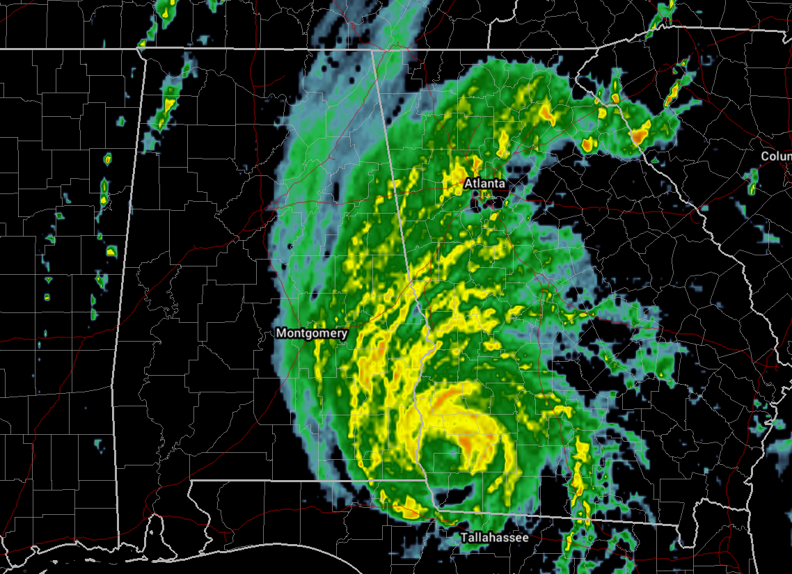
NOAA Doppler radar data indicate that the eye of Michael is now moving over southwestern Georgia. Recently reported wind gusts include:
Albany Georgia airport: 67 mph (107 km/h)
Tallahassee International Airport: 61 mph (98 km/h)
Dothan Alabama airport: 60 mph (96 km/h)
Dangerous storm surge continues along the coast of the Florida Panhandle. A National Ocean Service water level station at Apalachicola is still reporting nearly 5 feet of inundation above ground level.
LOCATION: 31.1N 84.9W
ABOUT 30 MI NNW OF BAINBRIDGE GEORGIA
ABOUT 35 MI WSW OF ALBANY GEORGIA
MAXIMUM SUSTAINED WINDS: 100 MPH
PRESENT MOVEMENT: NNE AT 13 MPH
MINIMUM CENTRAL PRESSURE: 950 MB
Over 300,000 customers are without power as of 5:00 PM CDT across the Florida Panhandle, with Bay and Leon counties being the hardest hit on the power grid.
Bay Medical Sacred Heart Hospital sustained damage as windows have been blown out, damage to the roof, and cracking of an exterior wall. Generators are up and running and patients have been moved to safe areas of the hospital.
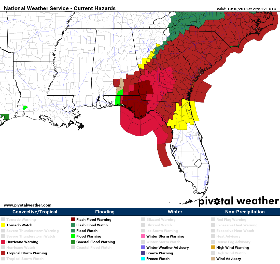
This is the latest map of watches and warnings as of 6:15 PM CDT.
LATEST HAZARDOUS WEATHER OUTLOOK FROM NWS BIRMINGHAM
Hurricane Michael will continue to move north northeast across southwest Georgia and later to the northeast across Georgia tonight into Thursday. As it does so, there remains a potential for marginal tropical storm force winds across the far southeast counties of Central Alabama.
Currently, most of the impacts are expected to be along and south of Interstate 85 through tonight. This is where rainfall amounts of 2 to 5 inches, with locally higher amounts, and wind gusts of 30 to 50 mph appear possible.
FEW TWEETS FROM JAMES SPANN’S TWITTER ARMY
Storm surge flooding this afternoon at St George Island… video from Mandi Jackson pic.twitter.com/cObxa5MVOS
— James Spann (@spann) October 10, 2018
My roommate sent me this from home in Thomasville, GA. Apparently trees down all over the town. #hurricanemichael2018 @spann pic.twitter.com/gmxZYDncr2
— Elliott Propes (@elliott_propes) October 10, 2018
The force of this hurricane. Unreal. pic.twitter.com/HALM8GpkgU
— Joey Krastel (@NimbusStorms) October 10, 2018
Destruction in Mexico Beach… from talarico.tessa (IG) pic.twitter.com/ZvmislgLBi
— James Spann (@spann) October 10, 2018
Category: Alabama's Weather, ALL POSTS, Tropical
About the Author (Author Profile)
Scott Martin is an operational meteorologist, professional graphic artist, musician, husband, and father. Not only is Scott a member of the National Weather Association, but he is also the Central Alabama Chapter of the NWA president. Scott is also the co-founder of Racecast Weather, which provides forecasts for many racing series across the USA. He also supplies forecasts for the BassMaster Elite Series events including the BassMaster Classic.Subscribe
If you enjoyed this article, subscribe to receive more just like it.


