Latest Drought Monitor Shows Parts Of Alabama With Abnormally Dry Conditions
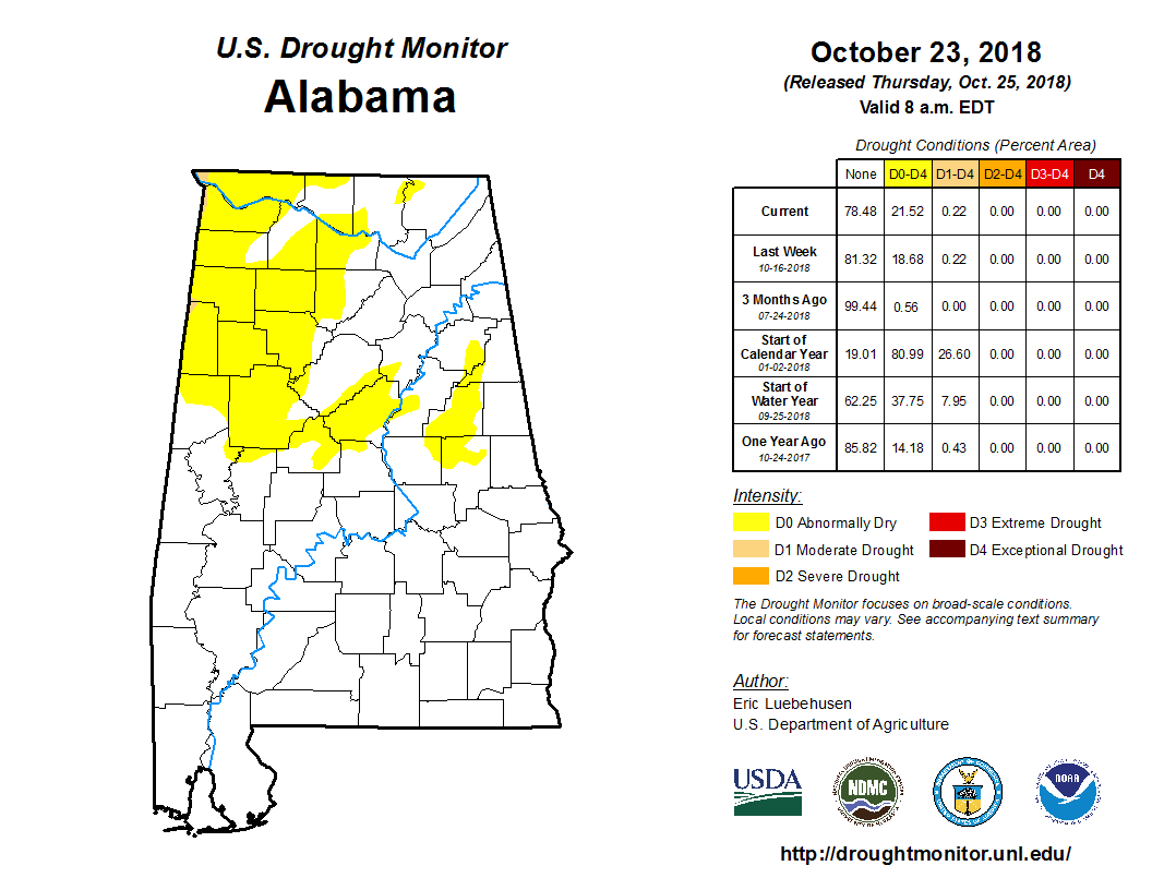
The latest US Drought Monitor Report is out for Alabama and it shows that parts of the northern half of the state is currently in the abnormally dry definition. The data on this map was captured on Tuesday, October 23rd, and released to the public on Thursday, October 25th. Therefore, the rainfall that we have received on Thursday is not included with this report.
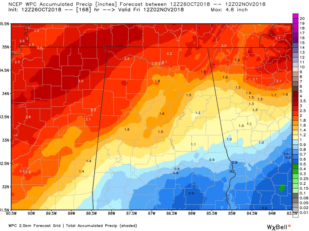
The good news is that the rainfall totals through the next seven days shows that locations defined as abnormally dry will get a decent amount of rain. Much of the northern half of the state are forecast to see 1.50 to 2.50 inches through next Friday, while the southern half will see 0.50 to 1.50 inches.
The next rainmaking system will move into the area starting on Thursday morning and continue through the entire day and finally move out by Friday morning. A deepening trough will be located just to our west and will allow for a cold front to sweep through the state, bringing with it showers and thunderstorms. A few storms could be strong, but at this point it is too early to tell if severe weather will occur.
Category: Alabama's Weather, ALL POSTS
About the Author (Author Profile)
Scott Martin is an operational meteorologist, professional graphic artist, musician, husband, and father. Not only is Scott a member of the National Weather Association, but he is also the Central Alabama Chapter of the NWA president. Scott is also the co-founder of Racecast Weather, which provides forecasts for many racing series across the USA. He also supplies forecasts for the BassMaster Elite Series events including the BassMaster Classic.Subscribe
If you enjoyed this article, subscribe to receive more just like it.


