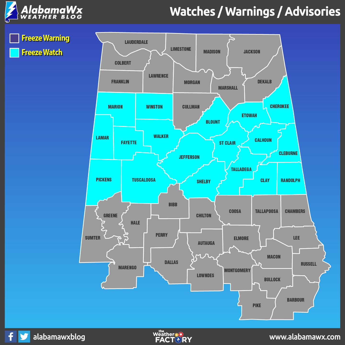
Freeze Watch Issued For Parts Of Central Alabama From 2:00 AM – 8:00 AM CST Sunday
A colder airmass will move into the northern counties tonight. Thereafter, below freezing temperatures are expected in areas across the north from 2:00 AM – 8:00 AM CST Saturday morning. Similar conditions are forecast early Sunday morning from 2:00 AM – 8:00 AM CST across all of our northern counties and portions of our central counties, roughly along and north of a line from Aliceville to Calera to Roanoke.
NWS Birmingham has issued a Freeze Watch that goes into effect from 2:00 AM to 8:00 AM CST on Sunday for Blount, Calhoun, Cherokee, Clay, Cleburne, Etowah, Fayette, Lamar, Jefferson, Marion, Pickens, Randolph, Shelby, St. Clair, Talladega, Tuscaloosa, Walker, and Winston counties.
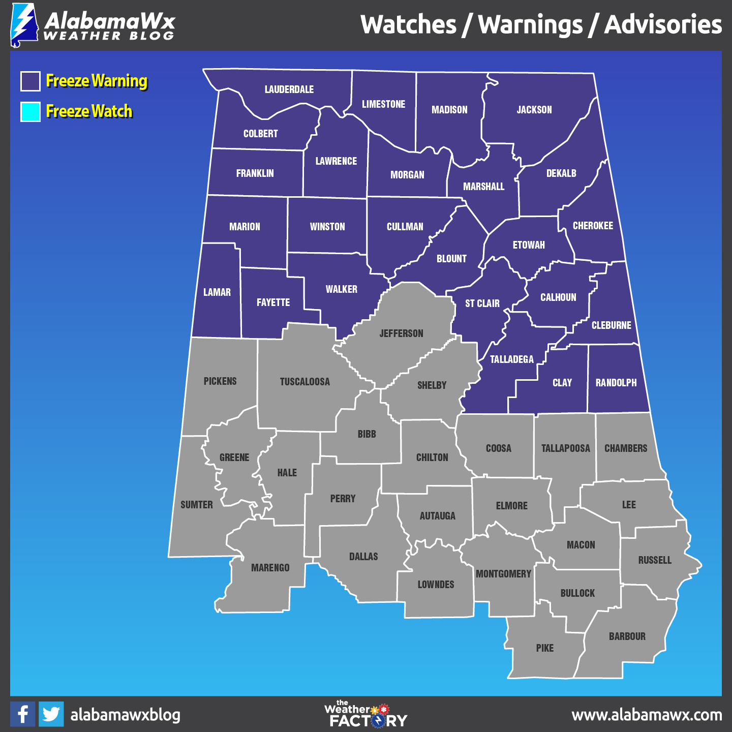
A Freeze Warning was issued earlier for parts of Central Alabama that goes into effect from 2:00 AM to 8:00 AM CST on Saturday for Blount, Calhoun, Cherokee, Clay, Cleburne, Etowah, Fayette, Lamar, Marion, Randolph, St. Clair, Talladega, Walker, and Winston counties.
Category: Alabama's Weather, ALL POSTS
About the Author (Author Profile)
Scott Martin is an operational meteorologist, professional graphic artist, musician, husband, and father. Not only is Scott a member of the National Weather Association, but he is also the Central Alabama Chapter of the NWA president. Scott is also the co-founder of Racecast Weather, which provides forecasts for many racing series across the USA. He also supplies forecasts for the BassMaster Elite Series events including the BassMaster Classic.Subscribe
If you enjoyed this article, subscribe to receive more just like it.


