New High-Resolution Model Output For Saturday’s Potential Severe Storm Threat
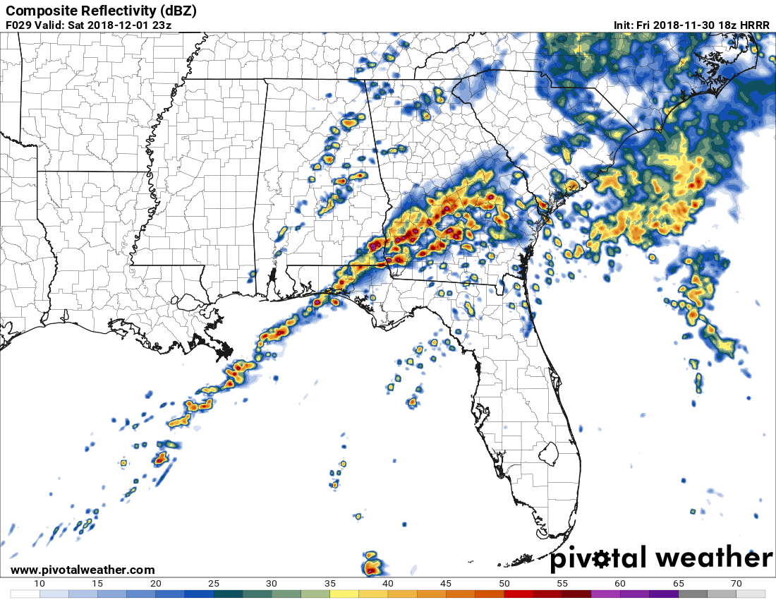
While the high-resolution NAM (3K) model continues to keep thunderstorm development nearly zero throughout the afternoon hours on Saturday, the first good run of the HRRR (18z) that reaches out to 36 hours (12:00 am Sunday) shows a little different story. The above image from the HRRR is the simulated radar valid at 5:00 pm Saturday and it does show some cellular development over the east and southeastern parts of Central Alabama. This is the first high-resolution model that has shown development during the afternoon and early evening hours.
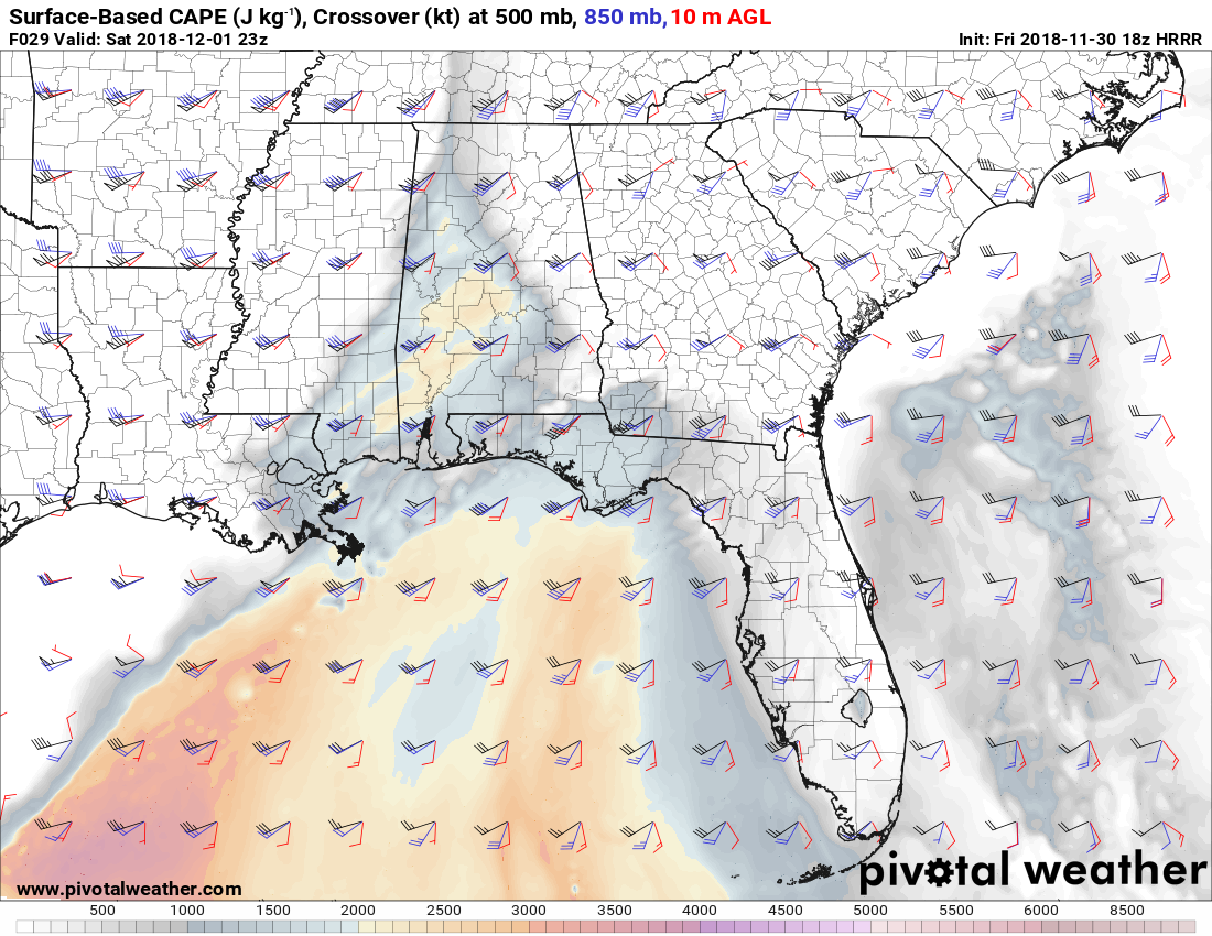
The Surface/850mb/500mb Crossover graphic from the same run at 5:00 pm show winds at the surface out of the south-southeast around 10 knots, then shifting rapidly at 5,000 feet out of the southwest around 40 knots and increasing in speed to 70 knots out of the southwest at the 18,000 feet level.
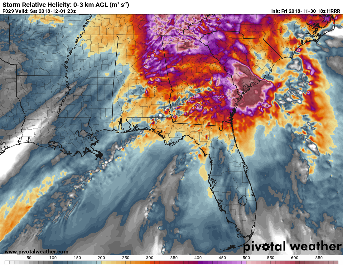
Helicity values on the same model run at 5:00 pm Saturday are more than high enough to support rotating updrafts. Couple that with the crossover graphic above, it shows that this will be a highly-sheared environment with the potential for rotating supercells.
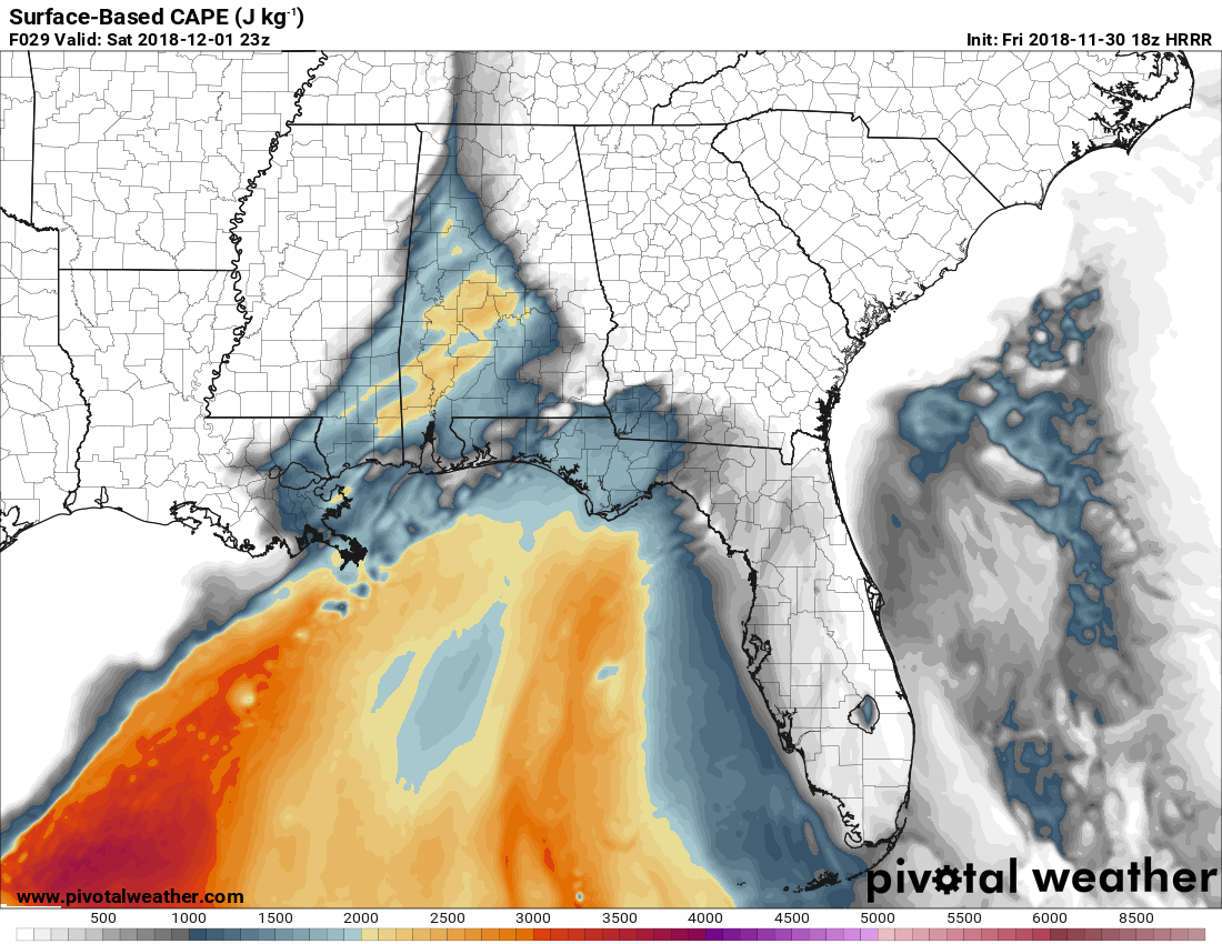
This image from the same model run shows the convective available potential energy (CAPE), also know as the instability values at the surface, as of 5:00 pm Saturday. We’ll have plenty of instability as values will be in the 1,000-2,200 J/kg range.
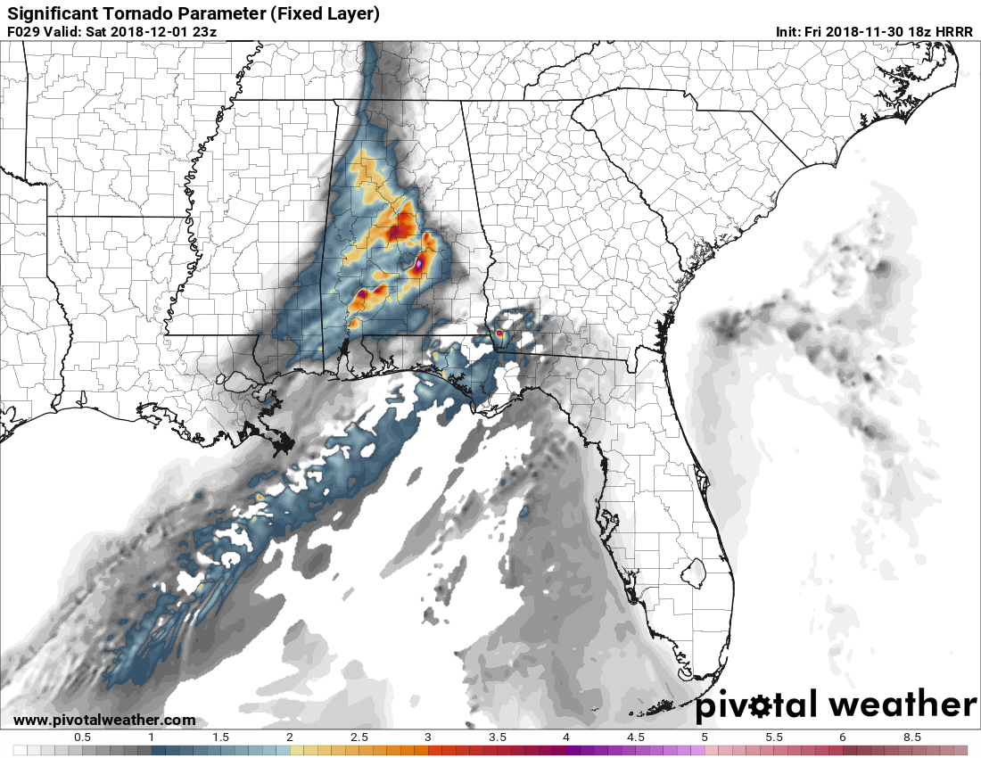
And last but not least, we take a look at the significant tornado parameter (STP) valid at 5:00 pm Saturday. This is definitely the highest values that I have seen on this system so far, but I also have a feeling that this run is over-estimating these values. Values are ranging from 1.0 in the extreme northern parts of the area and ramping up to 5.2 over the northeast corner of Lowndes county in the southern parts of Central Alabama. Remember, any number of 1.0 and above shows the potential of significant tornado development (EF@ and above), while values less than 1.0 are usually associated with non-tornadic supercells.
BOTTOM LINE: There are still some inconsistancies in the higher-resolution models. The NAM-3k has stayed relatively similar for the past couple of runs with no development during the afternoon, while the HRRR shows development after 4:00 pm with the potential of damaging winds and a few tornadoes. It’s almost to the point where we will have to wait and see how the rain and storms during the morning hours affect the atmosphere and whether they can stabilitze it enough to keep the afternoon storms from forming.
Morning storms should be under severe limits while one or two may be strong with gusty winds and should occur across Central Alabama in the 6:00 am to 12:00 pm time frame on Saturday. The window for the potential for strong to severe storms during the afternon and early evening hours will be from 12:00 pm to 6:00 pm Saturday. Once again, the severe storm threat is conditional on how the atmosphere recovers from the morning round of storms. There is a chance that storms do not form at all… BUT… if any do form during the afternoon, the potential will be there for those to quickly become strong to severe. The main threat will be from damaging thunderstorm winds and a couple of tornadoes. There is a much smaller threat of some hail, but that threat should be isolated in nature.
We’ll keep you updated on the AlabamaWx Weather Blog throughout the evening and the entire day on Saturday. Just be sure to have your severe weather action plan ready to go just in case your location goes under a warning on Saturday. Make sure you have fresh batteries in your flashlights and in your NOAA WeatherRadio. Also, have those smartphones fully charged and the ABC 33/40 app downloaded so you can watch tornado coverage from your place of safety if your location goes under awarning.
Category: Alabama's Weather, ALL POSTS
About the Author (Author Profile)
Scott Martin is an operational meteorologist, professional graphic artist, musician, husband, and father. Not only is Scott a member of the National Weather Association, but he is also the Central Alabama Chapter of the NWA president. Scott is also the co-founder of Racecast Weather, which provides forecasts for many racing series across the USA. He also supplies forecasts for the BassMaster Elite Series events including the BassMaster Classic.Subscribe
If you enjoyed this article, subscribe to receive more just like it.


