Warmer Days Ahead; Rain By Thursday Night
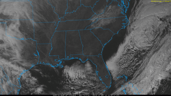
WARMING TREND: The freezing fog that produced icy bridges and dozens of crashes across the Birmingham metro area earlier today has dissipated; we have a cloudless sky this afternoon with temperatures in the 45-50 degree range. Tonight will be clear and cold again; most communities will drop into the 20s early tomorrow morning.
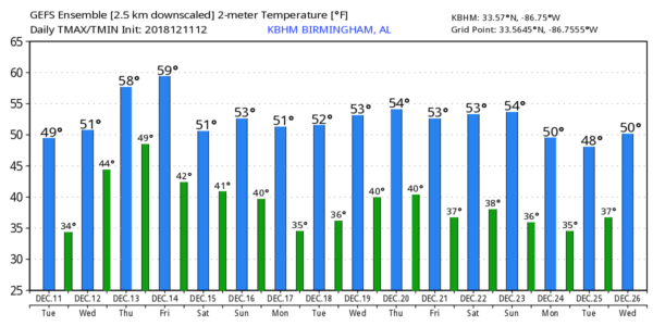
Tomorrow will be dry, and the warming trend continues. With a partly to mostly sunny sky, we rise into the mid to upper 50s.
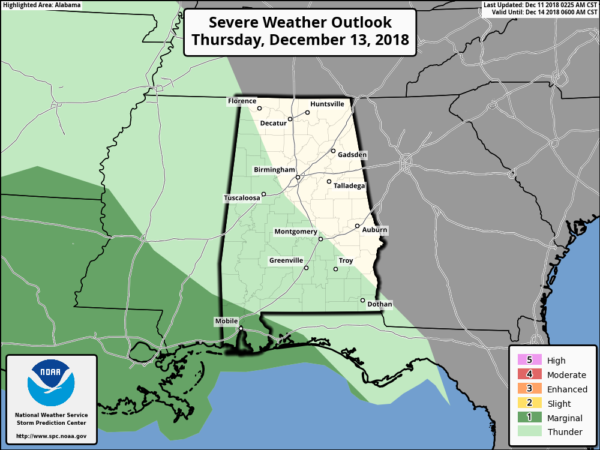
THURSDAY/FRIDAY: A deep surface low develops near Dallas Thursday, and south winds will increase across Alabama as the gradient tightens. Temperatures will rise to near 60 degrees, and rain will move into the state Thursday night. This is a fairly dynamic weather system, but thankfully we expect no surface based instability, and there is no threat of severe storms for the northern two-thirds of the state. And, probably no thunder.
We do note SPC has Mobile and Baldwin counties in a “marginal risk” (level 1/5) for severe storms Thursday night as unstable air from the Gulf could creep up into those two coastal counties.
Rain will continue through Friday as the surface low passes just north of Alabama; the high Friday will be in the 55-59 degree range.
THE ALABAMA WEEKEND: Showers will likely linger into Saturday morning across the state, but drier air begins to arrive Saturday afternoon as the rain ends. Sunday will be dry with ample sunshine; highs over the weekend will stay in the mid to upper 50s.
NEXT WEEK: For now the week looks quiet; generally dry with seasonal temperatures. See the ABC 33/40 Weather Blog for maps, graphics, and more details.
THIS MORNING’S FREEZING FOG: Temperatures dropped quickly down to the dewpoint across Central Alabama, and with a clear sky, light wind, and very wet soil conditions, freezing fog started to form. And, it became very dense by 3:00-4:00 a.m. The freezing fog did us in; tiny, supercooled liquid water droplets in freezing fog can create a coating of thin ice instantly on exposed surfaces like bridges and overpasses. Without the fog, most would not have had any problems this morning.
And, the concept of freezing fog is nothing new. Simple definition is fog that forms with surface temperatures below 32 degrees (F). Much like freezing rain is simply rain that falls in liquid form when the temperature is at or below freezing. The freezing fog today brought a huge impact to the Birmingham metro this morning, with dozens of crashes, some with injuries, across the Birmingham metro. The ice was mostly confined to bridges, but some black top roads accumulated ice across higher terrain.
BEACH FORECAST: Click here to see the AlabamaWx Beach Forecast Center page.
WEATHER BRAINS: Don’t forget you can listen to our weekly 90 minute show anytime on your favorite podcast app. This is the show all about weather featuring many familiar voices, including our meteorologists here at ABC 33/40.
CONNECT: You can find me on all of the major social networks…
Facebook
Twitter
Instagram
Pinterest
Snapchat: spannwx
Look for the next Weather Xtreme video here by 7:00 a.m. tomorrow…
Category: Alabama's Weather, ALL POSTS, Weather Xtreme Videos
About the Author (Author Profile)
James Spann is one of the most recognized and trusted television meteorologists in the industry. He holds the AMS CCM designation and television seals from the AMS and NWA. He is a past winner of the Broadcast Meteorologist of the Year from both professional organizations.Subscribe
If you enjoyed this article, subscribe to receive more just like it.


