

Early Afternoon Alabama Update: Warm Front Champing at the Bit to Come North
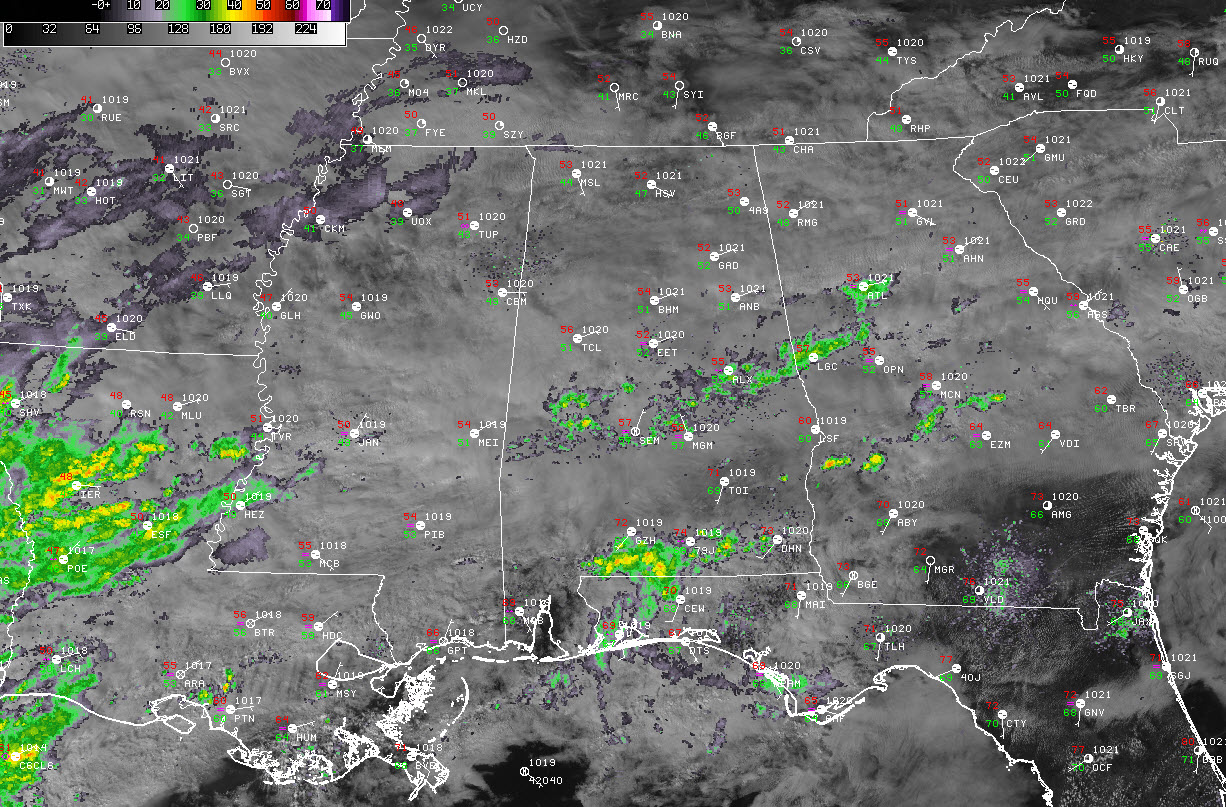
Alabama is fairly socked in with clouds early this afternoon as a moist flow out of the southwest continues at the main cloud level.
There are showers moving from west-southwest to east-northeast. They are located to the north of a warm front that is separating temperatures in the 50s to the north from readings in the 70s to the south.
High pressure over the Ohio Valley, to the north of Alabama, has kept a northeasterly flow in place over the northern two-thirds of the state. This has kept the warm front suppressed to the south.
The front will be on the move by this evening as the high to the north weakens and low pressure begins to form to the west. This will turn our flow to southerly and allow the warm, moist air to move northward. By midnight, dewpoints will each 60F at Birmingham and 65F at Montgomery. This is a key sign of what will happen tomorrow.
There will be a few showers overnight, but they won’t be very widespread or heavy. Temperatures will remain steady in the 50s or rise a couple of degrees during the predawn hours. It will become windy overnight, with winds averaging 25-25 mph and gusts occasionally over 35 mph.
By 7 a.m., all of Alabama except the northeast sections will have dewpoints > 60F. The day will be mostly cloudy, although there could be a few breaks in the clouds by 3 or 4 o’clock. By that time, the cold front will be approaching the northwest corner of the state.
The instability that is over eastern Mississippi will be waning by that time though, and only a narrow ribbon if it will make it into Alabama. There may be a brief window of opportunity for severe weather to form during the afternoon as the line of storms pushes into the state. We will be watching for any discrete low topped cells that form out in front of the main squall line. There doesn’t appear to be much chance that an isolated tornado could form, but it is not out of the question.
The line should reach Tuscaloosa/Jasper and Cullman by noon-1pm, Birmingham by 2-3 p.m. It should be weakening by then.
There could be a few damaging wind reports over northwest and west Alabama, but the best chance will be over eastern Mississippi. This is borne out by the CIPS analogs that study similar patterns and past events. It shows a decent chance there will be 5 or more severe reports in that area.
The cold front will reach Tuscaloosa between 5 and 7 p.m., Birmingham between 8-10 p.m. and Anniston by midnight.
But the flow stays southwesterly on Tuesday and temperatures get a little cooler, but the light showers continue. They will be a lot like today, with 50s north and lower 60s over South Central Alabama in places like Clanton and Alex City.
Another low will form to our west ahead of the main upper-level low. Rain will break out again Wednesday as the warm front comes back north. Thursday looks wet again as the warm front stalls out over North Central Alabama. Highs may stay in the 40s. Rain will become heavy late Thursday.
The rain should end Friday, although there will be a few light showers across North Alabama as the upper low moves just to our north. It should be rain, although there could be a few snowflakes mixed in. No accumulations are expected.
Then we move into a period of dry weather as high pressure takes control until the following week. Our next rain chances will come on Tuesday the 7th.
Category: Alabama's Weather, ALL POSTS
About the Author (Author Profile)
Bill Murray is the President of The Weather Factory. He is the site's official weather historian and a weekend forecaster. He also anchors the site's severe weather coverage. Bill Murray is the proud holder of National Weather Association Digital Seal #0001 @wxhistorianSubscribe
If you enjoyed this article, subscribe to receive more just like it.


