Rain Continues To Move Into Western Alabama; Tornado Warnings Just To The West
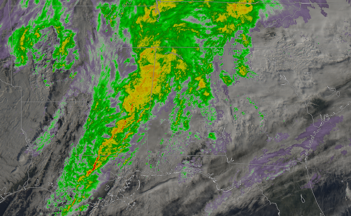
As of 8:45 AM, we have a good bit of showers over the northwestern portions of North and Central Alabama. At this point, there has been no lightning with this part of the main line. The good news is that there is plenty of cloud cover and showers over the northern half of the state that it will be hard to see enough instability to form to cause severe weather. At this point, the main risk for stronger to severe storms now look to be mainly south of a line from Reform to Birmingham to Heflin. The main threat continues to be from isolated damaging thunderstorm wind gusts with one or two brief spin-up tornadoes possible.
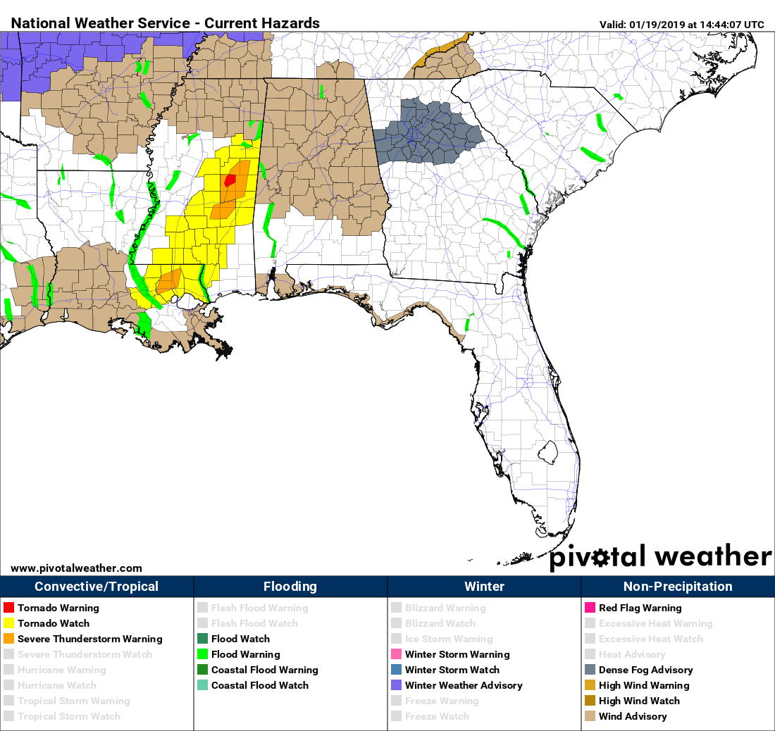
No severe watches or warnings are currently in effect for North and Central Alabama, but a Wind Advisory is in effect for all of the area until 7:00 pm tonight. Just to our west, there is a Tornado Watch in effect until 1:00 pm for a good bit of Mississippi and down into the eastern parts of Louisiana.
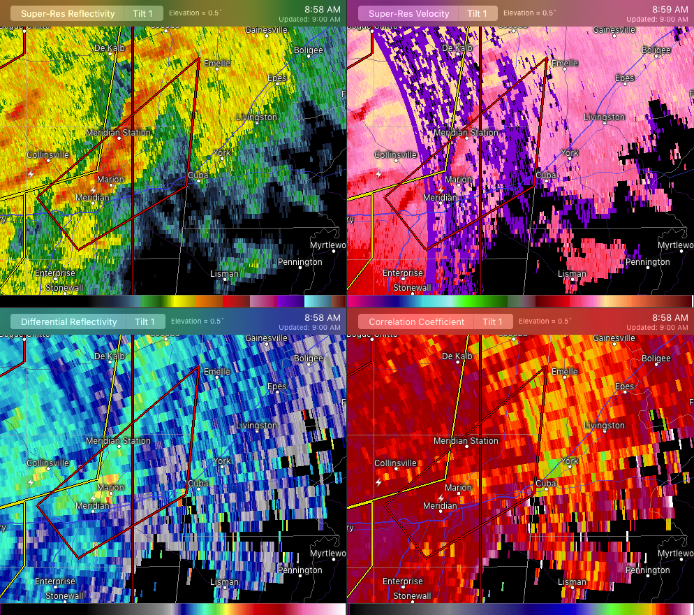
A Tornado Warning was just issued for parts of Kemper and Lauderdale counties in Mississippi. If the circulation continues into Alabama, a Tornado Warning would be needed for parts of Sumter County within the next 20-30 minutes.
We’ll continue to keep you posted throughout the day on the blog.
Category: Alabama's Weather, ALL POSTS
About the Author (Author Profile)
Scott Martin is an operational meteorologist, professional graphic artist, musician, husband, and father. Not only is Scott a member of the National Weather Association, but he is also the Central Alabama Chapter of the NWA president. Scott is also the co-founder of Racecast Weather, which provides forecasts for many racing series across the USA. He also supplies forecasts for the BassMaster Elite Series events including the BassMaster Classic.Subscribe
If you enjoyed this article, subscribe to receive more just like it.


