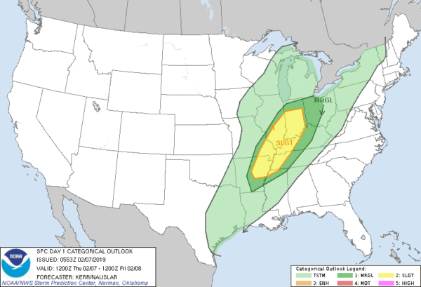
Record Warmth Again Today; Much Colder Tomorrow
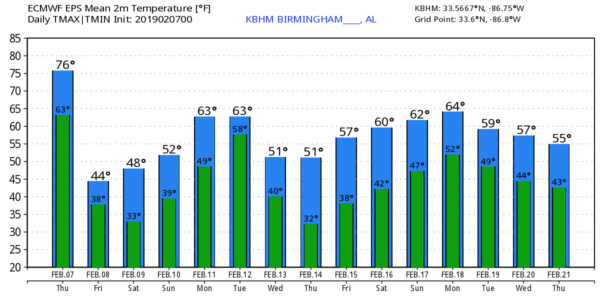
ONE MORE DAY OF WARMTH: The record high for Birmingham today is 76 set in 1999 and 1957; we are forecasting a high of 78 this afternoon. Some communities over in West Alabama could touch 80 degrees as our spring preview continues. The day should be dry with a mix of sun and clouds; severe storms are possible north and west of our state ahead of a sharp cold front.
Thankfully, the upper support will lift away from the region tonight, and we expect nothing more than a weakening band of showers as the front moves through Alabama.
MUCH COLDER TOMORROW: Tomorrow will feature a clearing sky, and the day will be much colder with a high between 47 and 50 degrees. A brisk northwest wind of 12-22 mph will make it feel colder. The wind will die down tomorrow night, and with a clear sky we project a low in the mid 20s by daybreak Saturday.
THE ALABAMA WEEKEND: Saturday will be partly sunny and cool with a high in the low 50s. Most of the state will stay dry Sunday, although we have introduced the risk of a few showers by mid to late afternoon over the northern quarter of the state. Sunday’s high will be in the mid 50s.
NEXT WEEK: Monday will be mostly cloudy and mild with scattered showers possible over North Alabama; the high will be in the low 60s. Then, a fairly dynamic storm system will set up west of Alabama on Tuesday, and we will mention a good chance of showers and thunderstorms Tuesday afternoon/night. There will be some surface based instability, so a few strong storms are possible, but for now the overall severe weather threat looks fairly low.
Rain ends early Wednesday as cooler air rolls into the state; some clearing is possible Wednesday afternoon with a high close to 50. Then, the weather looks cool and dry Thursday and Friday. See the Weather Xtreme video for maps, graphics, and more details.
ON THIS DATE IN 1835: A great freeze took place from February 2-9 across southern Georgia, southeastern South Carolina, and northern Florida. During this freeze, the St. Johns River was frozen, “several rods from the shore,” and people were able to walk a distance from the shore. Many citruses and other fruit trees were killed to the ground, never to grow again, when temperatures reached as low as 1ºF in Charleston and 8ºF in Jacksonville. A Florida gentleman told a newspaper that the state, “appeared as desolate as if a fire had swept over it,” after the severe freeze of that winter season.
BEACH FORECAST: Click here to see the AlabamaWx Beach Forecast Center page.
WEATHER BRAINS: Don’t forget you can listen to our weekly 90 minute show anytime on your favorite podcast app. This is the show all about weather featuring many familiar voices, including our meteorologists here at ABC 33/40.
CONNECT: You can find me on all of the major social networks…
Facebook
Twitter
Instagram
Pinterest
Snapchat: spannwx
I have a weather program today at White Plains Elementary in Calhoun County… look for the next Weather Xtreme video here by 4:00 this afternoon. Enjoy the day!
Category: Alabama's Weather, ALL POSTS, Weather Xtreme Videos
About the Author (Author Profile)
James Spann is one of the most recognized and trusted television meteorologists in the industry. He holds the AMS CCM designation and television seals from the AMS and NWA. He is a past winner of the Broadcast Meteorologist of the Year from both professional organizations.Subscribe
If you enjoyed this article, subscribe to receive more just like it.


