

A Freeze Ahead Late Tonight; Dry Tomorrow
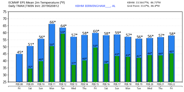
COLD NIGHT AHEAD: As expected, today is breezy and much colder across North/Central Alabama. We saw some low 80s at this time yesterday; Cullman and Haleyville are at 39 degrees at mid-afternoon today. Most communities are in the 40s, and with a clear sky and diminishing wind tonight temperatures will drop pretty quickly. We project a low in the 25-29 degree range early tomorrow morning.
THE ALABAMA WEEKEND: Tomorrow will be dry with a partly sunny sky… the high will be in the mid 50s. Clouds will increase tomorrow night, and Sunday will be mostly cloudy with potential for a few scattered showers. Nothing widespread or really heavy; Sunday’s high will be in the 50-55 degree range. A warm front will push northward through the region Sunday night.
NEXT WEEK: Monday will be mostly cloudy and warmer with a few scattered showers… temperatures will rise into the 60s. Then, rain is likely on Tuesday with a cold front approaching. Some thunder is possible Tuesday, but no severe storms are expected with very little surface based instability. Wednesday will be dry with a good supply of sunshine along with a high around 60. Clouds increase Thursday, and we will have periods of rain Thursday night and Friday.
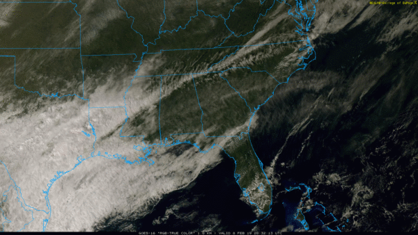
No sign of any issues with flooding, severe thunderstorms, snow, or ice for Alabama for the next 7 to 10 days… see the Weather Xtreme video for maps, graphics, and more details.
ON THIS DATE IN 2013: A nor’easter produced heavy snowfall over the New England states. Total snowfall in Boston, Massachusetts, reached 24.9 inches, the fifth-highest total ever recorded in the city. New York City officially recorded 11.4 inches of snow at Central Park, and Portland, Maine, set a record of 31.9 inches. Hamden, Connecticut recorded the highest snowfall of the storm at 40 inches. Many surrounding cities picked up at least 1 foot. In addition to the significant snowfall totals, hurricane-force wind gusts were recorded, reaching 102 mph in Nova Scotia, 89 mph at Mount Desert Rock, Maine, and 84 mph off the coast of Cuttyhunk, Massachusetts.
BEACH FORECAST: Click here to see the AlabamaWx Beach Forecast Center page.
WEATHER BRAINS: Don’t forget you can listen to our weekly 90 minute show anytime on your favorite podcast app. This is the show all about weather featuring many familiar voices, including our meteorologists here at ABC 33/40.
CONNECT: You can find me on all of the major social networks…
Facebook
Twitter
Instagram
Pinterest
Snapchat: spannwx
I had a great time today visiting the students at Glencoe Middle School; be looking for them on the Pepsi KIDCAM today at 5:00 on ABC 33/40 News! My next Weather Xtreme video will be posted here Monday morning by 7:00… enjoy the weekend!
Category: Alabama's Weather, ALL POSTS, Weather Xtreme Videos
About the Author (Author Profile)
James Spann is one of the most recognized and trusted television meteorologists in the industry. He holds the AMS CCM designation and television seals from the AMS and NWA. He is a past winner of the Broadcast Meteorologist of the Year from both professional organizations.Subscribe
If you enjoyed this article, subscribe to receive more just like it.


