More Storms Late Tonight/Tomorrow
After a round of noisy thunderstorms last night night with gusty winds, lots of lightning, and some hail, we expect a relatively quiet day today. A partly sunny sky with a high close to 80 degrees this afternoon. Any showers should be few and far between.
LATE TONIGHT: A thunderstorm complex will move into Alabama late tonight, most likely after midnight. SPC has a risk of severe storms defined for the western half of the state in their “Day 1” outlook, which is valid through 7:00 a.m. tomorrow…
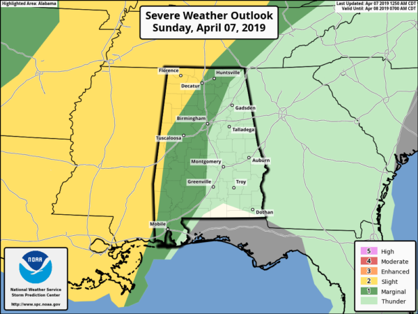
The thunderstorms should be weakening as they move into Alabama during the pre-dawn hours, but they could still produce gusty winds and some hail, much like the ones last night.
TOMORROW: There is a “marginal risk” (level 1/5) of severe thunderstorms for all of Alabama…
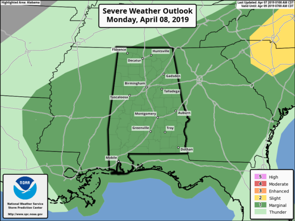
Additional showers and thunderstorms will develop during the day, and they could be strong. But, the overnight storms will help to limit instability, and wind fields are not especially strong. Once again, stronger storms Monday could produce some hail and strong gusty winds, especially where pockets of higher instability can develop. The tornado threat is very low.
REMEMBER: A severe thunderstorm is defined by storms that have either one inch diameter hail, or winds of 58 mph or higher. If we issued warnings for every thunderstorm with frequent lightning, loud thunder, creepy looking clouds, pea sized hail, or winds of 30/40 mph, then it would be all warnings, all the time, and warning fatigue would take over. Nobody would pay attention to warnings issued when thunderstorms are really severe.
Keep an eye on the blog for updates…
Category: Alabama's Weather, ALL POSTS
About the Author (Author Profile)
James Spann is one of the most recognized and trusted television meteorologists in the industry. He holds the AMS CCM designation and television seals from the AMS and NWA. He is a past winner of the Broadcast Meteorologist of the Year from both professional organizations.Subscribe
If you enjoyed this article, subscribe to receive more just like it.


