Showers/Storms Return Late Tomorrow
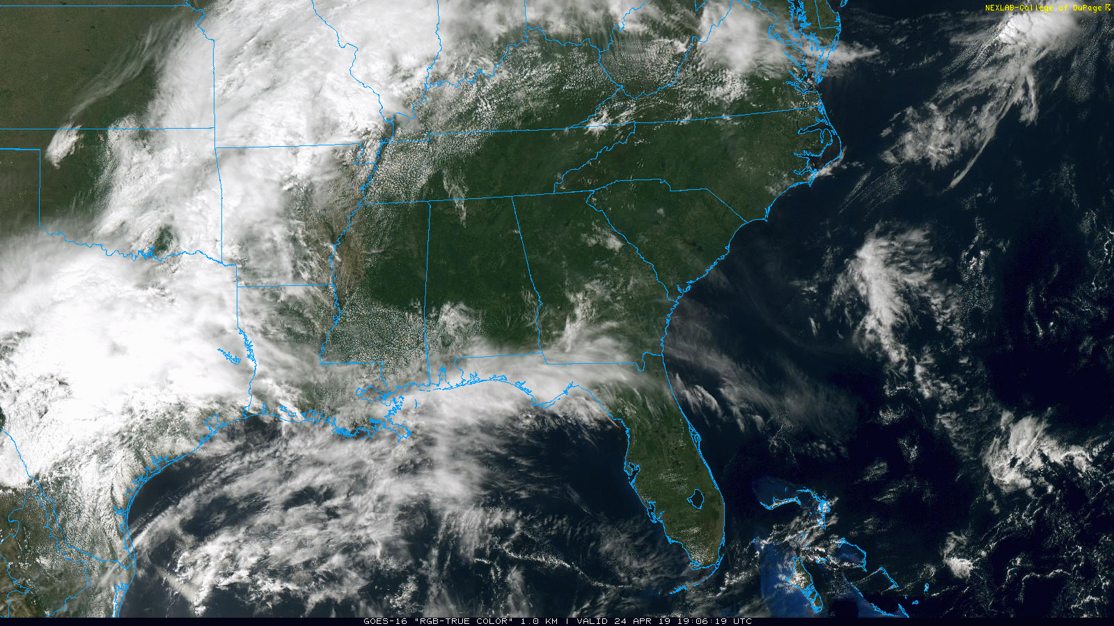
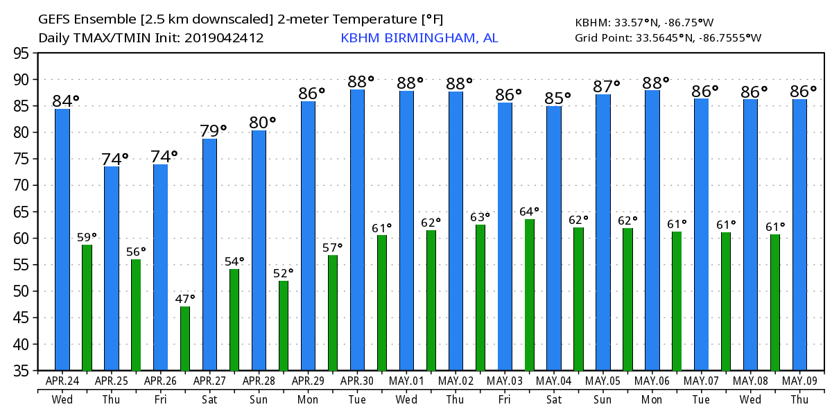
BEAUTIFUL SPRING DAY: The sky is sunny across North and Central Alabama this afternoon, and temperatures are generally in the 80-80 degree range. Tonight will be mostly fair with a low in the low to mid 60s.
RAIN RETURNS: Clouds will increase tomorrow ahead of the next wave to the west, and we will have a chance of showers and storms late tomorrow and tomorrow night statewide. SPC has expanded the severe weather risk a bit; we have a “slight risk” (level 2/5) for areas south of a line from Thomasville to Andalusia (Southwest Alabama), and a “marginal risk” (level 1/5) as far north as Moundville, Montgomery, and Eufaula.
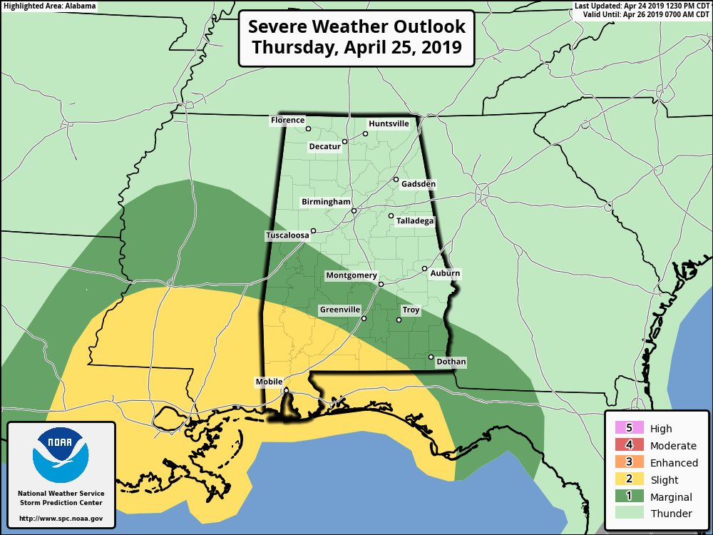
The best chance of severe storms will be over the southern third of Alabama, where instability values will be greater. A few strong storms are possible across Central Alabama with small hail and gusty winds. Rain amounts over the northern half of the state, most likely, will be fairly light, generally under 1/2 inch. Heavier totals will be found over South Alabama where stronger thunderstorms are likely. The main window for showers and storms will come from about 4:00 p.m. tomorrow through 4:00 a.m. Friday.
FRIDAY AND THE WEEKEND: The sky becomes mostly sunny Friday; the high will be in the mid 70s. Then, Saturday will be sunny and warm with a high around 80. A weak front will drift into the state Sunday, but again we believe for now the air will be too dry for any meaningful rain. Expect a mix of sun and clouds Sunday with a high in the upper 70s.
RACE WEEKEND AT TALLADEGA: The sky will be mostly sunny Friday and Saturday; the high Friday will be close to 75, followed by a high near 80 Saturday. Sunday will be dry with a mix of sun and clouds along with a high in the upper 70s at Talladega.
NEXT WEEK: An upper ridge will build across the Deep South, and most likely it will be our warmest week so far this year with highs in the mid 80s daily… a few spots could reach the upper 80s. A few showers could return over North Alabama toward the end of the week… See the Weather Xtreme video for maps, graphics, and more details.
ON THIS DATE IN 1908: The “Dixie Outbreak”. At least 34 tornadoes touched down generally east of the Mississippi River from April 23 through April 26, 1908. These tornadoes generally occurred from Texas to Georgia, then northward from Oklahoma to Tennessee. The violent storms killed at least 320 people and injured over a thousand citizens. One of the hardest hit communties was Purvis, Mississippi, where the town was completely leveled and 55 citizens lost their lives. At least four tornadoes touched down in Alabama during this outbreak of severe weather. These tornadoes were responsible for approximately 48 fatalities and at least 260 injuries. An EF-4 moved from Walker County to Dekalb County in North Alabama, and was responsible for 35 deaths.
BEACH FORECAST: Click here to see the AlabamaWx Beach Forecast Center page.
WEATHER BRAINS: Don’t forget you can listen to our weekly 90 minute show anytime on your favorite podcast app. This is the show all about weather featuring many familiar voices, including our meteorologists here at ABC 33/40.
CONNECT: You can find me on all of the major social networks…
Facebook
Twitter
Instagram
Pinterest
Snapchat: spannwx
I enjoyed seeing the students today at Hayden Elementary… be looking for them on the Pepsi KIDCAM today at 5:00 on ABC 33/40 News! The next Weather Xtreme video will be posted here by 7:00 a.m. tomorrow…
Category: Alabama's Weather, ALL POSTS, Weather Xtreme Videos
About the Author (Author Profile)
James Spann is one of the most recognized and trusted television meteorologists in the industry. He holds the AMS CCM designation and television seals from the AMS and NWA. He is a past winner of the Broadcast Meteorologist of the Year from both professional organizations.Subscribe
If you enjoyed this article, subscribe to receive more just like it.


