A Quick Check on Alabama’s Weather Just Before 3 p.m.
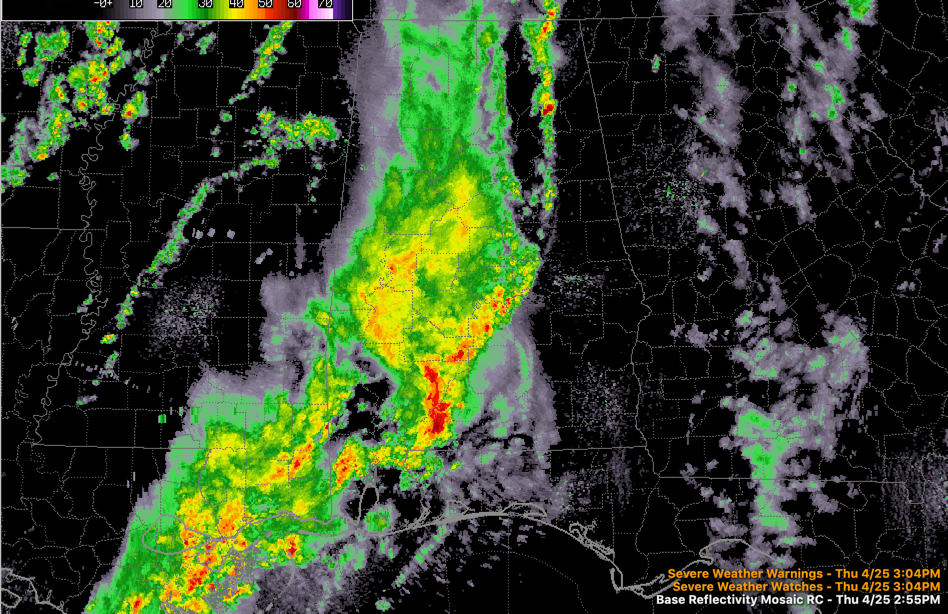
An area of rain and storms is pushing across Alabama this afternoon ahead of a strong upper-level trough and cold front. There is lightning from south of Tuscaloosa to the coast, but to the north all the precipitation is rain.
The severe weather threat is limited to areas south of a line from Butler to Greenville to Troy.
A tornado watch remains in effect across southern Alabama and the Florida Panhandle until 8 p.m.
Ahead of the main rain area, a line of showers is over Northeast Alabama. The heaviest one is near Gadsden.
The cold front is still back near the Mississippi River. A few showers and maybe some thunder will be possible until the front arrives late tonight.
Tomorrow will feature increasing sunshine, a blustery northwest wind, and highs in the lower and middle 70s.
Category: Alabama's Weather, ALL POSTS
About the Author (Author Profile)
Bill Murray is the President of The Weather Factory. He is the site's official weather historian and a weekend forecaster. He also anchors the site's severe weather coverage. Bill Murray is the proud holder of National Weather Association Digital Seal #0001 @wxhistorianSubscribe
If you enjoyed this article, subscribe to receive more just like it.


