A Quick Check On Our Weather Situation Just Before 10:00 AM
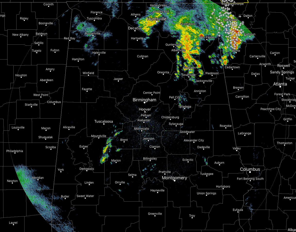
As of 9:35 am, we still have some showers and thunderstorms in the northeastern corner of the state stretching down into much of Etowah County and over into the extreme northern portions of St. Clair and Calhoun counties. These continue to push off to the north-northeast at around 30 MPH and should be out of the area within the next 90-120 minutes. There are a few scattered pockets of showers back to the southwest over Bibb, Perry, and Hale counties, but these are just quick showers that will move through quickly and pose no threat of becoming strong at the moment.
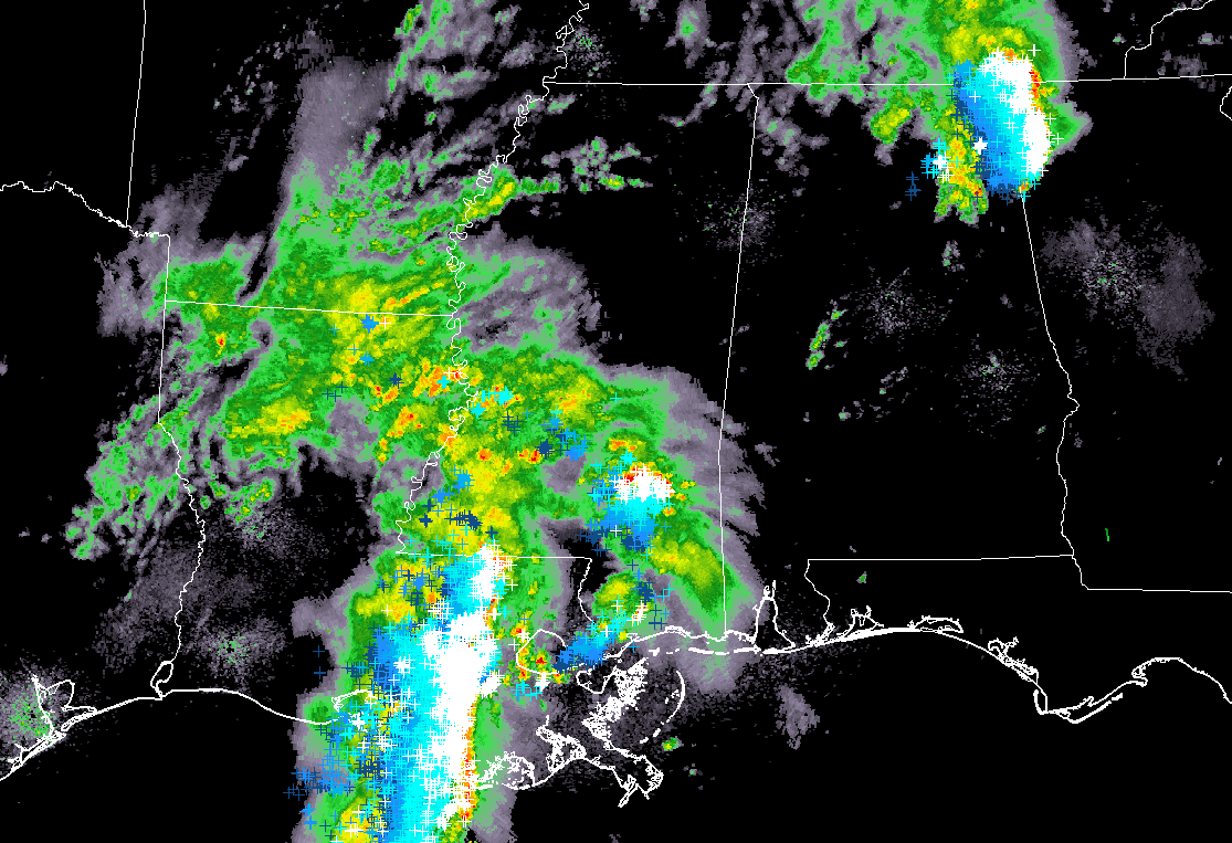
Our attention turns back to the southwest over southern Mississippi and eastern Louisiana where our next round of showers and thunderstorms are currently located. A severe thunderstorm warning is in effect for several parishes in southeastern Louisiana, but that is the only severe weather at the moment with this line of storms. All of this will be moving into the western and southwestern portions of Central Alabama right around or just before the 1:00 pm hour.
Some good news to report…
The morning showers and thunderstorms look to have made an impact in the thinking for the northern portions of Central Alabama as NWS Birmingham has removed locations north of a line from Reform to Gardendale to Piedmont out of any severe storm risk. They have a Marginal Risk for locations south of that line down to a line from Demopolis to Clanton to Alexander City, and a Slight Risk for locations south of that through the remainder of the Central Alabama counties.
The main threat continues to be from damaging thunderstorm winds up to 60 MPH. There is a smaller threat of hail up to quarter-size. The threat for tornadoes is too small to be mentioned as winds will be unidirectional and unfavorable for tornadic development.
The main window for stronger to severe storms remain the same, from 1:00 pm to 10:00 pm. Locations along and west of a line from Brookwood to Uniontown could see those storms between 1:00 pm and 5:00 pm. Locations east of that to a line from Ohatchee to Rockford to Montgomery could see those storms between 3:00 pm and 7:00 pm. Locations east of that could see strong to severe storms from 6:00 pm to 10:00 pm.
We will still have some lingering showers and maybe a few rumbles of thunder throughout the overnight and into the early morning hours on Sunday, but none of those are expected to be strong or severe.
Category: Alabama's Weather, ALL POSTS, Severe Weather
About the Author (Author Profile)
Scott Martin is an operational meteorologist, professional graphic artist, musician, husband, and father. Not only is Scott a member of the National Weather Association, but he is also the Central Alabama Chapter of the NWA president. Scott is also the co-founder of Racecast Weather, which provides forecasts for many racing series across the USA. He also supplies forecasts for the BassMaster Elite Series events including the BassMaster Classic.Subscribe
If you enjoyed this article, subscribe to receive more just like it.


