Noisy Storms Just South Of Birmingham; Plus, A Quick Midday Update On Our Weather Situation
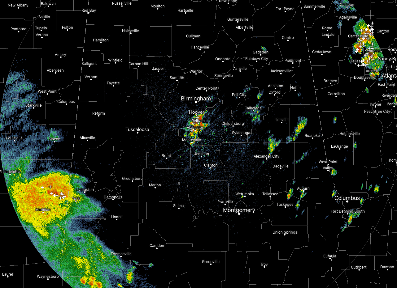
At 11:35 am, we have a small cluster of thunderstorms riding along the Jefferson/Shelby County line that is putting down heavy rainfall and a good bit of cloud-to-ground lightning. This cluster is moving to the northeast at 35 MPH. If you are in the path of this batch of storms, go indoors until it passes. If you can hear thunder, you’re close enough to be struck by lightning.
Storms are now starting to push into the southwestern portions of Central Alabama at this point, but none of this activity is strong or severe at this point. We’ll have to watch this activity as it moves farther into the area and the air continues to destabilize.
Temperatures are currently in the 70s to the lower 80s across Central Alabama. Birmingham was at 75 degrees, while Montgomery has already climbed up to 82 degrees as the warm spot. The cool spot is Gadsden at 70 degrees.
Forecast continues to stay on-track… the earlier activity seems to have made an impact in the thinking for the northern portions of Central Alabama as NWS Birmingham has removed locations north of a line from Reform to Gardendale to Piedmont out of any severe storm risk. They have a Marginal Risk for locations south of that line down to a line from Demopolis to Clanton to Alexander City, and a Slight Risk for locations south of that through the remainder of the Central Alabama counties.
The main threat continues to be from damaging thunderstorm winds up to 60 MPH. There is a smaller threat of hail up to quarter-size. The threat for tornadoes is too small to be mentioned as winds will be unidirectional and unfavorable for tornadic development.
The main window for stronger to severe storms remain the same, from 1:00 pm to 10:00 pm. Locations along and west of a line from Brookwood to Uniontown could see those storms between 1:00 pm and 5:00 pm. Locations east of that to a line from Ohatchee to Rockford to Montgomery could see those storms between 3:00 pm and 7:00 pm. Locations east of that could see strong to severe storms from 6:00 pm to 10:00 pm.
Category: Alabama's Weather, ALL POSTS, Severe Weather
About the Author (Author Profile)
Scott Martin is an operational meteorologist, professional graphic artist, musician, husband, and father. Not only is Scott a member of the National Weather Association, but he is also the Central Alabama Chapter of the NWA president. Scott is also the co-founder of Racecast Weather, which provides forecasts for many racing series across the USA. He also supplies forecasts for the BassMaster Elite Series events including the BassMaster Classic.Subscribe
If you enjoyed this article, subscribe to receive more just like it.


