Beneficial Rain On The Way
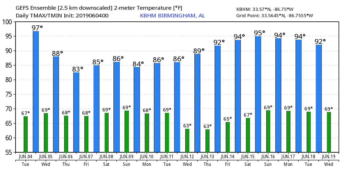
ONE MORE DRY DAY: For Birmingham (based on data from the airport), today will be the 19th consecutive day without measurable rain. The sky will be partly to mostly sunny with a high in the low 90s for most communities; parts of West Alabama will see mid 90s.
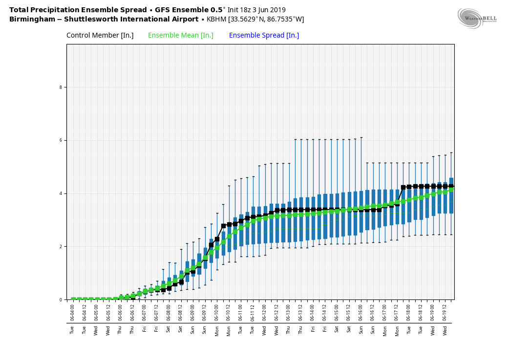
HERE COMES THE RAIN: Clouds will increase across Alabama tomorrow, and we will bring in a chance of showers and thunderstorms. Then, a fairly wet pattern unfolds for Thursday and Friday with a mostly cloudy sky and occasional showers and thunderstorms. No organized severe storms are expected, and heat levels will drop with highs between 81 and 84 degrees for most places on these two days.
THE ALABAMA WEEKEND: Unsettled weather continues. The sky will stay generally cloudy Saturday and Sunday with a good chance of showers and thunderstorms. There will, of course, be some decent breaks in the rain, and the sun might even peek out a time or two. But if you have something planned outdoors be ready for occasional rain, and some lightning at times. The high will be in the mid 80s both days.
NEXT WEEK: Showers and storms remain possible Monday and Tuesday, but they should thin out later in the week. Highs will be in the 80s Monday through Wednesday, and then close to 90 Thursday and Friday. See the Weather Xtreme video for maps, graphics, and more details.
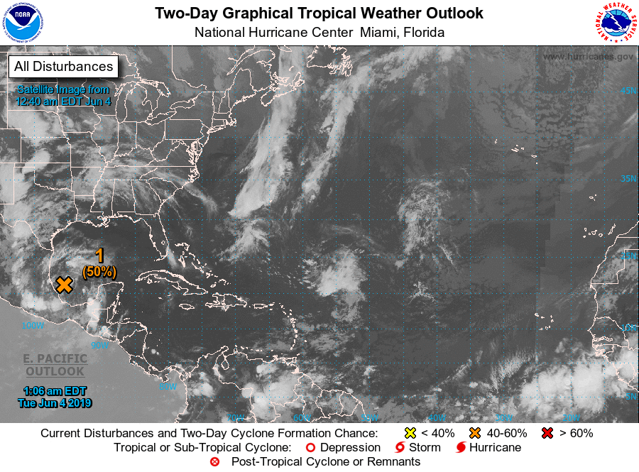
TROPICS: According to NHC, the disturbance in the Southwest Gulf of Mexico has a 50 percent chance of becoming a tropical depression or storm over the next 36 hours before moving into the Mexican coast. Moisture from this feature will move up through the Texas coastal plain and into the Deep South in 3-5 days, helping to enhance rain coverage across Alabama and adjacent states. The rest of the Atlantic basin is quiet.
ON THIS DATE IN 1966: A tropical disturbance that would develop into Hurricane Alma was over Central America, and while moving through Honduras, it dropped heavy rainfall that killed at least 75 people in the city of San Rafael. After crossing Cuba, Alma intensified further to reach winds of 125 mph in the Gulf of Mexico. The hurricane passed west of Key West, Florida, causing a power outage and flooding. Alma dropped heavy rainfall and produced winds across most of Florida, which damaged crops and caused scattered power outages. The hurricane weakened before moving ashore near Apalachee Bay. Damage in Florida was estimated at $10 million, and there were six deaths in the state.
BEACH FORECAST: Click here to see the AlabamaWx Beach Forecast Center page.
WEATHER BRAINS: Don’t forget you can listen to our weekly 90 minute show anytime on your favorite podcast app. This is the show all about weather featuring many familiar voices, including our meteorologists here at ABC 33/40.
CONNECT: You can find me on all of the major social networks…
Facebook
Twitter
Instagram
Pinterest
Snapchat: spannwx
Look for the next Weather Xtreme video here by 4:00 this afternoon… enjoy the day!
Category: Alabama's Weather, ALL POSTS, Weather Xtreme Videos
About the Author (Author Profile)
James Spann is one of the most recognized and trusted television meteorologists in the industry. He holds the AMS CCM designation and television seals from the AMS and NWA. He is a past winner of the Broadcast Meteorologist of the Year from both professional organizations.Subscribe
If you enjoyed this article, subscribe to receive more just like it.


