Several Days Of Beneficial Rain Ahead For Alabama
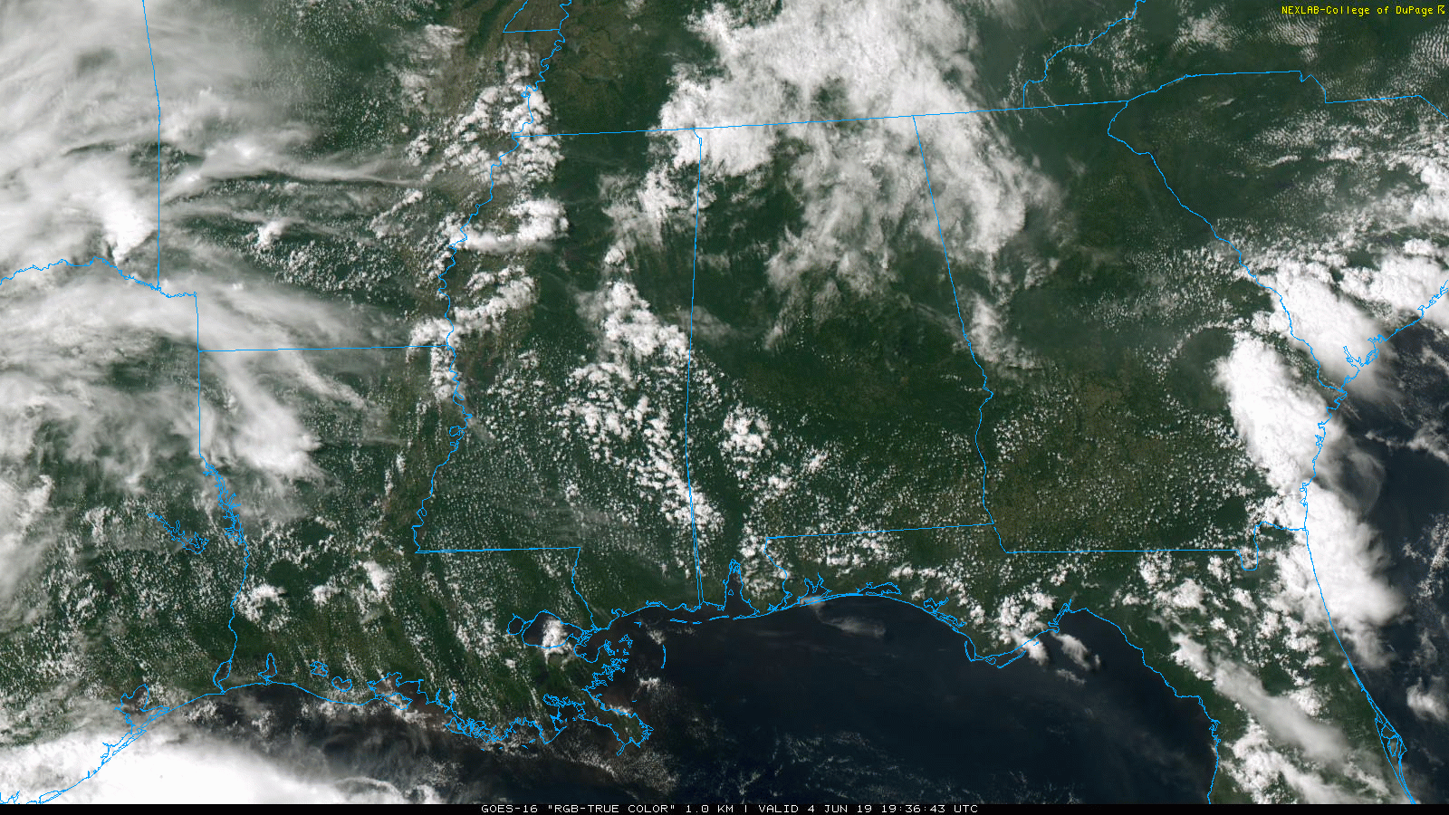
THIS AFTERNOON: Most of Alabama is dry this afternoon with a mix of sun and clouds along with temperatures in the upper 80s and low 90s. A few isolated showers have formed over the Tennessee Valley, and to the wes over Mississippi.
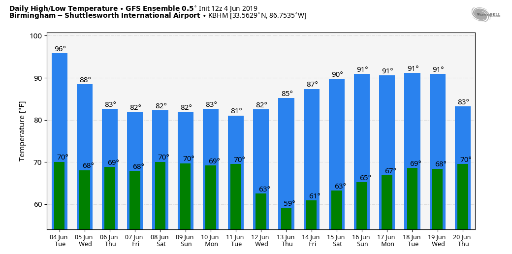
TOMORROW THROUGH FRIDAY: A deep layer of tropical moisture will move into the region, and we will forecast mostly cloudy weather on these three days with a good chance of showers and thunderstorms. There will be breaks in the rain, but showers are possible at almost any hour of the day or night. Heat levels come down with highs mostly in the 80-85 degree range; some places could hold in the 70s most of the day Thursday and Friday due to clouds and rain.
THE ALABAMA WEEKEND: The beneficial rain event continues. Expect occasional showers and thunderstorms Saturday and Sunday with highs in the low to mid 80s. If you have something planned outdoors, there will be breaks in the rain, and you might even see a peek of sun from time to time, but the overall pattern is wet. No way of knowing the exact start/stop times for the rain at any given location. On the positive side, no severe thunderstorms are expected.
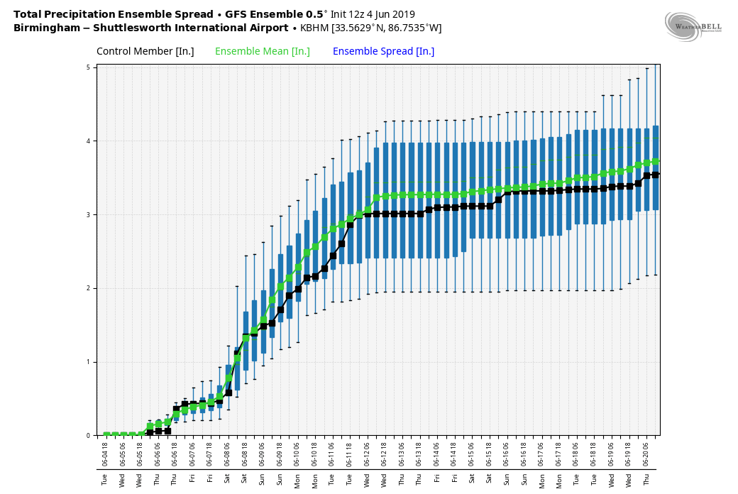
Rain amounts between tomorrow and Sunday will be in the 3 to 5 inch range for much of Alabama. Keep in mind many places have received no measurable rain since May 12, so this soaking is very much needed.
NEXT WEEK: Showers remain possible Monday, but as the upper trough shifts east of Alabama, we will be mostly dry on Tuesday, and for the rest of the week. Highs will be mostly in the mid to upper 80s for the first half of the week, and close to 90 by Thursday and Friday. See the Weather Xtreme video for maps, graphics, and more details.
TROPICS: It now looks like the disturbance in the Southwest Gulf of Mexico won’t develop into a tropical depression (NHC has dropped the chance to 20 percent), but moisture from the system will stream into the southern U.S. later this week and over the weekend, enhancing the rain potential. The rest of the Atlantic basin is quiet.
ON THIS DATE IN 1966: A tropical disturbance that would develop into Hurricane Alma was over Central America, and while moving through Honduras, it dropped heavy rainfall that killed at least 75 people in the city of San Rafael. After crossing Cuba, Alma intensified further to reach winds of 125 mph in the Gulf of Mexico. The hurricane passed west of Key West, Florida, causing a power outage and flooding. Alma dropped heavy rainfall and produced winds across most of Florida, which damaged crops and caused scattered power outages. The hurricane weakened before moving ashore near Apalachee Bay. Damage in Florida was estimated at $10 million, and there were six deaths in the state.
BEACH FORECAST: Click here to see the AlabamaWx Beach Forecast Center page.
WEATHER BRAINS: Don’t forget you can listen to our weekly 90 minute show anytime on your favorite podcast app. This is the show all about weather featuring many familiar voices, including our meteorologists here at ABC 33/40.
CONNECT: You can find me on all of the major social networks…
Facebook
Twitter
Instagram
Pinterest
Snapchat: spannwx
Look for the next Weather Xtreme video here by 7:00 a.m. tomorrow…
Category: Alabama's Weather, ALL POSTS, Weather Xtreme Videos
About the Author (Author Profile)
James Spann is one of the most recognized and trusted television meteorologists in the industry. He holds the AMS CCM designation and television seals from the AMS and NWA. He is a past winner of the Broadcast Meteorologist of the Year from both professional organizations.Subscribe
If you enjoyed this article, subscribe to receive more just like it.


