Weather Xtreme: Rain Chances Continue Through Midweek, Then Sunshine Returns
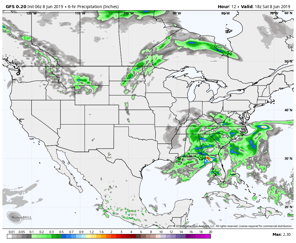
TODAY
A low will be centered over the northwestern parts of the state today and we’ll continue to have rounds of showers and thunderstorms move through Central Alabama. We do not expect any organized severe weather, but there is a possibility that we may have one or two storms that will become strong. Afternoon highs will be in the 80s. We’ll continue to have a chance of showers and a few thunderstorms throughout the night with lows in the upper 60s to the lower 70s.
SUNDAY
The low moves very little to the north and will be centered over central Tennessee on Sunday. Tropical moisture stays in place and we’ll continue to have periods of showers and thunderstorms. Highs will be in the lower to mid-80s across the area.
MONDAY
The low will finally get forced out of the area on Monday and will be located way up in Canada to the north of the eastern Great Lakes which will finally start to thin out the rain chances for Central Alabama somewhat. Showers and thunderstorms will continue to be likely early in the morning, but chances will greatly decrease throughout the day. Highs will be in the lower to mid-80s across the area.
TUESDAY
The bad news is that another low will form and move over the southwestern parts of Georgia on Tuesday, bringing increased rain chances to the southeastern parts of Central Alabama during the daytime hours. Much of the area north of I-20 and west of I-65 will stay dry while shower and thunderstorm chances increase as you move southeast. Highs will be in the upper 70s to the mid-80s.
WEDNESDAY
The low stays parked over southwestern Georgia on Wednesday, but it looks like it weakens and finally gets pushed out of the area by a deep upper trough pushing in from the northwest. We’ll continue to have a chance of showers and thunderstorms across the area, but chances will be higher east of I-65. Highs will be in the lower to mid-80s.
THURSDAY
We finally get a chance to dry out as high pressure will start to move closer to the area from the west on Thursday. Skies will be mostly sunny with we’ll have no rain for a change. Highs will be in the upper 70s to the mid-80s.
FRIDAY
That high will be over the northern parts of the state on Friday, meaning for us plenty of sunshine and highs in the lower to mid-80s across the area.
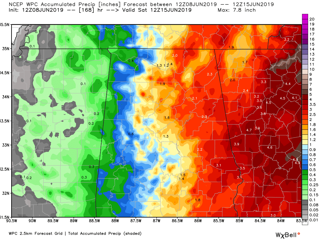
RAINFALL TOTALS THROUGHOUT THE WEEK
The rainfall projections from the WPC for the next seven days shows the possibility of amounts totaling as low as 0.25 inches in the west to as high as 3.00 inches in the east. All of this rain should alleviate any drought issues we were starting to see across the area.
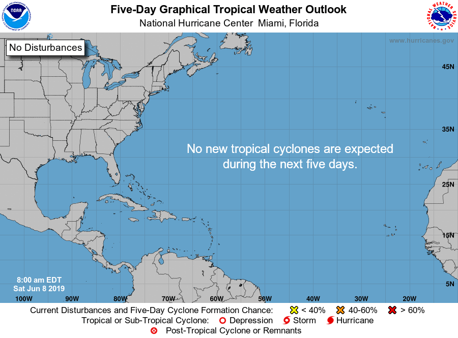
A QUICK LOOK AT THE TROPICS
The Atlantic Basin remains quiet today and no new tropical cyclones are expected to develop during the next five days.
ON THIS DAY IN WEATHER HISTORY
1989 – Thunderstorms produced severe weather over the Central Gulf Coast Region during the day and evening. Severe thunderstorms spawned 17 tornadoes, including one which injured ten persons and caused a million dollars damage at Orange Beach, AL. Thunderstorm winds gusting to 90 mph killed three persons and injured four others at Mobile AL. Thunderstorms also deluged Walnut Hill and Avalon Beach, FL, with eight inches of rain.
BEACH FORECAST CENTER
Get the latest weather and rip current forecasts for the beaches from Fort Morgan to Panama City on our Beach Forecast Center page. There, you can select the forecast of the region that you are interested in.
ALREADY OFF TO A HOT START IN 2019! ADVERTISE WITH THE BLOG!
We have enjoyed over 10 MILLION page views on AlabamaWx.com so far in 2019! Don’t miss out! We can customize a creative, flexible and affordable package that will suit your organization’s needs. Contact Bill Murray at (205) 687-0782.
E-FORECAST
Get the Alabama Wx Weather Blog’s Seven-Day Forecast delivered directly to your inbox by email twice daily. It is the most detailed weather forecast available in Central Alabama. Subscribe here… It’s free!
CONNECT WITH THE BLOG ON SOCIAL MEDIA
You can find the AlabamaWx Weather Blog on the major social media networks:
Facebook
Twitter
Instagram
WEATHERBRAINS
Don’t forget you can listen to our weekly 90 minute netcast anytime on the web at WeatherBrains.com or on iTunes, Stitcher, or Spotify. This is the show all about weather featuring many familiar voices, including the meteorologists at ABC 33/40.
Category: Alabama's Weather, ALL POSTS, Weather Xtreme Videos
About the Author (Author Profile)
Scott Martin is an operational meteorologist, professional graphic artist, musician, husband, and father. Not only is Scott a member of the National Weather Association, but he is also the Central Alabama Chapter of the NWA president. Scott is also the co-founder of Racecast Weather, which provides forecasts for many racing series across the USA. He also supplies forecasts for the BassMaster Elite Series events including the BassMaster Classic.Subscribe
If you enjoyed this article, subscribe to receive more just like it.


