Air You Can Wear
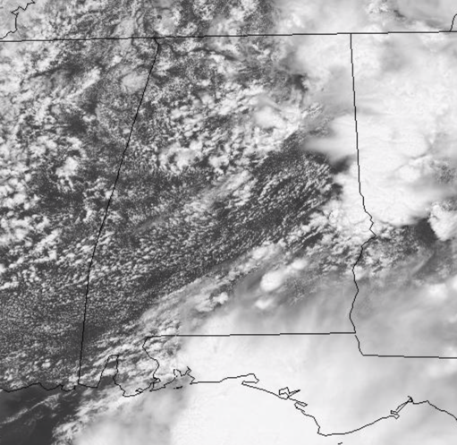
Dew points continue to be well into the 70s today, and that is making for a very muggy air mass across the state. It is also providing fuel for showers and storms that we are seeing once again today. Through the morning hours, most of the activity has been east of Interstate 65 where we are seeing pockets of heavy rain with numerous showers and storms.
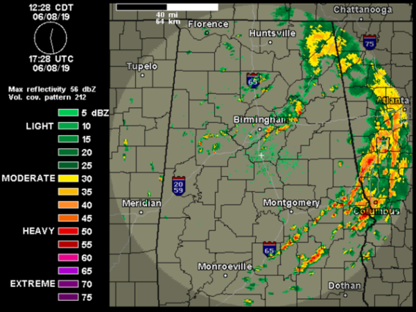
There is also quite a bit of lightning in some of the strong storms, but for the most part we are not expecting organized severe weather across the state. Now of course there could be a few storms which pulse up and flirt with becoming severe, but for the most part, the more intense storm threat today will be along the Gulf Coast and to the east over in Georgia.
For the rest of today, we will continue to see a mix of sun and clouds with scattered to numerous showers and storms possible anytime, anywhere, but it looks like the greatest concentration of activity will be across eastern portions of the state.
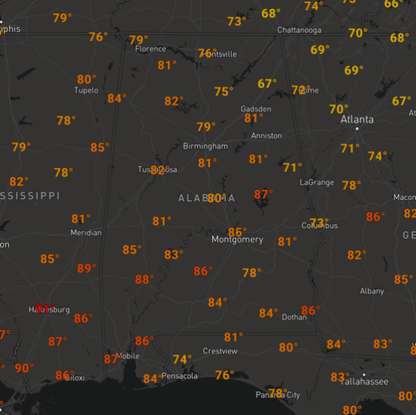
Temperatures will mainly be in the 80s through this afternoon.
Tonight, we are going to continue to see passing showers and storms across the state with lows in the upper 60s and lower 70s.
TOMORROW: More of the same as the overall wet weather pattern will persist across the state. Expect a partly sunny cloudy day with showers and storms from time to time. It won’t rain all the time, but you will likely be dodging rain drops along the way through the day. Highs will once again be in the 80s with very muggy conditions.
WORLD TEMPERATURE EXTREMES: Over the last 24 hours, the highest observation outside the U.S. was 122.4F at Mitribah, Kuwait. The lowest observation was -116.0F at Vostok, Antarctica.
CONTIGUOUS TEMPERATURE EXTREMES: The highest observation was 116F at Falcon Lake, TX. The lowest observation was 19F at Horton Peak, ID.
WEATHER ON THIS DATE IN 1966: A tornado ripped right through the heart of the capitol city of Topeka KS killing sixteen persons and causing 100 million dollars damage. The tornado, which struck during the evening, cut a swath of near total destruction eight miles long and four blocks wide. It was the most destructive tornado of record up until that time.
Category: Alabama's Weather, ALL POSTS
About the Author (Author Profile)
Macon, Georgia Television Chief Meteorologist, Birmingham native, and long time Contributor on AlabamaWX. Stormchaser. I did not choose Weather, it chose Me. College Football Fanatic. @Ryan_StinnetSubscribe
If you enjoyed this article, subscribe to receive more just like it.


