Scattered Storms Out There At Midday, Strong Storms Possible This Afternoon
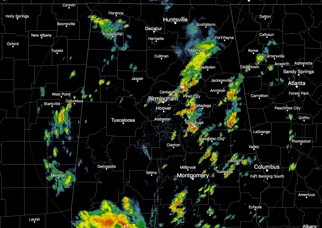
At 11:50 am, we continue to have a good bit of shower and thunderstorm activity over the eastern half of Central Alabama. The heavier storms are located in a ragged line stretching from Ashville and Springville southward to Sylacauga. Much of the heavier showers and thunderstorms are located over South Alabama and the panhandle of Florida. Those storms may be helping out in keeping any stronger storms from forming up this way. All of the activity is moving off to the northeast at 20-25 MPH.
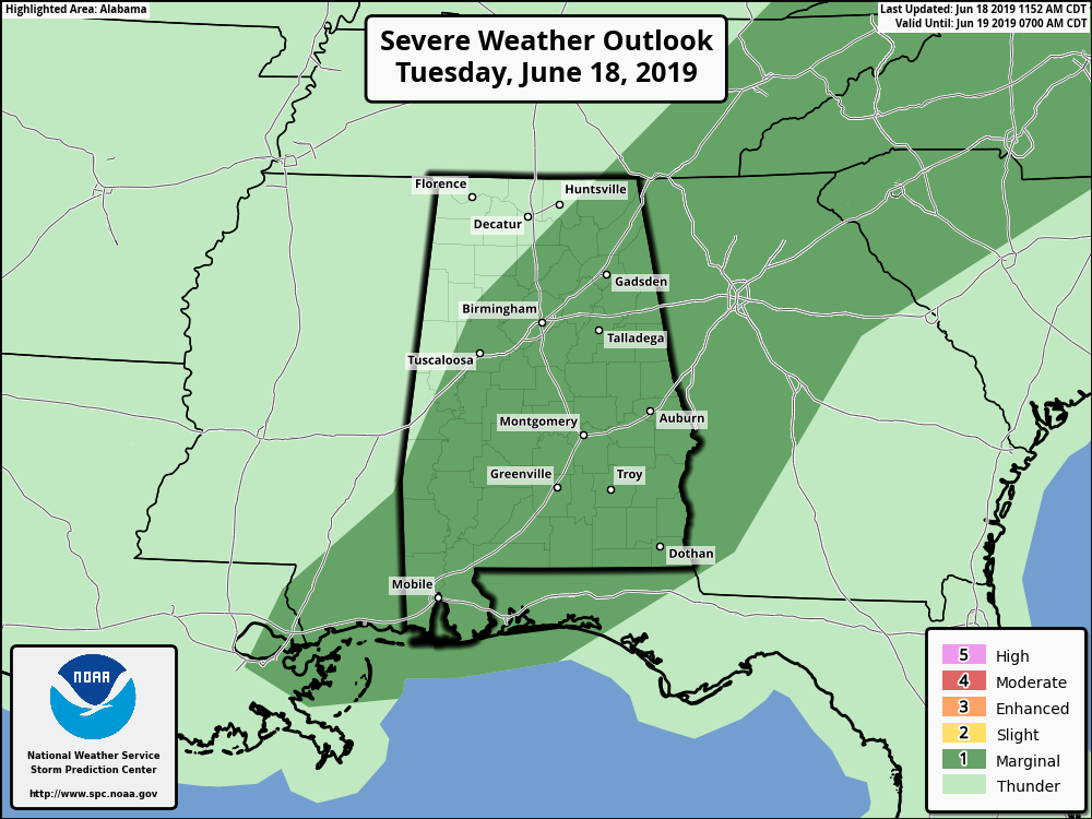
Much of Central Alabama was defined in a Marginal Risk for severe storms earlier today, and the latest update from the SPC continues to show that as being the case. If any storm was to become strong or severe, strong to isolated damaging wind gusts up to 60 MPH will be the main threat.
For the rest of today, we’ll continue to have scattered to numerous showers and thunderstorms move through Central Alabama as a trough will be passing through the area. We may see a strong thunderstorm or two, but cloud cover should keep daytime highs in the mid to upper 80s and limit instability. By the time we reach the evening hours, the trough will be over in Georgia and combine that with the loss of daytime heating, we’ll rapidly see a decrease in shower and thunderstorm activity. While we’ll continue to have a very small risk of a few isolated showers during the late night and overnight hours, most locations will stay dry. Lows will be in the upper 60s to the lower 70s.
On Wednesday, we’ll continue to have a small risk of scattered afternoon and evening showers and thunderstorms, but coverage should be much less than what we see today. Skies will be partly to mostly cloudy with highs making it back up into the upper 80s to the lower 90s. Wednesday evening will see an increase of shower and thunderstorm chances especially over the northern parts of Central Alabama as another shortwave will be approaching the area. While we could have one or two strong storms, severe weather is not expected. Lows will be in the lower to mid-70s.
A QUICK LOOK AT THE TROPICS
The Atlantic Basin remains quiet today and no new tropical cyclones are expected to develop during the next five days.
ON THIS DAY IN WEATHER HISTORY
1970 – Wind and rain, and hail up to seven inches deep, caused more than five million dollars damage at Oberlin KS.
BEACH FORECAST CENTER
Get the latest weather and rip current forecasts for the beaches from Fort Morgan to Panama City on our Beach Forecast Center page. There, you can select the forecast of the region that you are interested in.
ALREADY OFF TO A HOT START IN 2019! ADVERTISE WITH THE BLOG!
We have enjoyed over 10 MILLION page views on AlabamaWx.com so far in 2019! Don’t miss out! We can customize a creative, flexible and affordable package that will suit your organization’s needs. Contact Bill Murray at (205) 687-0782.
E-FORECAST
Get the Alabama Wx Weather Blog’s Seven-Day Forecast delivered directly to your inbox by email twice daily. It is the most detailed weather forecast available in Central Alabama. Subscribe here… It’s free!
CONNECT WITH THE BLOG ON SOCIAL MEDIA
You can find the AlabamaWx Weather Blog on the major social media networks:
Facebook
Twitter
Instagram
WEATHERBRAINS
Don’t forget you can listen to our weekly 90 minute netcast anytime on the web at WeatherBrains.com or on iTunes, Stitcher, or Spotify. This is the show all about weather featuring many familiar voices, including the meteorologists at ABC 33/40.
Category: Alabama's Weather, ALL POSTS
About the Author (Author Profile)
Scott Martin is an operational meteorologist, professional graphic artist, musician, husband, and father. Not only is Scott a member of the National Weather Association, but he is also the Central Alabama Chapter of the NWA president. Scott is also the co-founder of Racecast Weather, which provides forecasts for many racing series across the USA. He also supplies forecasts for the BassMaster Elite Series events including the BassMaster Classic.Subscribe
If you enjoyed this article, subscribe to receive more just like it.


