Slight Risk For Severe Storms Continues Through The Overnight Hours
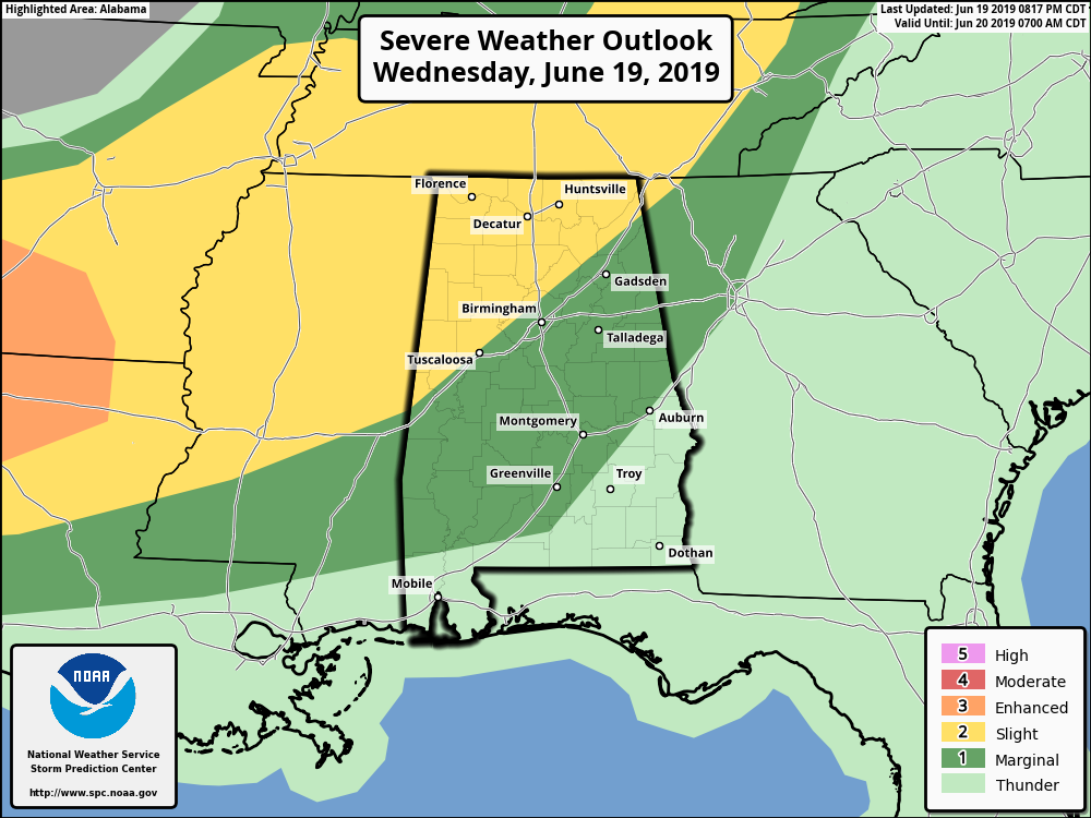
The Storm Prediction Center has just recently updated the risks for Central Alabama throughout the remainder of tonight and through the overnight and early morning hours on Thursday. The new Day 1 Severe Weather Outlook is valid until 7:00 am Thursday morning.
A Slight Risk is up for locations along and north of a line from Tuscaloosa to Kimberly to Fort Payne.
A Marginal Risk is up for locations south of that to a line stretching from Tuskegee to Auburn to Huguley.
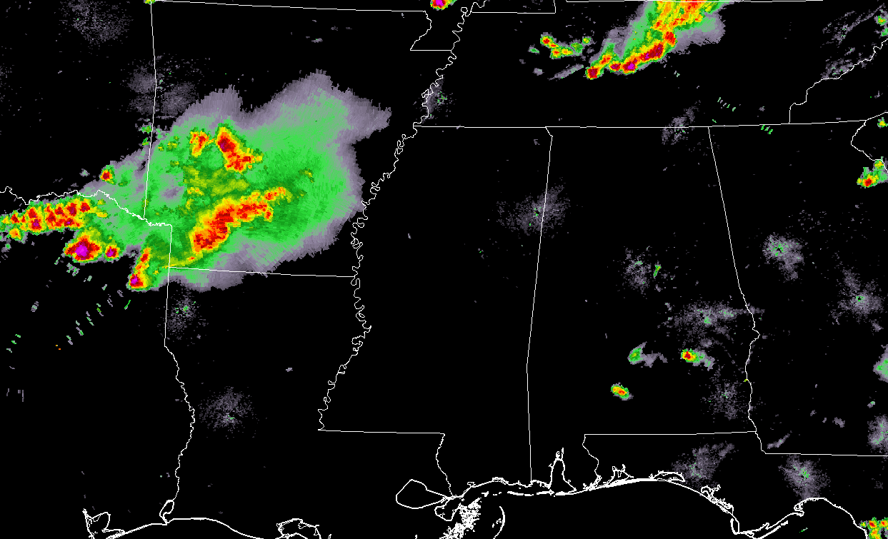
At 8:30 pm, the MCS that is expected to affect Central Alabama during the overnight hours is currently located over southern Arkansas and back into extreme eastern Texas and extreme northwestern Louisiana. There is a possibility that this system will weaken as it approaches the area, but there will be ingredients in place that should maintain its strength. Mixed-layer CAPE will be around 2,000 J/kg and effective bulk shear will be around 30-40 knots. Winds in the 925-850 mb level should also allow the system to replenish itself as it travels through the southeast.
The main threat with this MCS will be from damaging winds up to 60 MPH, but you can also expect some heavy rainfall, dangerous lightning, and some small hail will be possible.
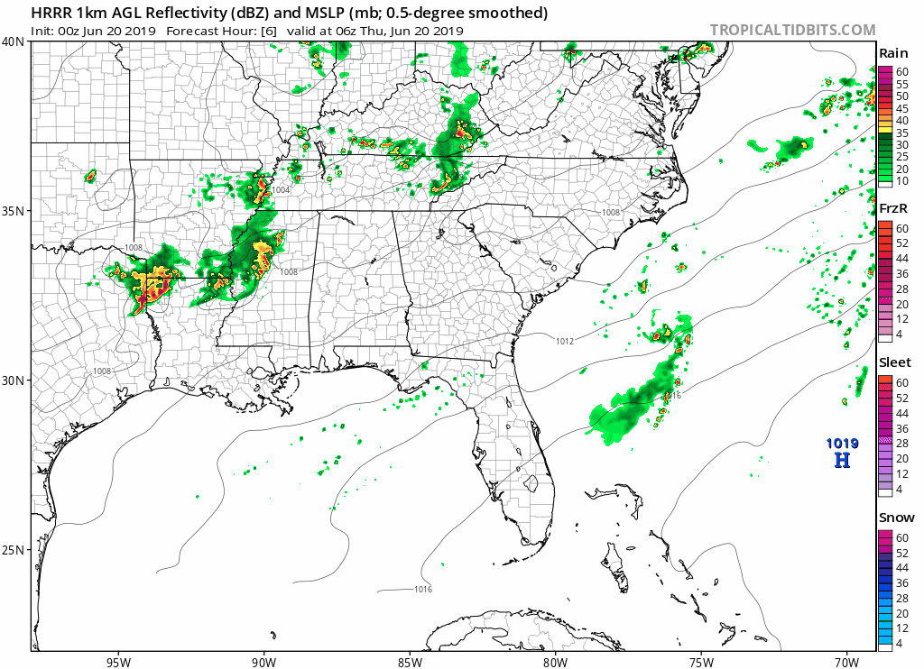
The main window for the potential for strong to severe storms associated with the MCS will be from 1:00 am through 7:00 am from west to east. At this point, it looks like most of the action will be north of the I-20 corridor, but everyone in the severe risks will need to stay up-to-date with the developing conditions. This run of the HRRR shows the MCS weakening as it moves into Central Alabama, but with the ingredients listed above, it may stay stronger for a little while longer than projected.
I’ll be with you throughout the night and overnight hours as long as there is a threat of severe weather. Another update will be out in a few hours unless a watch is issued or there is a need to drastically change the forecast.
Category: Alabama's Weather, ALL POSTS, Severe Weather
About the Author (Author Profile)
Scott Martin is an operational meteorologist, professional graphic artist, musician, husband, and father. Not only is Scott a member of the National Weather Association, but he is also the Central Alabama Chapter of the NWA president. Scott is also the co-founder of Racecast Weather, which provides forecasts for many racing series across the USA. He also supplies forecasts for the BassMaster Elite Series events including the BassMaster Classic.Subscribe
If you enjoyed this article, subscribe to receive more just like it.


