Radar Check at 2 p.m.: Numerous Showers and Storms North of I-59
Numerous showers and storms have formed this afternoon over North and North Central Alabama in a moist and unstable airmass.
CAPE values are running 4,000-5,500 joules/kg. Lapse rates are very steep in the low and mid levels of the atmosphere. This means that temperatures drop quickly with height, and this allows updrafts to become strong, leading to strong storms.
One of the limiting factors to organized storms is bulk wind shear, which is light with light winds aloft. This means storms will be mainly of the pulse or multi-cellular varieties.
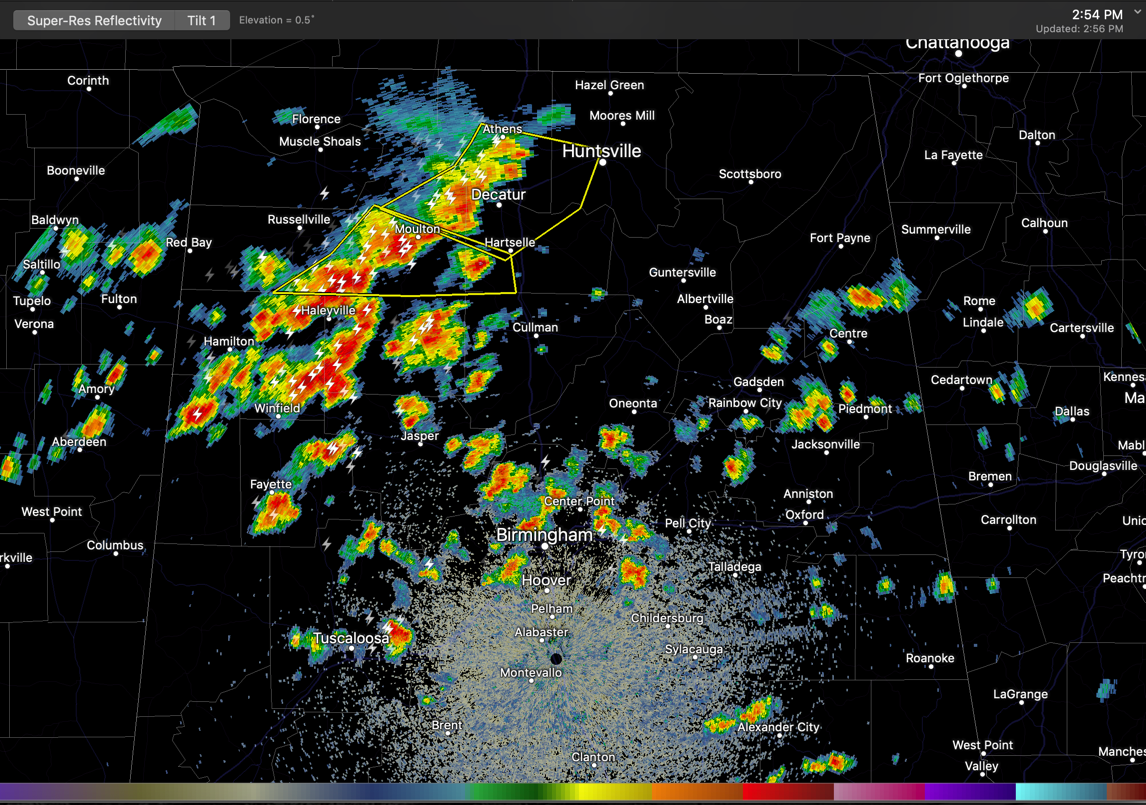
The strongest storms at 3 p.m. extend from west of Decatur to near Hamilton in Marion County. But showers and storms are numerous in areas along and north of I-59.
Storms will continue to grow in intensity and coverage through the afternoon. Some of them will become strong to severe with damaging winds the main threat.
A severe thunderstorm watch remains in effect until 9 p.m. for much of North and North Central Alabama. There is a threat of damaging winds, as well as heavy rain and deadly lightning. Be alert if you are outside and pay attention to the latest information this afternoon and tonight.
Another complex of storms will move into North Alabama abt 7-8 p.m. tonight. We will be tracking it to what impact it has on Central Alabama overnight.
Category: Alabama's Weather, ALL POSTS
About the Author (Author Profile)
Bill Murray is the President of The Weather Factory. He is the site's official weather historian and a weekend forecaster. He also anchors the site's severe weather coverage. Bill Murray is the proud holder of National Weather Association Digital Seal #0001 @wxhistorianSubscribe
If you enjoyed this article, subscribe to receive more just like it.


