

Sun, Heat, Storms
SCATTERED STORMS FIRE UP AGAIN TODAY: We are in that time of the year when the weather forecast will mention “scattered, mostly afternoon and evening showers and thunderstorms” on a daily basis, and we will have them around again later today. Odds of any one spot getting wet today are around one in three; otherwise the sky will be partly sunny with a high generally in the low 90s.
TOMORROW THROUGH THE WEEKEND: Showers and storms should be a little more numerous on these three days with the chance of any one place getting wet running in the 40/50 percent range. Most of the showers and thunderstorms will come from 1:00 until 11:00 p.m… but a morning or late night shower certainly can’t be ruled out. Like most summer days, the thunderstorms will be pretty random, and there is no way of knowing in advance exactly when and where they form. Look for a mix of sun and clouds each day with highs between 87 and 92.
NEXT WEEK: Global models continue to advertise a rather high amplitude pattern for summer, with an upper trough developing over the eastern half of the nation. A surface front will approach from the north, giving a higher coverage of showers and thunderstorms Monday and Tuesday. Drier air could slip into the northern half of the state Wednesday and Thursday, but we all know fronts rarely get that deep into our state this time of the year. But, we will scale back the chance of showers on those two days to mainly South Alabama. See the Weather Xtreme video for maps, graphics, and more details.

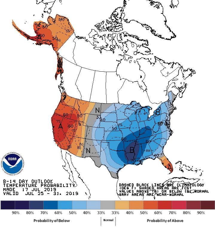
We do note CPC in their 8-14 day temperature outlook, for the period July 25-31, does show below average temperatures for the eastern two-thirds of the U.S. Understand for us, this doesn’t mean “cool”… but “not as hot”.
TROPICS: The Atlantic basin remains very quiet, and tropical storm formation is not expected through the weekend.
ON THIS DATE IN 1996: A massive rainstorm in north central and northeast Illinois led to widespread flooding. Aurora reported 16.94 inches of rain, establishing a state record for the most rain in a single day. Other heavy totals included 13.60 inches at Joliet, 9.24 inches in Wheaton, 8.09 inches in DeKalb, and 7.82 inches at Elgin. This event is often called “the second most damaging weather disaster in Illinois History.”
BEACH FORECAST: Click here to see the AlabamaWx Beach Forecast Center page.
WEATHER BRAINS: Don’t forget you can listen to our weekly 90 minute show anytime on your favorite podcast app. This is the show all about weather featuring many familiar voices, including our meteorologists here at ABC 33/40.
CONNECT: You can find me on all of the major social networks…
Facebook
Twitter
Instagram
Pinterest
Snapchat: spannwx
Look for the next Weather Xtreme video here by 4:00 this afternoon… enjoy the day!
Category: Alabama's Weather, ALL POSTS, Weather Xtreme Videos
About the Author (Author Profile)
James Spann is one of the most recognized and trusted television meteorologists in the industry. He holds the AMS CCM designation and television seals from the AMS and NWA. He is a past winner of the Broadcast Meteorologist of the Year from both professional organizations.Subscribe
If you enjoyed this article, subscribe to receive more just like it.


